


Typical late August weather will continue for Acadiana over the next couple of days with a weak front producing showers and storms by late Friday, and then more pleasant weather should eventually follow.
In the near term, expect more of the same for our Thursday and Friday with the slight chance of a late afternoon/early evening shower or thunderstorm.

Highs will continue in the low-mid 90s through Thursday.
By Friday a frontal trough will approach the area late in the day generating a good chance of showers and thunderstorms into Friday evening.
Some activity may linger for early Saturday, but eventually drier and slightly cooler air will move in for the remainder of the holiday weekend, and perhaps through mid-next week.

Rainfall totals could be in the 0.5-1.5" range, but today's Euro is going for the lower side for now...we'll fine tune this rain outlook in the days ahead.
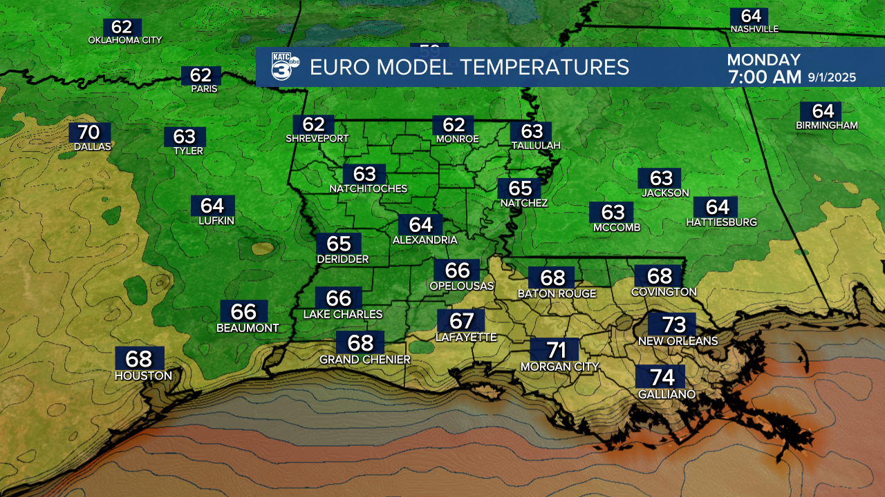
Highs this weekend/early next week may be limited to the mid-upper 80s this weekend, while Monday and Tuesday morning lows in Acadiana could drop into the mid-upper 60s...not quite fall-like, but it's a start!

See the KATC 10 Day Forecast for the latest.
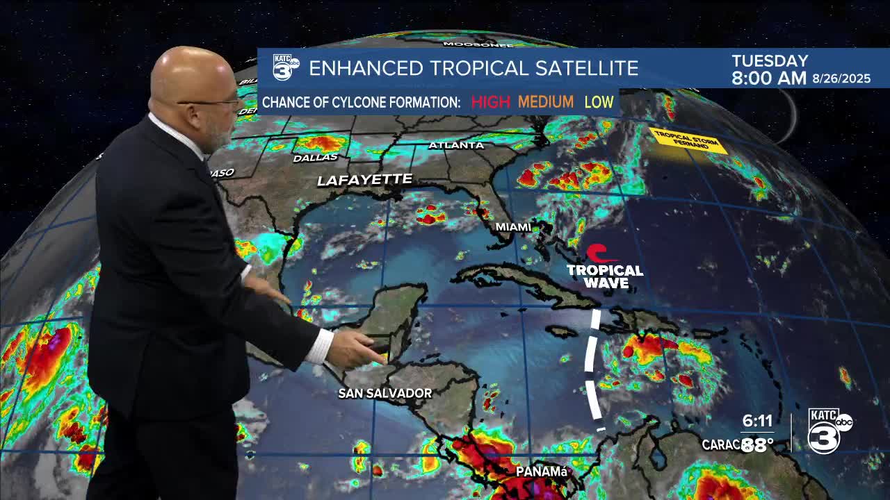
Meanwhile, the Atlantic tropics are relatively quiet given we're entering the peak time of year...and today is the 33rd anniversary of Hurricane Andrew...more below:
