


Acadiana will continue to experience above normal spring temperatures this week with morning fog possible each day until our next front arrives by this weekend.
Also, there is a more significant change in the pattern emerging on the horizon.

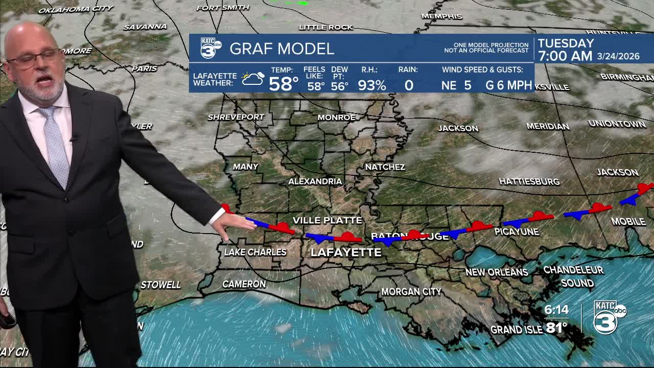
In the near term, a weak front is expected to run out of gas across Acadiana tonight with foggy conditions likely south of the boundary.

Thus, the National Weather Service has issued Dense Fog Advisory for the I-10 parishes southward tonight into Tuesday tomorrow morning.

There is another signal for more widespread fog for tomorrow night into Wednesday morning.

And given our stagnant pattern, this may repeat most of the week until the next, more definitive front (most likely with no rain) arrives Friday night into Saturday.

Look for daytime highs to continue to reach the lower to 80s each day of this week under partly cloudy skies...and we may see readings topping out closer to the mid-80s come Thursday and Friday.

Acadiana's next front arrives with little or no fanfare, meaning no rain, Friday night with temperatures cooling 3-5°, but still remaining slightly above normal this weekend.
This weekend's front will move back northward Sunday into early next week and could draw some Gulf moisture and spark a few isolated showers.
A bigger change is on the horizon mid-late next week as our ridge of high pressure aloft breaks down allowing for disturbances approaching from the west, and much better rain chances to develop, especially toward the end of next week.

See the KATC 10 Day Forecast for the latest.
And for allergy sufferers, the eye-watering tree pollen is expected to stay "very high" in Acadiana all week long.
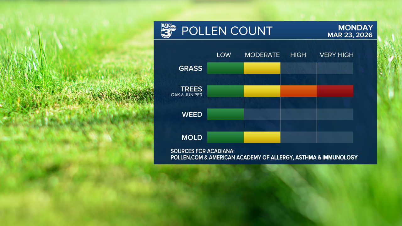
Hopefully, the rain on the horizon later next week may be able to wash some of the pollen out down the road.
