



More rain a embedded thunderstorms remain in the forecast for Acadiana Tuesday with some locally heavy downpours possible especially early in the day.
The chance of showers and thunderstorms should begin to ease Wednesday with drier and hotter conditions likely for the area later this week and through the entire weekend.

In the near-term, showers will slowly dissipate this evening with another round of showers and storms developing toward daybreak Tuesday.
Rain chances look to be highest (70%) during the first half of the day Tuesday with lingering cloudiness into the afternoon hours.
Rain totals through Wednesday should be 1-2" or less with much lesser amounts farther to the north, and much higher amounts near the coast and offshore per the GRAF Model below.

At least the rain and storms are keeping temperatures down with highs Monday reaching the lower 80s with more of the same expected Tuesday.
Acadiana should see a little more sun and temperatures rebounding back into the mid-upper 80s Wednesday with the chance of scattered showers and storms remaining in the forecast, but tentatively down to roughly 40%.
Thereafter, rain chances look to drop to near 10% or less Thursday through the weekend as stable high pressure develops in the Gulf and exerts it's influence on Acadiana.

Daytime highs will likely be reaching back into the low to perhaps, mid-90s by this weekend.
Heat index values later this week and into the weekend could push their highest levels this summer to date, with readings pushing the 104°-109° range during the afternoons.
See the KATC 10 Day Forecast and the Power Doppler 3 Radar page for the latest.
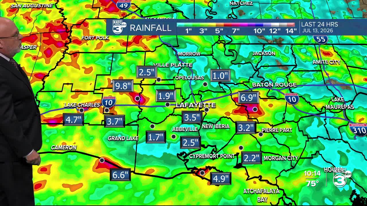
Some big rain totals earlier Monday:
As of 3pm Monday, roughly 1-4" fell across portions of Acadiana with most of that coming early this morning.
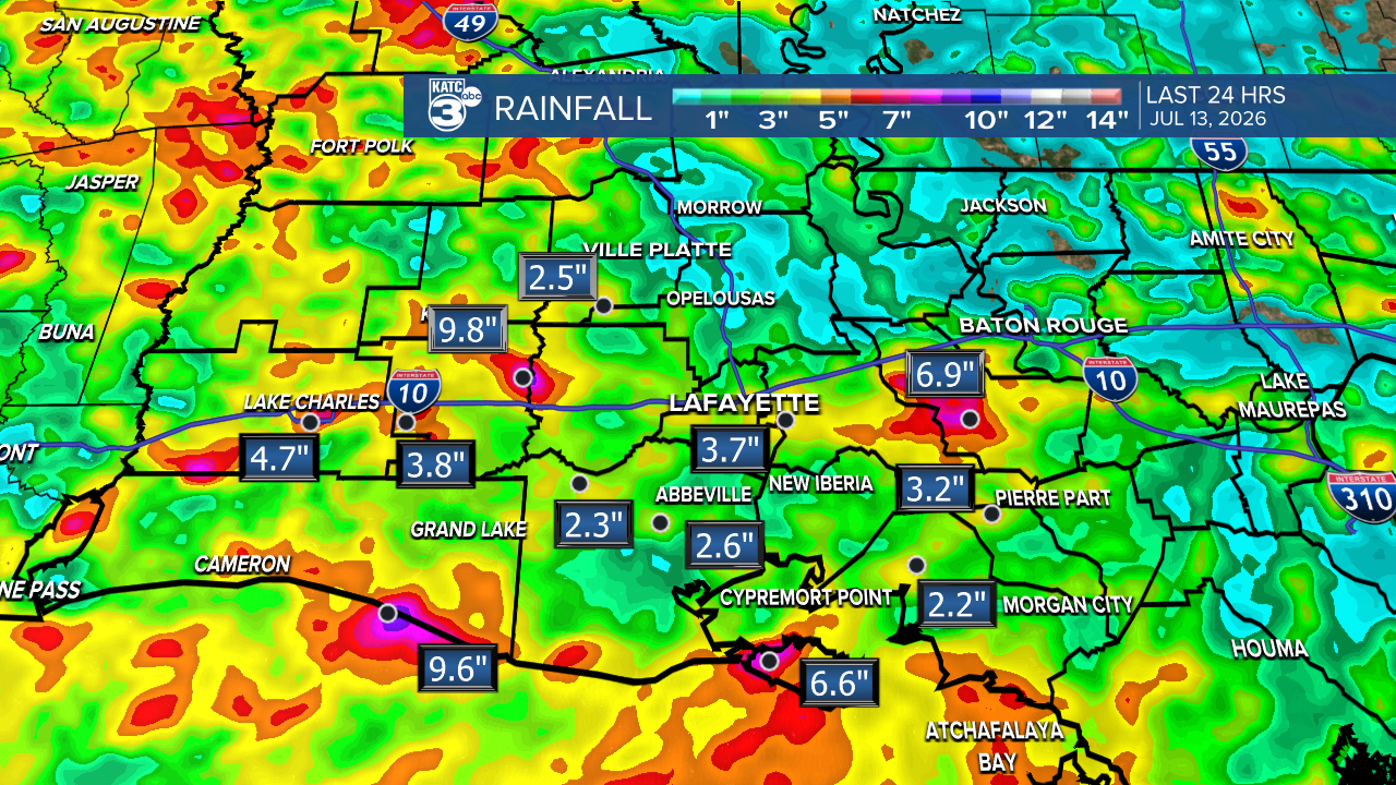
And in traditional Louisiana style, some 24 hour hot spots of 6-10"!
