


Acadiana will continue to see its "normally scheduled" with hot and humid conditions accompanied by up and down rain chances, while the tropics stay active, but not for the Gulf.
After a healthy scattering of showers and thunderstorms across the Acadiana area Monday afternoon, slightly drier more stable air should move in for our Tuesday allowing us to lower the chance of storms just a bit...closer to 30%.

Otherwise expect a sun and cloud mix with high temperatures reaching the mid-90s before afternoon/early evening storms kick in.
Much the same could be said for Wednesday, although rain chances may go a touch higher.
Heat index values will likely climb to 105-110° in spots over the next couple of days.
The weather pattern is expected to change to become more conducive for thunderstorm activity Thursday into Friday, but by the weekend rain chances may lower once again.
See the KATC 10 Day Forecast for the latest:
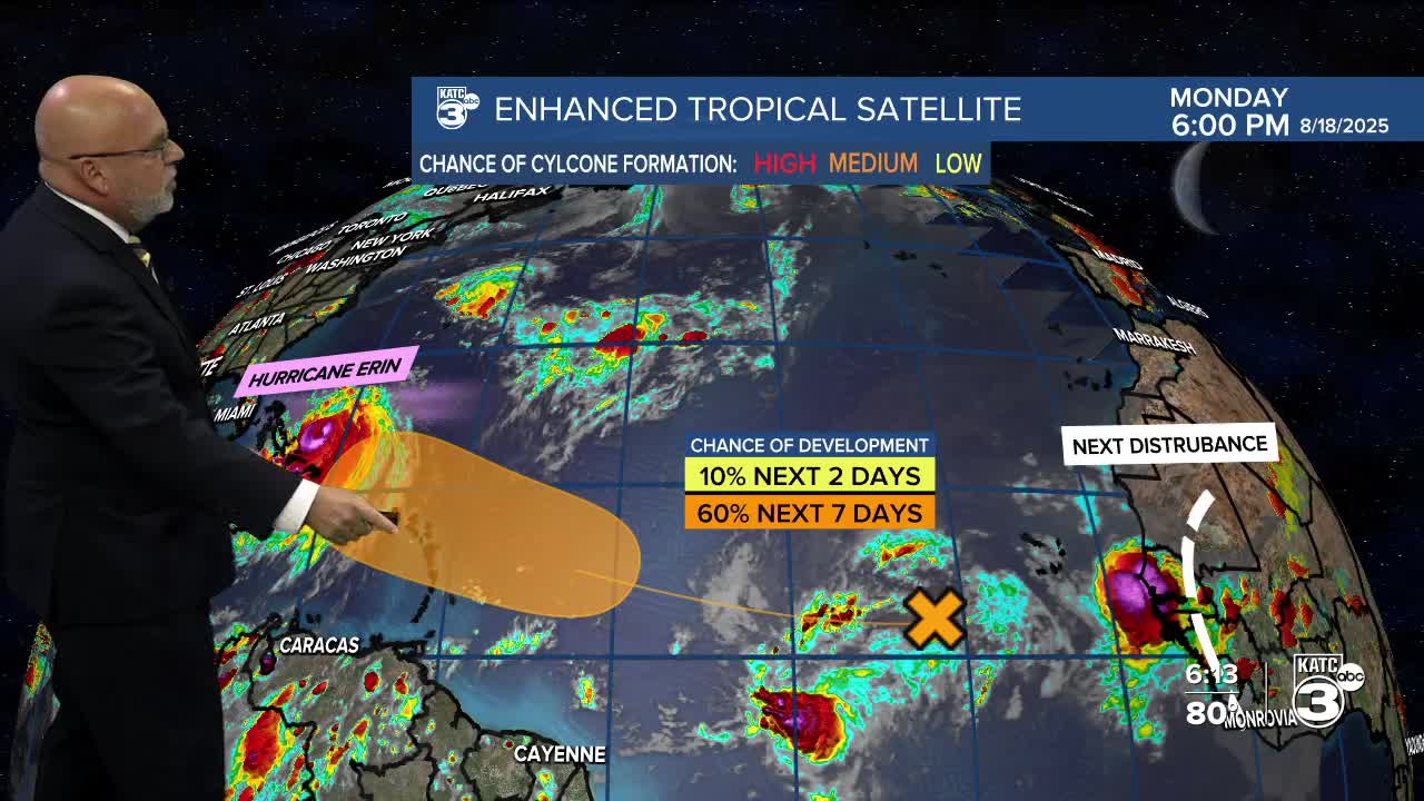
Meanwhile in the tropics, Major Hurricane Erin churning just east of the Bahamas is expected to remain a powerful and expanding storm over the next couple of days.

Monday afternoon's NHC update included the raising a Tropical Storm Watch from Beaufort Inlet to Duck, North Carolina including Pamlico Sound and a Storm Surge Watch from Cape Lookout to Duck, North Carolina.
More on Erin and the next system we're tracking:
Friday night saw explosive development with Erin from a tropical storm to a Cat 5 hurricane in a little over 24 hours...here's more and the satellite study:
