


Over the past few days just about everyone saw some rainfall as June storms popped up each afternoon. As we end the month, some of the rains will be suppressed today and Thursday. We normally can't drop the rain chance completely this time of year, but compared to the earlier part of the week, I think more of you will stay dry today. Especially inland parishes.
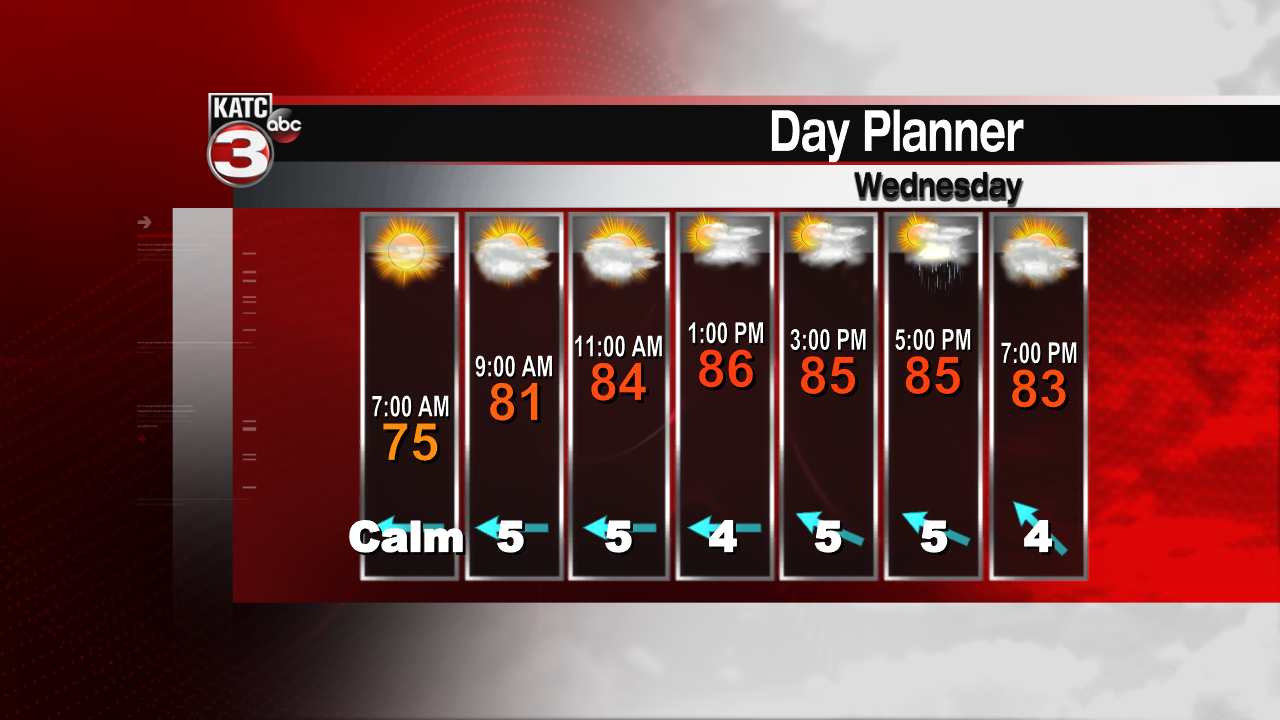
That said, the upper low over Mexico continues to drift west, therefore the main moisture flow will be over the Lone Star State. A tiny upper low over the northeastern Gulf of Mexico has pulled a but of drier air aloft over much of the central Gulf coast. There's a lot of moisture in the lower levels, so daytime heating will still get some showers and storms popping. But it appears the rains will be more likely along I-10 to the coast, and also more widely scattered. With less coverage of rain, temperatures will be hotter.
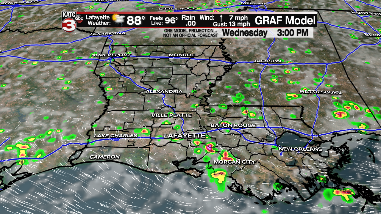
Temperatures are expected to hit 90 for most of us, lower 90s for the inland parishes. The heat index values should climb above 100 for a while as dew points remain high. About half of you will get some relief with the afternoon storms. It appears this pattern should linger into Thursday, but rain chances will be up again as we get into the weekend. Hopefully most of the rains will be over by the evening so any fireworks displays will be able to go on. Temperatures over the weekend will hold in the upper 80s.

We're now watching two disturbances over the Atlantic Ocean. One is near the Windward Islands. This is what we were focusing on yesterday, but today the wave appears a bit weaker, and the NHC is dropping the chance for development to just 10%.
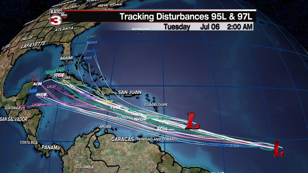
Another wave farther to the east has a better chance for development now. NHC is putting a 50% bet on development over the next two days, and 70% over the next five. It appears we'll have another named storm out there, that is forecast to track into the Caribbean over the weekend. Some models push it toward the Gulf of Mexico next week. We'll watch this one closely, of course best to have preparations together now while the weather is quiet locally!
