


Acadiana will continue to experience the hot summer weather pattern into the weekend, but some storms Saturday night may lower the furnace slightly for Sunday.

In the near term, expect highs Friday and Saturday to top out in the mid-90s while rain chances remain minimal.

Heat index values during the afternoon will be in the 102°-108° range through Saturday.
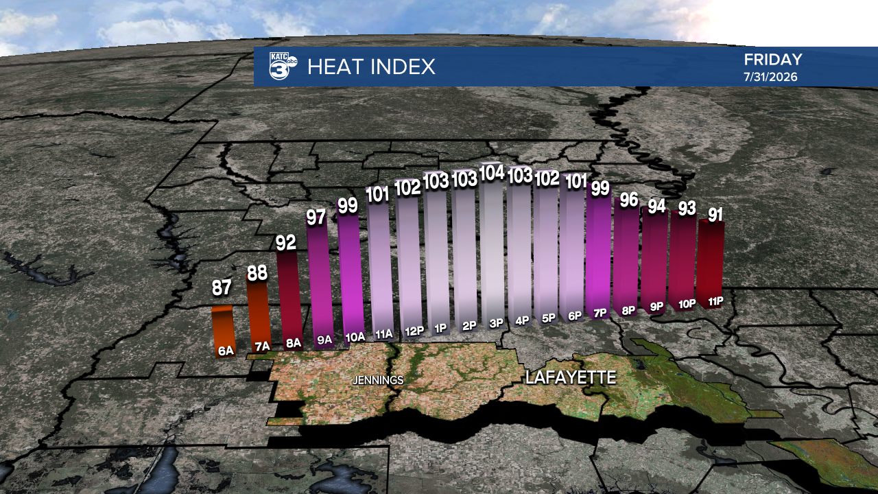
Sultry nights are expected through Saturday with lows hovering near 80° and heat index values around 90°!
Meanwhile, a weak frontal trough will push through the area Saturday night.

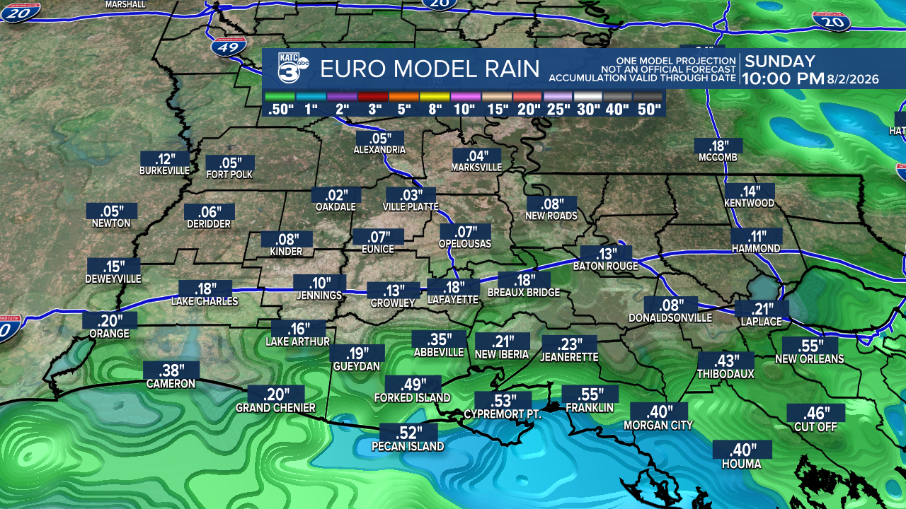
There should be a decent chance (60-70%) of some showers and/or thunderstorms with this feature, however models are not to keen on widespread coverage or amounts.
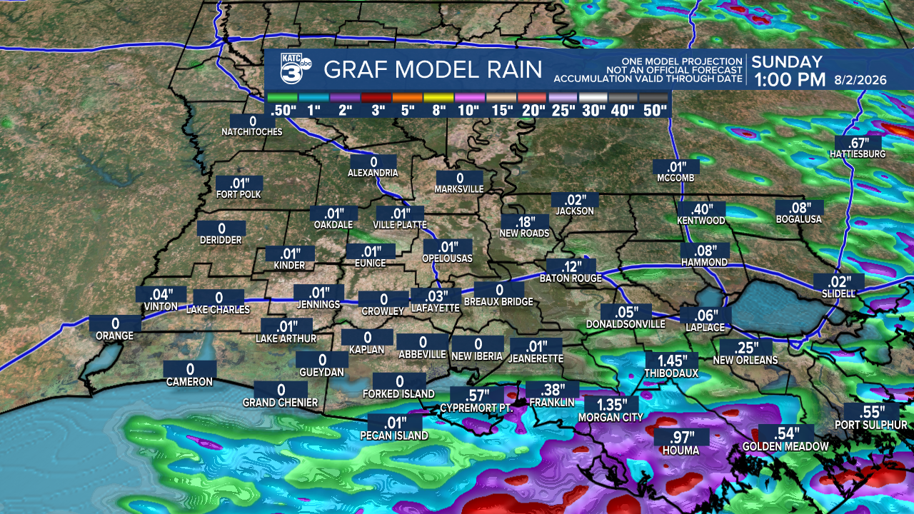
All decent rain totals look to manifest by the coast or offshore per the GRAF model, while the Euro is a little more generous inland yielding roughly 1/4", at best. Hopefully the forecast changes in this regard Friday.
The trough should clear the coast Sunday lowering our highs closer to 92°-93°, and should reduce our dew points and heat index by a few degrees Sunday afternoon.
Next week looks to bring more typical summer weather with above normal heat as highs continue for the most part, in the mid-90s. There will be the chance of a few isolated showers or storms (10-30%...and some rain chances might be generous) on any given day.
Overall, it looks drier than normal for the first week of August, with no persistent or significant rain-makers in the forecast for now.
See the KATC 10 Day Forecast for the latest.
The tropics remain quiet in the Atlantic Basin, and should stay that way through mid-August.

And given this year's set-up, we'll still have to watch for "close-in" development later this season...anything that might be close to the SE U.S. Coast and/or northern half of the Gulf.
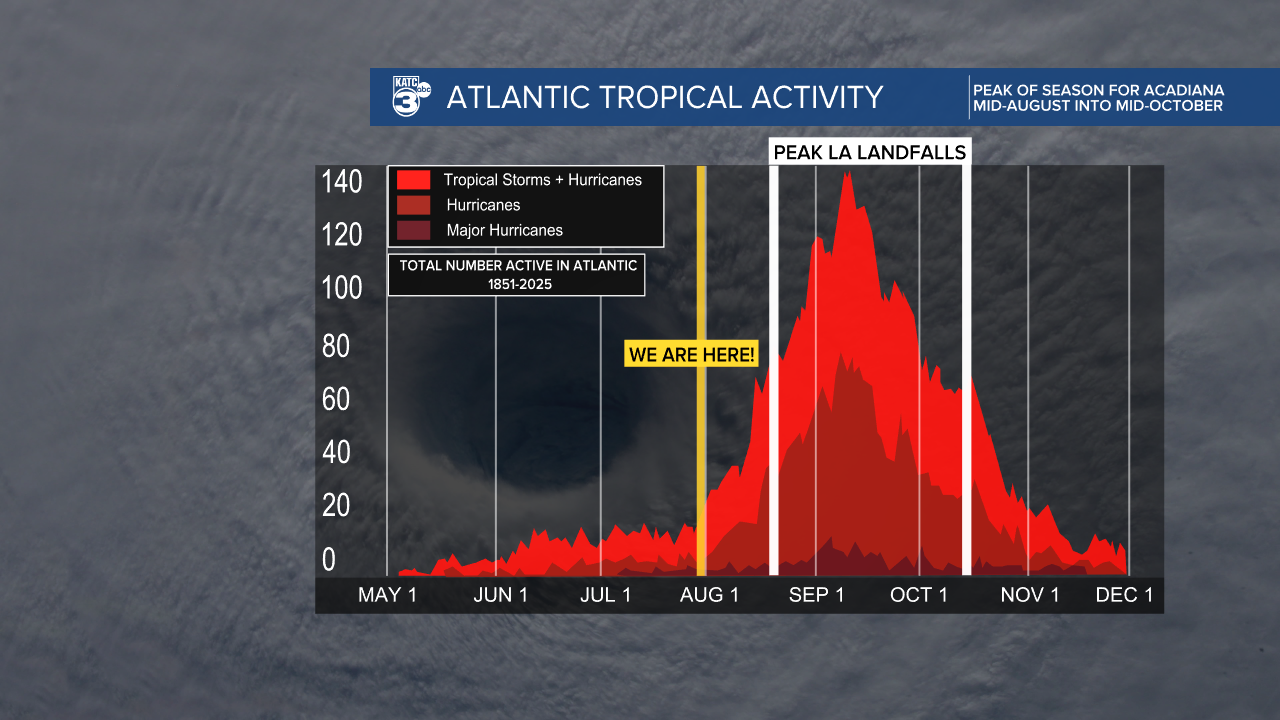
The peak of hurricane season for Acadiana and Louisiana doesn't begin for another 3-4 weeks.
