


Moderating, milder temperatures are in the forecast for Acadiana Wednesday, along with plenty of clouds and the chance of occasional patchy light rain shower activity.
A weak disorganized disturbance aloft will traverse the area Wednesday likely sparking scattered light shower activity from time to time.

Temperatures overnight will be closer to the near normal 40s while highs Wednesday will be limited to the mid-upper 60s thanks to the expected cloud cover.

And with warmer temperatures and increased Gulf moisture ahead for the area into Thursday, fog could be an issue Wednesday night into Thursday morning.
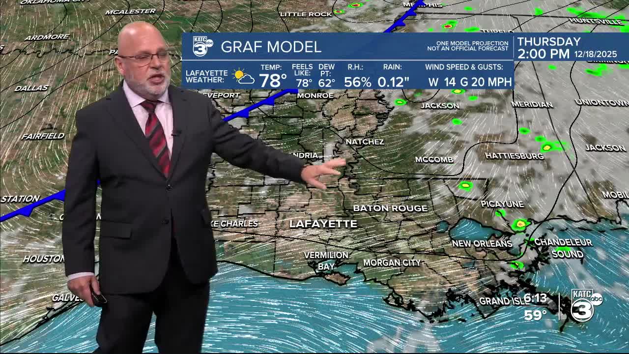
Thursday will see temperatures soaring into the mid to possibly upper 70s ahead of our next front that arrives Thursday night.
A few showers will be possible ahead of the front during the day Thursday and accompanying the front passage Thursday evening.
Temperatures will cool back to near normal (lows in the low-mid 40s/highs in the 60s) with sunny skies to finish the week Friday.
The cool front's effects will be short-lived with moderating temperatures back into the low-mid 70s this weekend.
Temperatures increase further to some 10° above normal for most of Christmas week along with minimal to near zero rain chances.
See the KATC 10 Day Forecast for the latest.
