


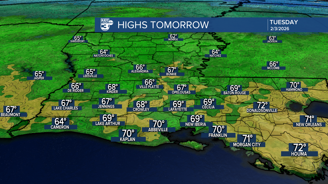
Although Acadiana will see temperatures in the 60s Tuesday, another cold front of Pacific origin, will arrive by Wednesday morning cooling us off again for a couple of days.
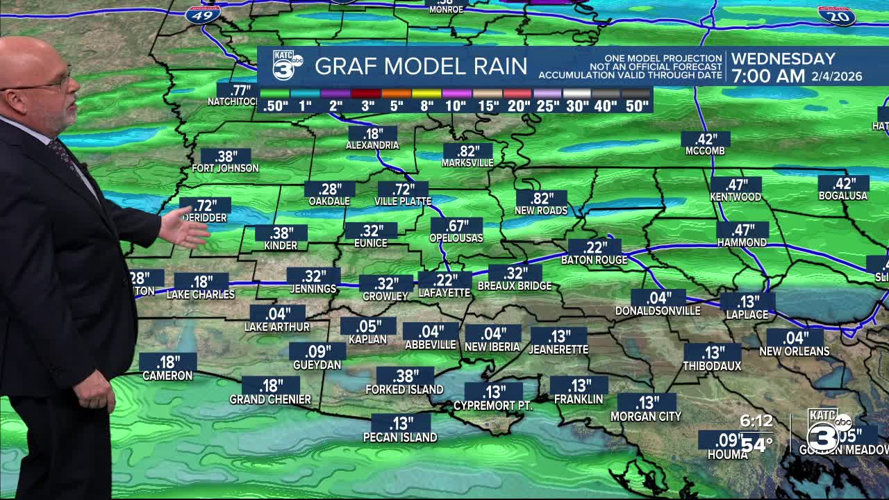
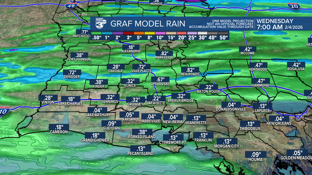
Ahead of the front, we'll see increasing clouds throughout Tuesday with some scattered shower activity developing for the afternoon (especially to the west), with more widespread showers and perhaps a few rumbles of thunder Tuesday night, ending Wednesday morning.
No severe weather nor much rain with this one, with most of us likely to receive 1/4 of an inch or less.
Meanwhile in the near-term, we won't be below freezing tonight for a change...in fact, the last 7 out of 9 nights have been sub-freezing!
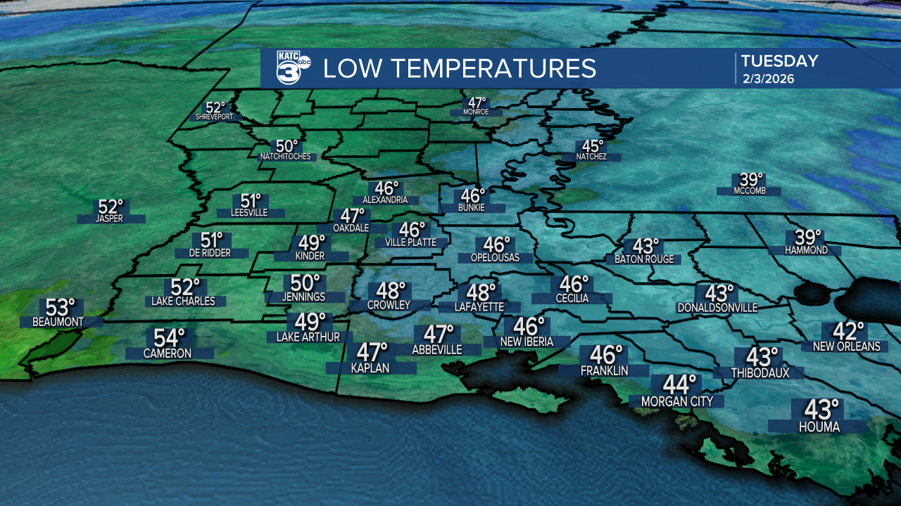
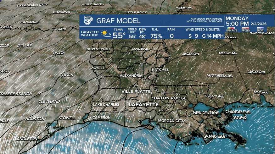
Actually temperatures will be some 15-18° milder tonight/Tuesday morning as compared with this Monday morning, with lows holding into the 40s across Acadiana thanks to southerly winds and clouds encroaching from the west.
Mostly cloudy and mild for our Tuesday, but don't get used to the 60s quite yet, as the next front cools us for Wednesday, but as mentioned earlier, this front will be of Pacific origin, not arctic.
However, we'll still see readings dropping into the low-mid 30s for Wednesday and Thursday nights.
Daytime highs will be in the 50s Wednesday and Thursday.
And after a chilly start Friday morning, look for milder temperatures into the afternoon and the weekend...and perhaps most of next week.
Daytime highs will be warming into 70s by this weekend, and they may stay in that range through most of next week!
Still too early to call for Mardi Gras, but all the local parades into this weekend and event for most of next week look to be in good shape!
See the KATC 10 Day Forecast for the latest.
