


A major, disruptive winter storm continues to take shape for portions of the Southern U.S. to the East Coast this weekend, with a crippling ice storm expected for the northern part of our state.
The question remains as to whether Acadiana will see accumulating freezing rain, but we do know for sure, the coldest stretch of weather all winter is coming this weekend into much of next week.
In the near term, it's going to become breezy and milder as southeasterly winds have returned, which should hold our lows tonight in the upper 40s to lower 50s.
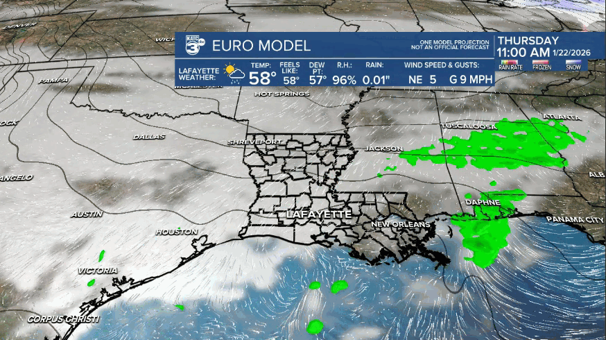
A disturbance approaching from the southwest in the sub-tropical jet stream should bring scattered showers to the area Wednesday (near 60%), primarily into the afternoon and early evening hours.
Temperatures will push toward the upper 60s Wednesday despite the expected cloud cover.
Thursday and Friday will keep plenty of clouds in the area along with some lower end chances of scattered showers before the weekend winter shock arrives.
A huge arctic airmass will invade the U.S. later this week, with the main question is not how cold, but when will sub-freezing temperatures arrive here locally.
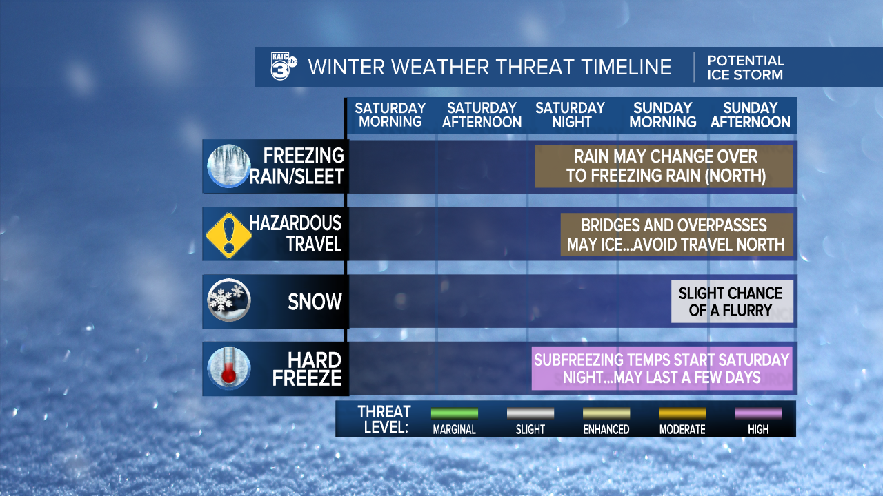
Look for a strong cold front to push through the area Friday night holding our temperatures in the 40s Saturday and then dropping toward the lower 30s to upper 20s Saturday night.
A favorable jet stream orientation will usher in copious amounts of Pacific moisture over the cold air in place Saturday, likely producing one of the bigger Southern winter storms for much of the Southern U.S., from Northeast Texas/Oklahoma eastward to the Carolinas and East Coast.
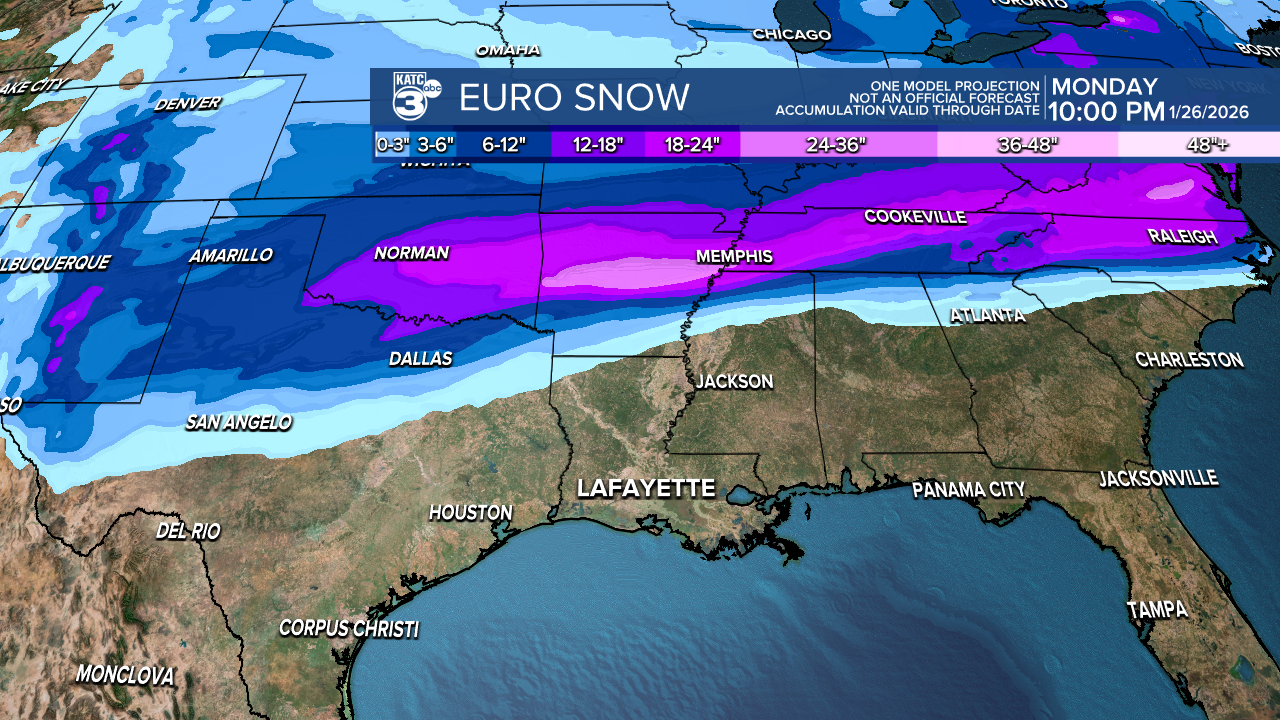
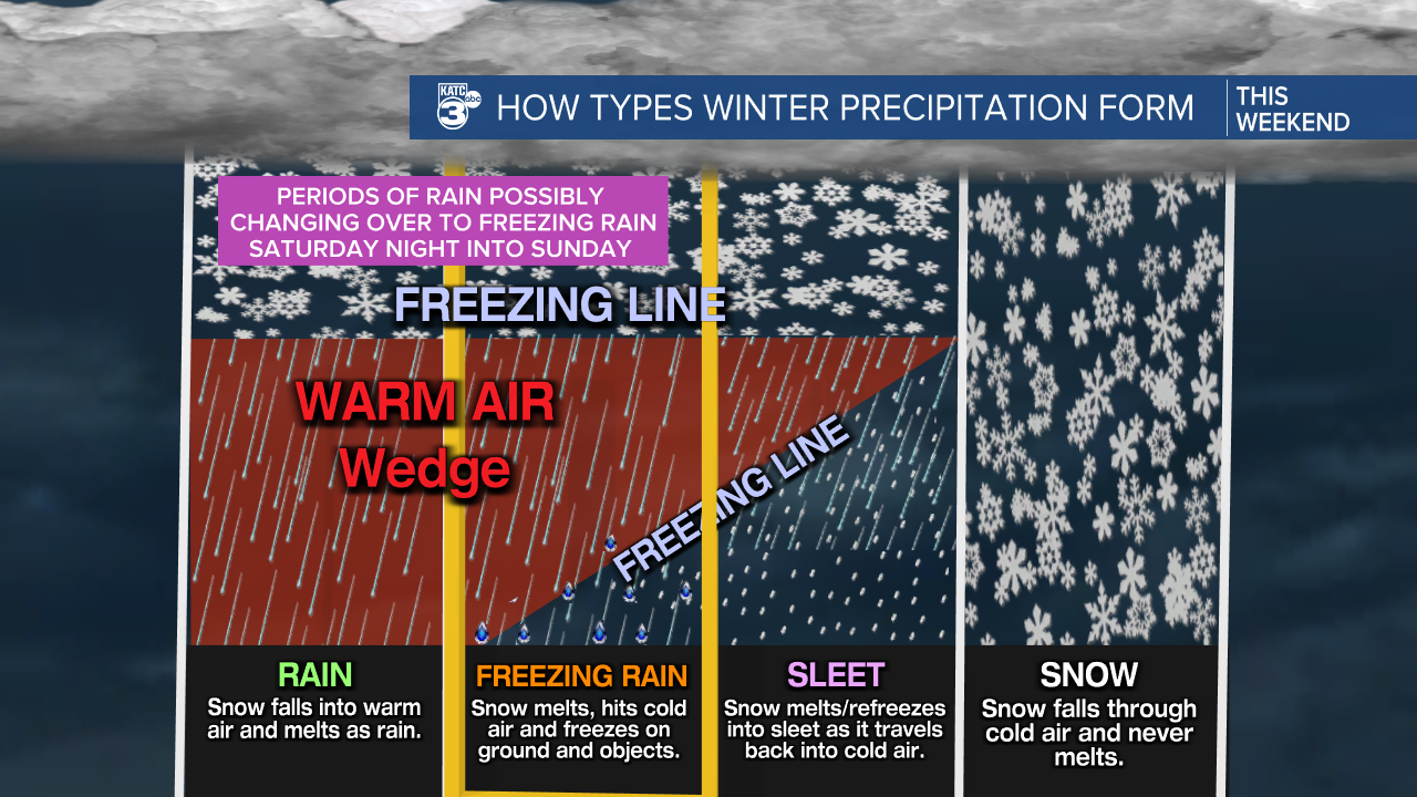
On the southern end of this system will be periods of cold rains, while in between a crippling ice storm will become likely.
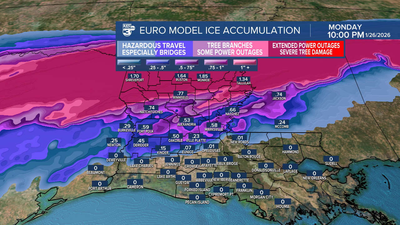
Today's models put Acadiana right on the edge of a hazardous winter weather event while the GFS is all-in on an ice storm for Acadiana.
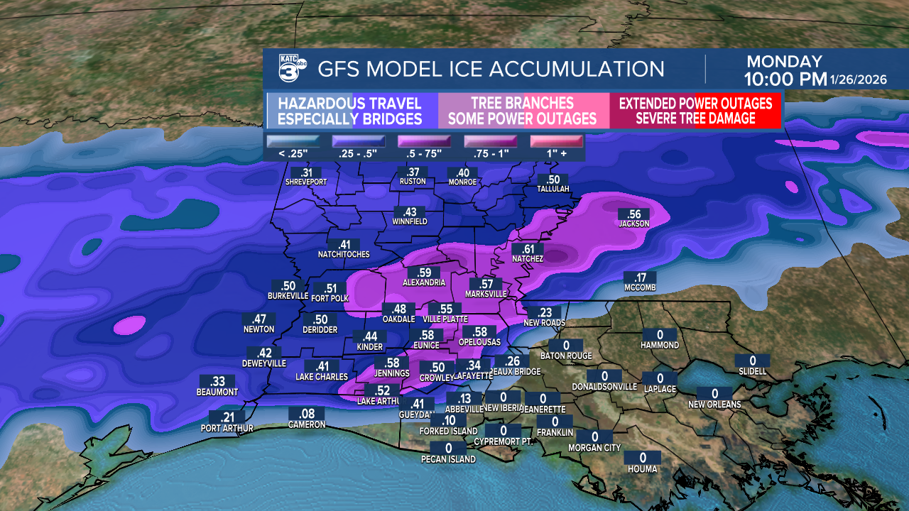
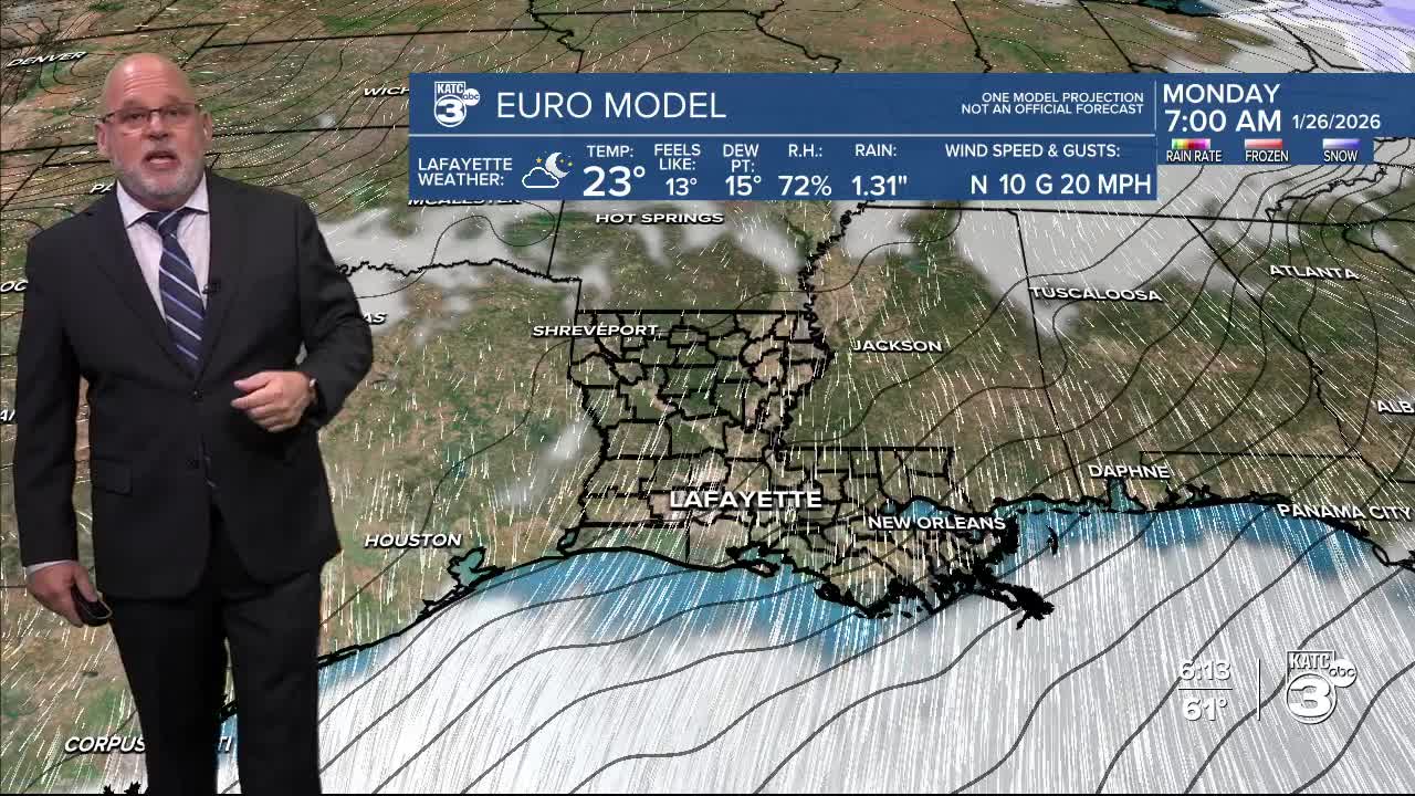
It remains too early to be specific on how it will play out across Acadiana, but we should prepare for the possibility of rain changing over to freezing rain Saturday night into Sunday.
The areas most at risk this weekend for hazardous travel would be from the northern Acadiana parishes on northward.
Prime-time for precipitation should be from Saturday night into Sunday with the possibility of rain/and or freezing rain briefly changing over to some sleet and perhaps a snow flurry by the end of Sunday.
But none of this is set in stone, as we are yet too far out from us being able to utilize and evaluate the high resolution models, which we won't be privy to, until Thursday...so stay tuned for changes.
Meanwhile, we do know, that Acadiana will see its coldest stretch of winter coming this weekend and continuing next week....which makes the precipitation forecast and the type of precipitation that much more important, as wherever the big snows and ice fall, they'll like stay for a couple of days.
At this point travel along the I-20 Corridor could be shutdown this weekend including impacts at major airports such as Dallas, Nashville, Atlanta and perhaps, even Houston may have major delays etc.
Stay with KATC for the latest...the latest 10 Day Forecast below:

