


Acadiana will firmly be in late summer's grasp here this week as kids start heading back to school.
We've got plenty of sunshine coming up over the next few days and rain chances are going to be at a premium.
That being said an isolated shower or two may not be likely Monday or Tuesday, but they will be possible.
Rain chances will creep up Wednesday but nothing that will have any major impacts on your plans.

Ultimately this is going to be a fairly quiet weather week locally with little change from day to day.
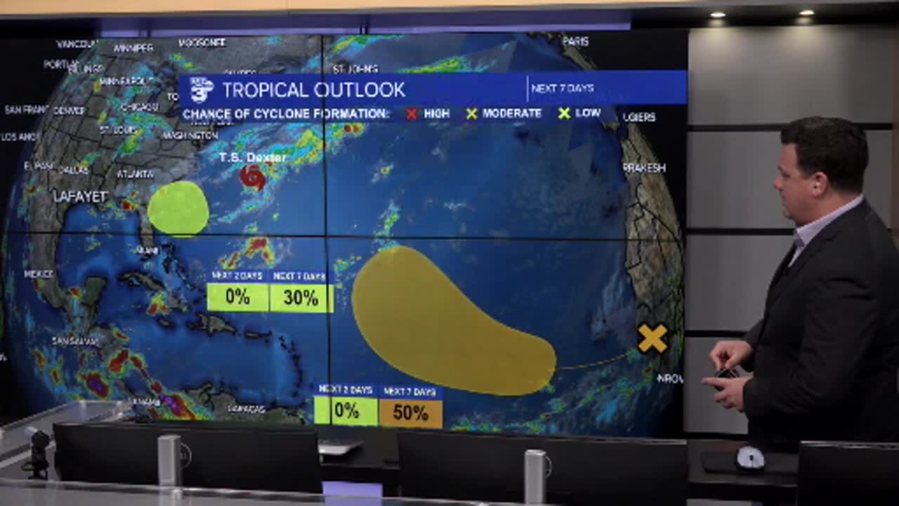
It is worth noting, however, that seemingly overnight the tropics have really come to life.

T.S. Dexter formed early Monday morning and will stay out in the Atlantic, with another system potential developing along that same boundary.
Models are indicating the central Atlantic Basin will become more active in the next week or so and those storms will need to be closely monitored.
The good news is that nothing is threatening the Gulf at this time, and there's no imminent threat to Louisiana.
This is the start of a tense time down here though as we move into the peak of the season so make sure you stay vigilant in monitoring the forecast.
