


Acadiana's stubborn, late summer pattern will continue with hotter and drier than normal conditions, but with a slight chance of an isolated shower on any given day this week.
Look for partly cloudy and hot days with highs continuing in the low-mid 90s while night time/morning lows cool to near normal...around 70° at night through the weekend.
There may be a slight uptick in the chance of an isolated shower or thundershower compared with the last several days, with rain chances remaining near 20% or less on any given day through the weekend.

Moving into next week, there looks to be a frontal trough that could generate a better chance of showers and perhaps a few thunderstorms during the early/mid-week period, but any significant rainfall and any cooling behind the frontal trough looks limited at this time.
See the KATC 10 Day Forecast for the latest.

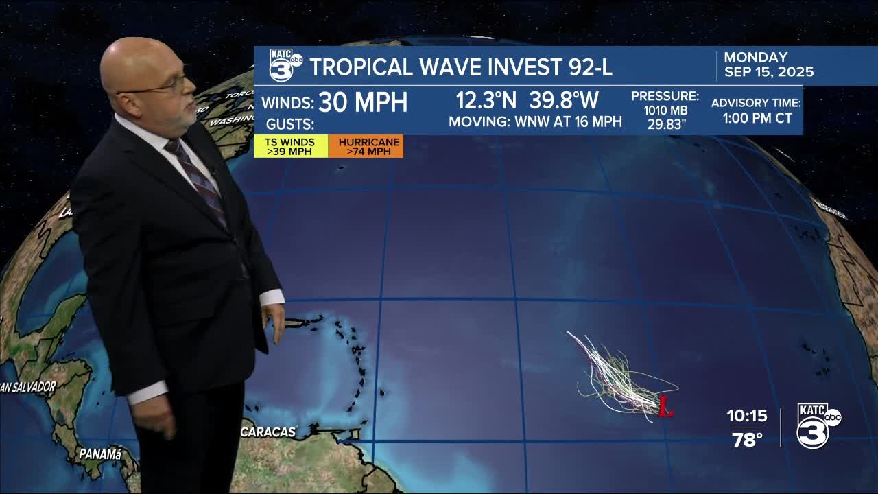
Meanwhile in the tropics, a disturbance in the mid-tropical Atlantic is looking more organized and has a 90% chance of development beyond 48 hours as it is expected to move into a favorable environment for further development.

Per the National Hurricane Center: "A tropical depression or tropical storm is likely to form by the middle to latter part of this week as the system moves west-northwestward at 10 to 15 mph over the central tropical Atlantic."

All guidance at this time suggest this system will remain an Atlantic system...Bermuda may have to watch this one at some point.
The next name on the list remains "Gabrielle".
Closer to home, the Northern Gulf looks to remain quiet through the rest of this month...and that's great news.
