


Acadiana's late summer weather pattern continues for this second week of fall, and it looks to continue for at least the next week to 10 days.
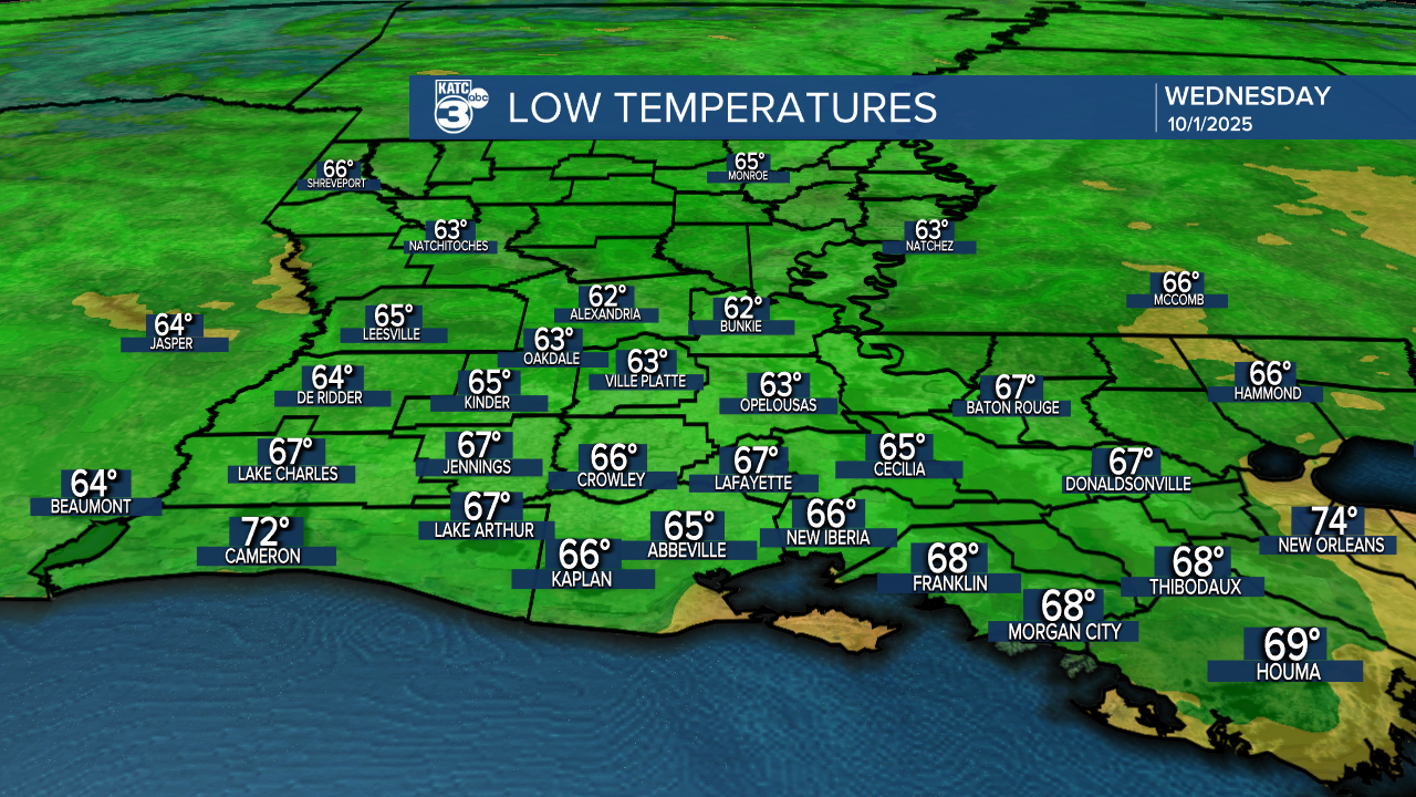
In the near term, look for anywhere between 1-3° cooler for Acadiana for Wednesday morning, with lows generally in the mid-upper 60s.
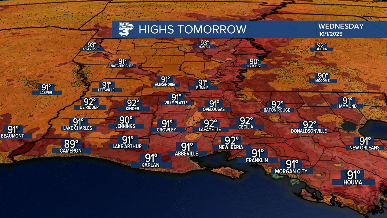
But summer temperatures, and probably a degree or two hotter than Tuesday, is anticipated for Wednesday with highs approaching and near 92°.
At least the humidity should keep the heat index close to the actual temperature Wednesday.
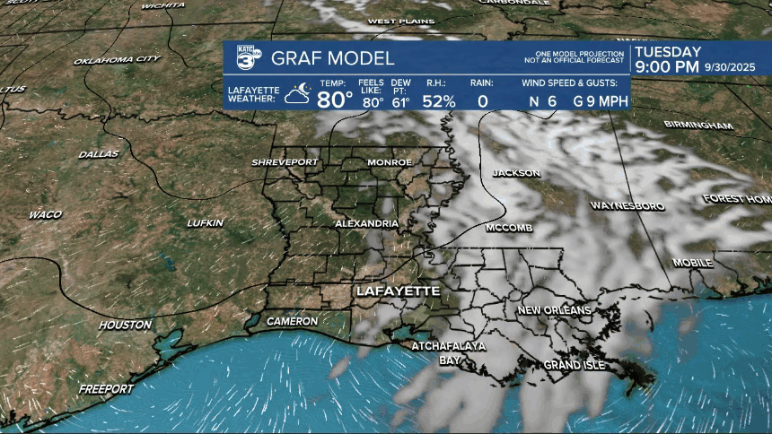
Staying dry for Wednesday, but perhaps a few spotty showers may develop Thursday, as a very weak frontal trough approaches from the northeast.
Rain chances Thursday look no higher than 20-30% at best.
It'll be back to dry conditions with above normal daytime highs into the weekend.
Wednesday should be the hottest day of the week with highs ranging from 91-93° across most of the area.
The frontal trough and airmass behind that arrives Thursday could serve to bring our daily highs and lows down for a few days, but the extended outlook into next week is "front-less" with above normal daytime temperatures continuing.
It should stay dry Friday into Saturday, but some Gulf moisture will creep back into the area Sunday into Monday, allowing for a low end chance of scattered showers and perhaps, a few thunderstorms.
Thereafter, we may still not be done with the 90s, even toward the latter part of the KATC 10 Day Forecast.
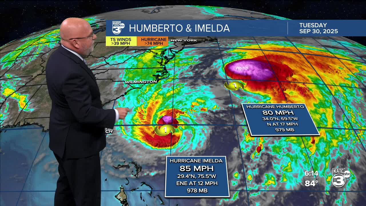
Meanwhile in the tropics, we continue to monitor two hurricanes in the Atlantic, with Humberto weakening significantly since yesterday while Imelda begins to strengthen.
Latest from the National Hurricane Center
Finally, the Climate Prediction Center issued their weekly 2-3 week tropical outlook, highlighting that the areas from the Eastern Pacific to the Western Caribbean and northward toward the Southern Gulf may become active in 2-3 weeks.

It's way too early to tell whether the Northern Gulf States might be at risk, and statistically, by the 3rd week of October it's usually quite difficult for storms to move northward across the Gulf.
However, we have seen weirder things happen in the past, and even this year...so no relaxing quite yet on this hurricane season.
More below:
