


After a round of "graupel" this morning, much of Acadiana may see a late season light freeze for Tuesday morning.
And for those seeking the usual warmer than normal spring temperatures, they'll be back for the weekend.
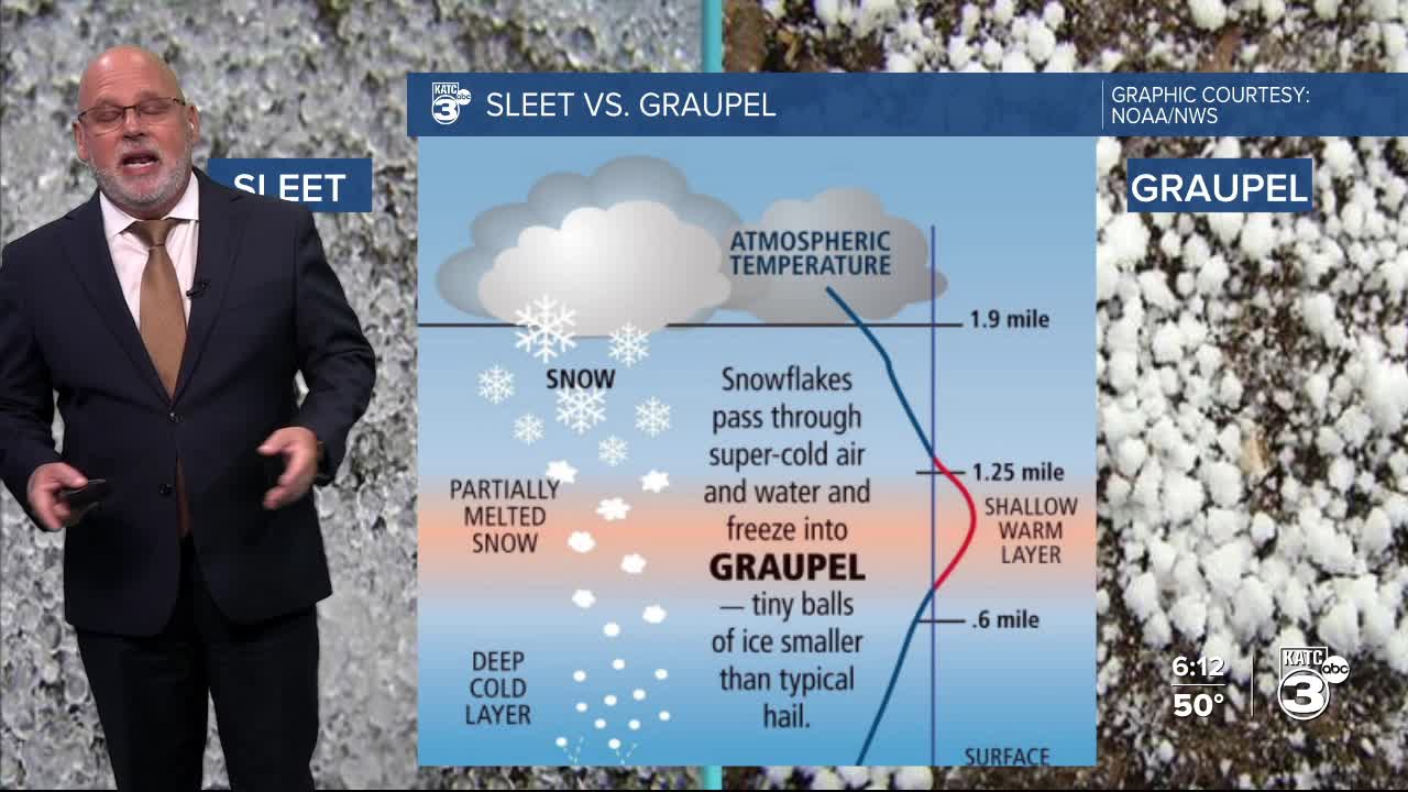
First off, Acadiana got a bit of a surprise this morning as a weak mid-level disturbance produced a brief round of light rain showers that turned into "graupel" and some sleet this morning.
Graupel, a German term used as early as the late 1800s, gets its name as a diminutive term for "graupe", which refers to pearl barley or hulled grain.
In today's case, the graupel started as snow (which usually falls at 8-12 feet in most winter weather scenarios, and for us, usually melts before even getting close to the ground) that fell through a warmer and drier atmospheric dry layer at roughly 5,000 feet.
This warmer layer partially melted the snowflakes, but also cooled the atmosphere through an evaporative process a little closer to the ground...while this occurred, there was a net cooling of the milder/drier layer of the atmosphere, which chilled it below freezing, that didn't allow for the snow to completely melt, and refroze it into small slushy balls that we saw this morning.
This process didn't last long, and there was some sleet pellets that also fell after the initial round of graupel.
Graupel is also known as soft hail, as to not be confused with typical, mostly warm season hail storms.
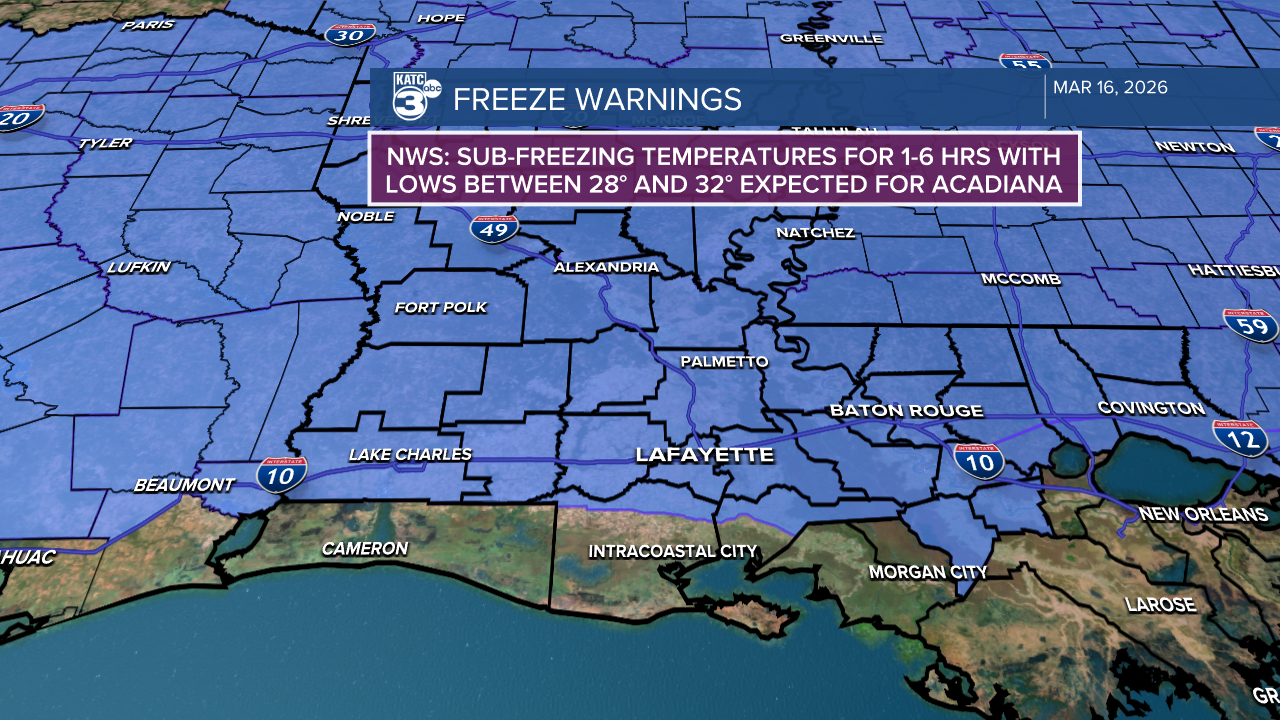
Meanwhile, portions of Acadiana may see a light freeze tonight with lows dropping into mostly the low-mid 30s, but some upper 20s will be possible for our northern parishes into Central Louisiana.
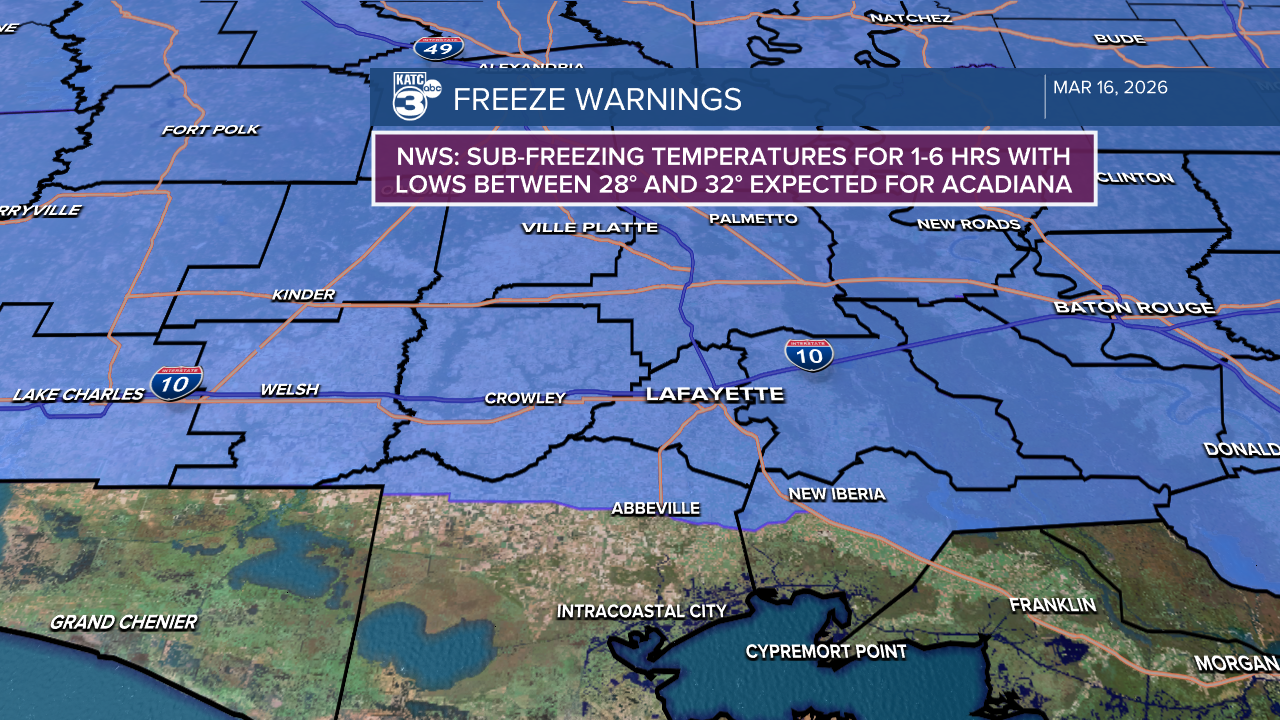
Thus the Freeze Warning for most of Acadiana, primarily from the highways 14 and 90 corridor on northward.
Per the National Weather Service, freezing temperatures may last for near 1 hour to the south, and up to 4-6 hours for our northern-most areas...not pipe-busting, but enough cold to put a hurt on tomato and sensitive plants.

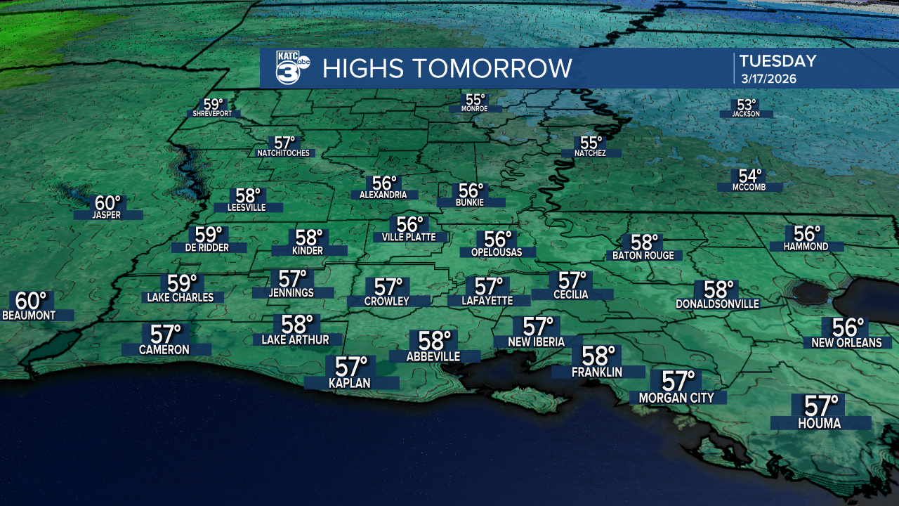
Sunshine and milder temperatures with less wind are expected for our Tuesday with highs pushing into the mid-upper 50s.
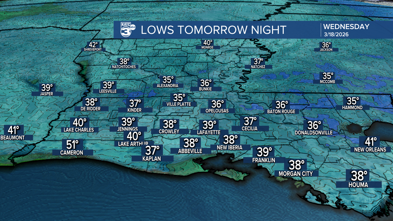
Tomorrow night/Wednesday morning will not be as cold, but will still be unfriendly to the tender plants with lows in the mid-upper 30s.
Thereafter, expect a warming trend later this week, and we'll likely reach the lower 80s with above normal temperatures this weekend and through most, if not all, of next week.
And for now, there are minimal rain chances in the KATC 10 Day Forecast.
Finally, on a celestial note, Acadiana will pass through the "equilux" into Tuesday.

This is when daylight and darkness are almost equal! (11:59 of daylight today and tomorrow 12:01).
