


Acadiana will see one more light freeze/frost for Tuesday morning...thereafter, it's a full spring pattern ahead!
In the near term, with clear skies, nearly calm winds and a Canadian air mass in place, Acadiana will likely see temperatures dipping into the upper 20s to lower 30s for a few hours around daybreak Tuesday.

This is mainly a "plant and pets" threat, there should be no pipe worries as temperatures will not be that far below freezing, and if so, only for a few hours around daybreak.
This could be the last potential frost and/or light freeze the area may see for the winter season, as we do not see anything nearly as chilly as tonight on the horizon for at least the next 2-3 weeks...if not more, and then it may be until November!
Temperatures will rebound nicely Tuesday under full sun with highs reaching the mid-60s.

Breezy southerly winds will develop for the area Tuesday afternoon and will get rather gusty into Wednesday.
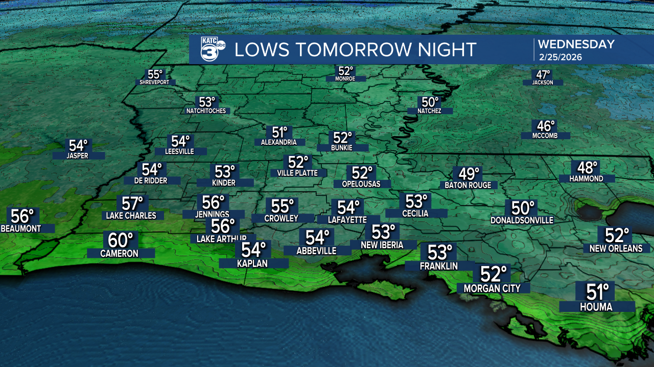
That means our lows tomorrow night/Wednesday morning will likely hold in the 50s.
And in spite of a fair bit of cloud cover returning Wednesday breezy southerly winds should help is out to reach at least the mid-70s.
The rest of the 10 Day Forecast that takers us into the first week of March looks like a continuation of spring-like temperatures.
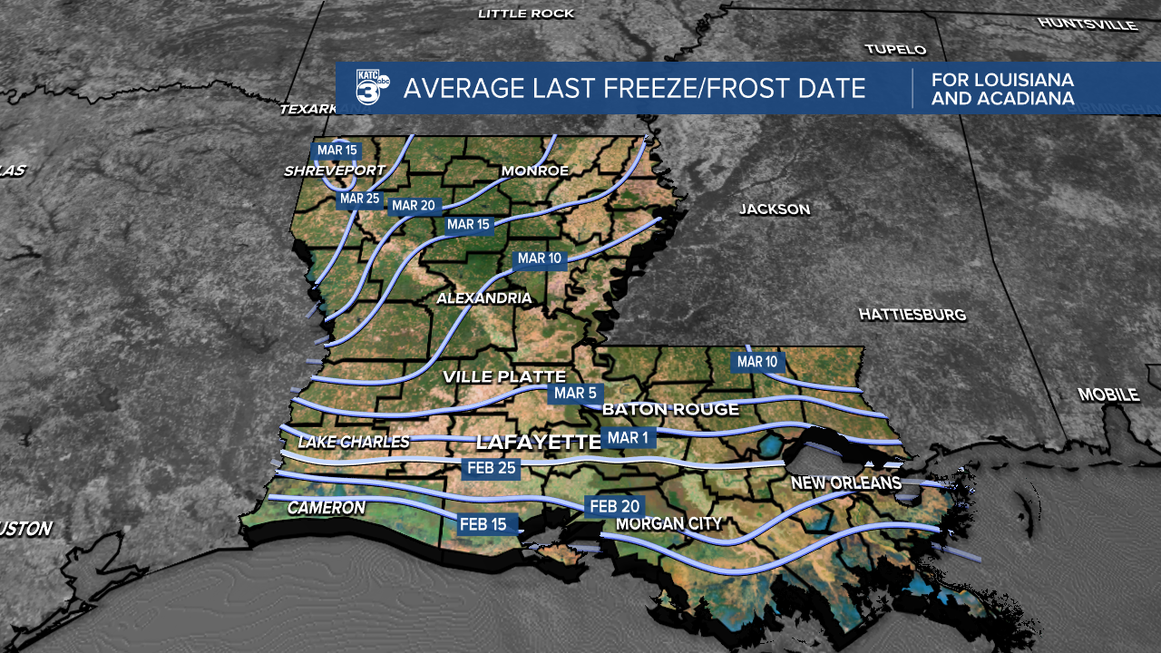
Climatologically-speaking, it appears that tonight's light freeze/frost for Acadiana is pretty much on schedule, if but a few days early!
