


There is nothing remarkable about the forecast pattern Acadiana finds itself in this week.
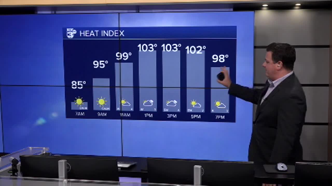
High are within a degree or two of average which this time of year is about 93, with a heat index in the low 100s which is very typical for this time of year.
Rain chances remain scattered but nothing that has much of an impact on your day, unless you catch an unlucky downpour during your commute.
If you were to write a text book on typical summer weather in Louisiana, you'd be safe to include a picture of our current 10 day forecast.

Not that I'm complaining.
This week marks nine years since Acadiana's Historic Flood, so the alternative can always be worse.
Speaking of the alternative while it is quiet locally we do see plenty of activity in the tropics.
T.S. Erin is on it's path to becoming a major hurricane and thankfully looks like it will eventually curve out into the Atlantic.
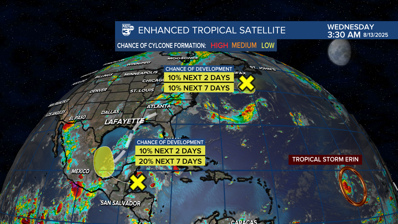
There is a bit of moisture just east of the Yucatan that became an area of interest on Tuesday.
Development isn't expected, but should be something to watch as it gets into the Bay of Campeche.
This will eventually move into Mexico with a little of the moisture having a chance at getting to Acadiana, but won't impact our rain chances much.
