

Acadiana is starting Thursday with patchy fog and the potential for isolated strong to severe thunderstorms.
The Storm Prediction Center has placed Acadiana in a Marginal Risk (1 out of 5) for severe weather today. While storm coverage will remain scattered and localized, any storm that develops could become severe, producing hail and gusty winds.

The Weather Prediction Center also outlines the area under a Level 1 out of 4 Excessive Rainfall Risk, meaning localized heavy downpours may result in brief, isolated flooding in low-lying or poorly drained areas.

Despite the unsettled weather, high temperatures will still climb into the low to mid 80s—a trend that looks to hold steady for the rest of the week


Looking ahead, Wednesday will bring the highest rain chances of the week, with scattered showers and thunderstorms likely throughout the day.
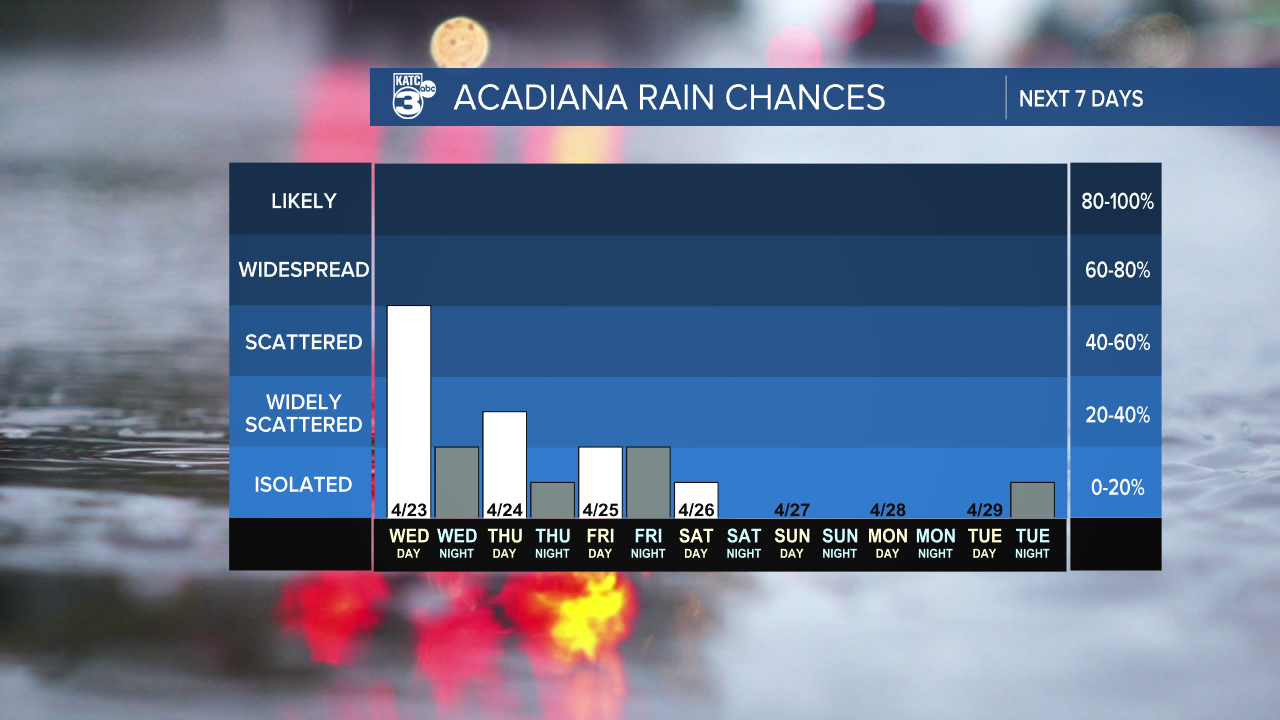
But for those planning to attend Festival International this weekend, there’s good news. Rain chances taper off, and we’re expecting warmer and drier conditions, with highs climbing into the mid to upper 80s—perfect for enjoying the music, food, and celebration downtown.
Stay tuned to KATC for the latest forecast updates, and remember to enable weather alerts on your mobile devices in case storms develop near you.

