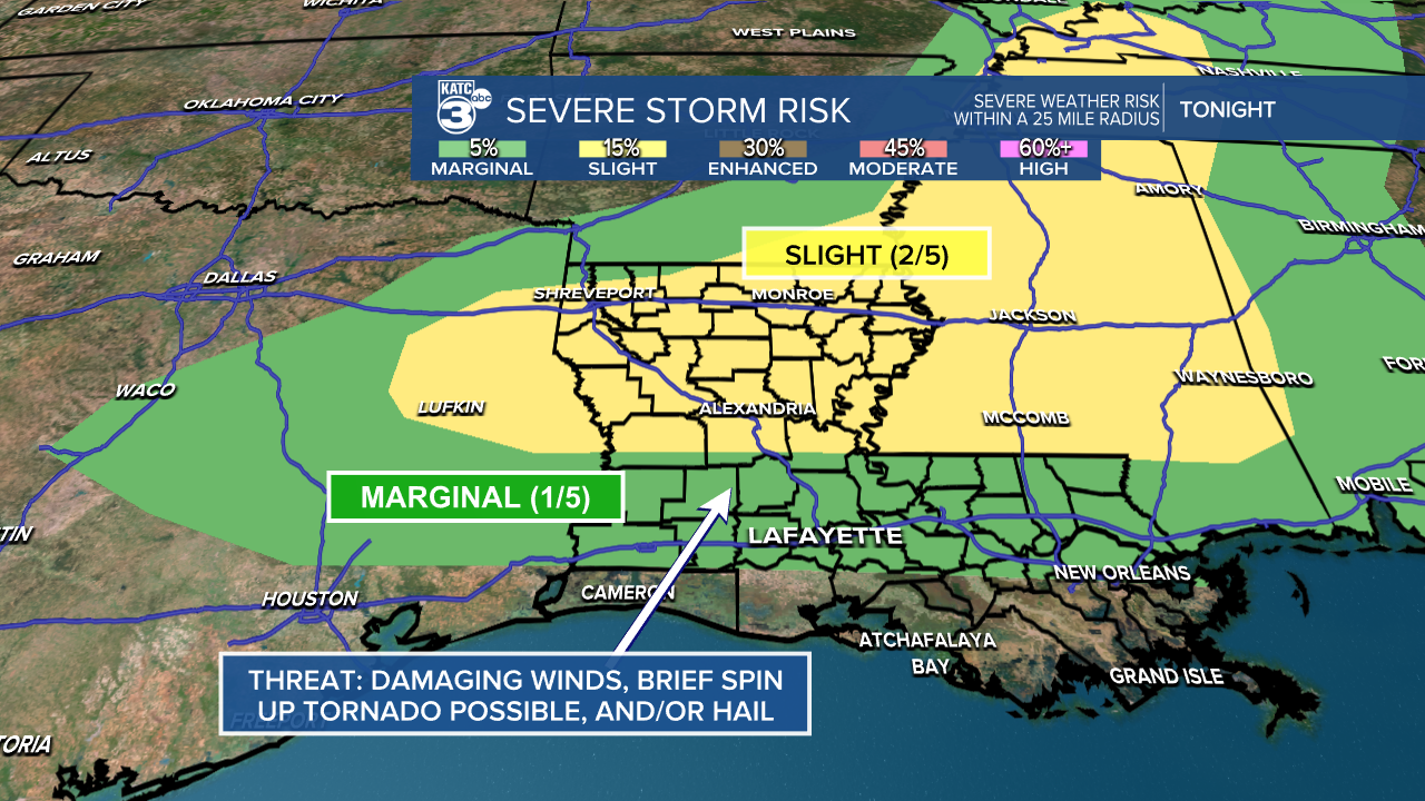
We’ve got an active night ahead as half of our region is under a marginal (1/5) risk for isolated severe storms. Be on the lookout for potential threats like damaging winds, isolated tornadoes, and hail.
A tornado watch is in effect for northwest Louisiana until 11 PM, and northeast Louisiana until 3 AM Sunday. Expect a line of thunderstorms to roll through Central Louisiana around midnight, making its way south near I-10 shortly after.
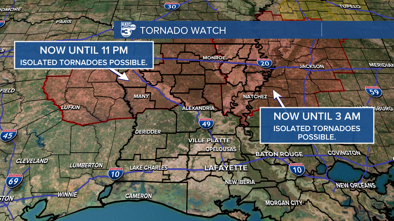
The good news? All storms should clear out of Acadiana before daybreak tomorrow!


Make sure your weather alerts are activated tonight so you stay informed about any watches or warnings.
Invest 98L is still a tropical wave a few hundred miles east of the Windward Islands. While it’s producing some disorganized showers and storms right now, conditions may improve next week, potentially leading to the formation of a tropical depression.

On another note, the other disturbance in the northern Atlantic has moved into cooler waters, which means it’s not expected to develop further.

See the KATC 10 Day Forecast for the latest.
