

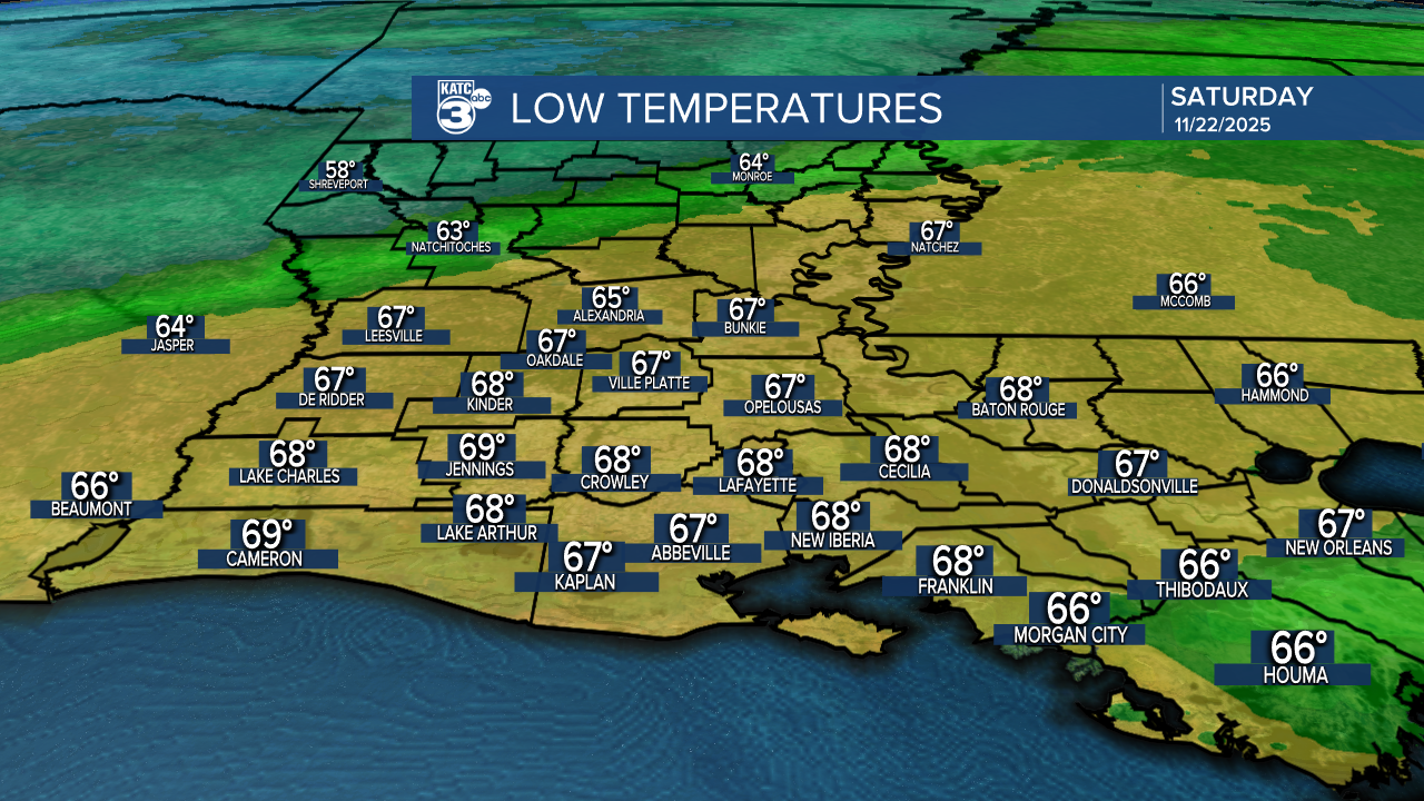
As we look ahead to the weekend, it’s shaping up to be fairly dry and warm. Tonight, expect lows in the upper 60s.
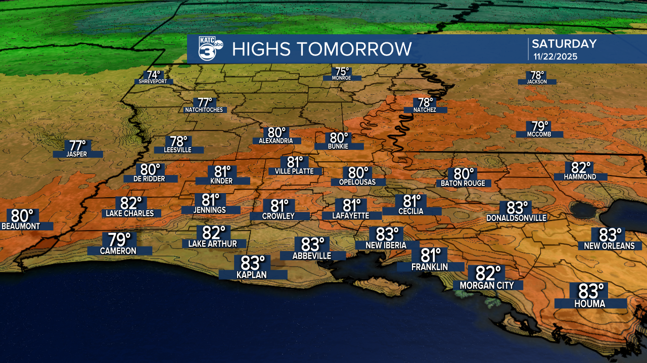
Tomorrow brings highs in the low 80s, though we might see a few showers with an incoming cold front after midnight.
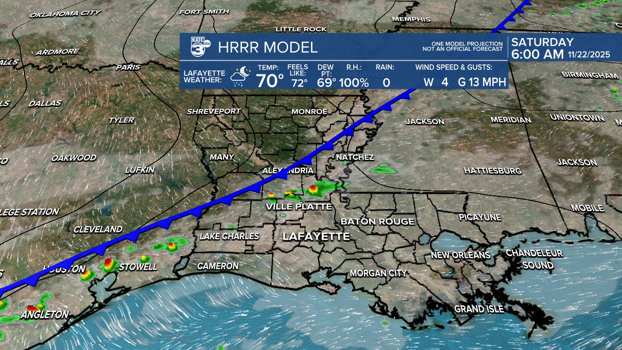
But don’t worry—the rest of the weekend is expected to be rain-free.
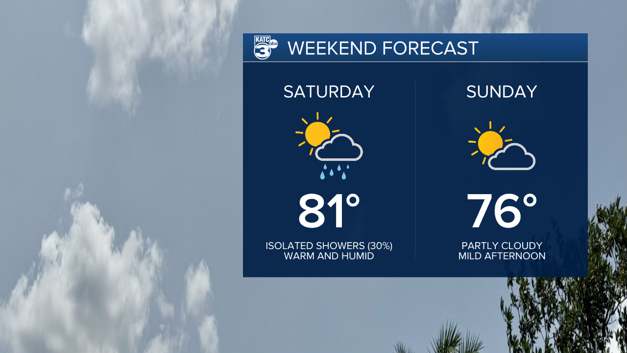
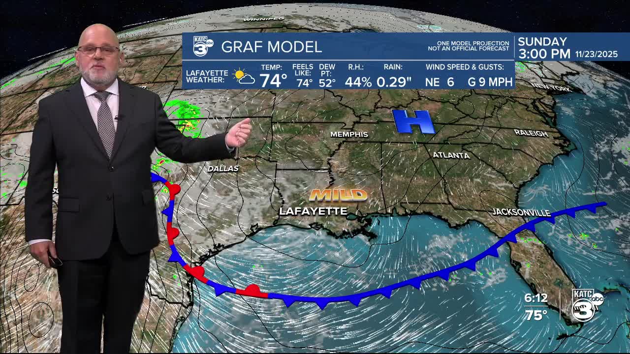
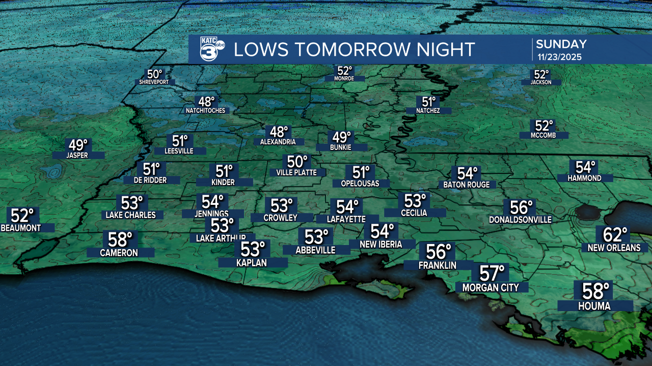
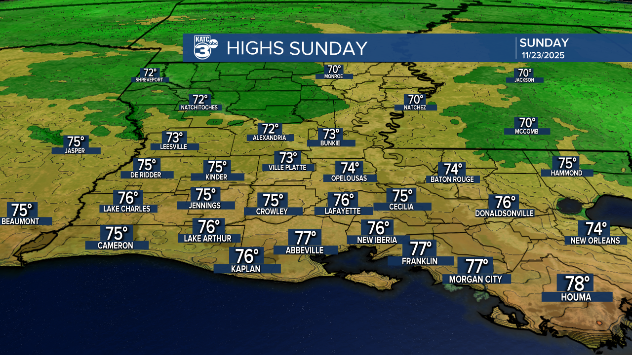
Temperatures cool down a tad going into Sunday, morning lows dip into the 50s, but warming up into the 70s by the afternoon.
Now, let’s talk Thanksgiving week! Monday is shaping up to be a fantastic travel day with a pleasant mix of sun and clouds. However, be prepared for some changes as another cold front rolls in Monday night into Tuesday.
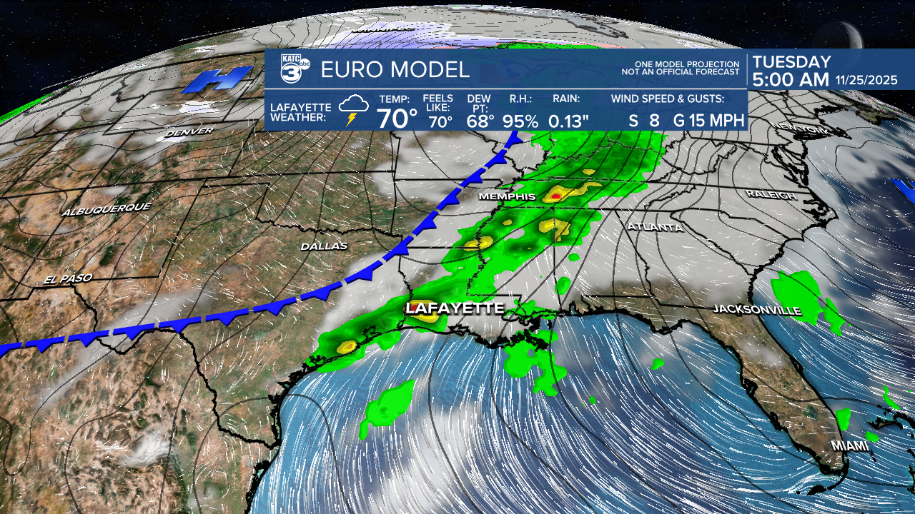
This could bring showers and storms on Tuesday morning, and the WPC has placed us under a marginal risk for flash flooding due to heavy rain.
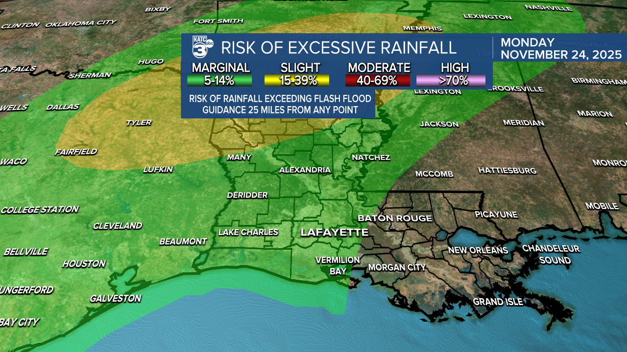
Rainfall amounts may increase, so stay tuned as we get closer to the day!
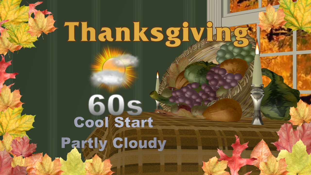
Good news for travelers: Wednesday and Thanksgiving Day look great! Expect cooler temperatures on Thanksgiving with morning lows in the 40s, but warming up nicely into the 60s by the afternoon.
Follow Meteorologist Breyanna Lewis for further updates.
See the KATC 10 Day Forecast for the latest.
