


After another nice one for Acadiana Saturday, look for increasing humidity and some rain chances developing Sunday into early next week...thereafter, it gets only wetter.
in the near term, expect another mild overnight into Saturday morning with temperatures in the upper 60s to lower 70s by daybreak.

Saturday will be mostly cloudy in the morning and gradually become mostly sunny, breezy and warm into the afternoon, with highs in the mid- to possibly upper 80s in a few spots.

Starting Sunday into next week, the sub-tropical jet stream will be moving overhead, and will likely stay for at least a week or more.
This means more cloud cover and a few pop-showers or thundershowers Sunday, Monday into Tuesday...all the while humidity increases to more summer-like levels.

By mid-next week, stronger disturbances in the sub-tropical jet will allow for higher more widespread rain chances, and the chance of a daily soaking from Wednesday through next weekend.
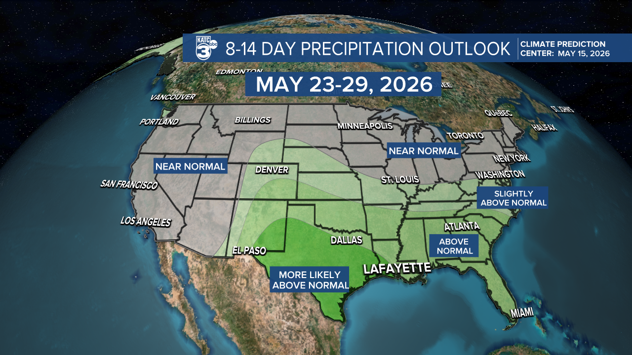
The unsettled pattern looks to last longer per the latest Euro Model and the Climate Prediction Center's outlook through the end of the month.
The pattern that initiates mid-next week will have best rain chances during the day, but there could be some night time activity on occasions.
While premature to assess whether there will be any severe weather and/or flood threats, it's beginning to look soggier and soggier for the area from mid-week on.

The 10 day Euro rain accumulations continue to grow with each model run...with several inches possible on any given day for the latter part of this forecast period...with more to come thereafter.
Meanwhile, see the KATC 10 Day Forecast for the latest.
