


JUNE 3, 2025 — Acadiana's weather will gradually get be getting hotter into the weekend with the return of scattered, primarily afternoon, pop-up showers and a few thunderstorms.
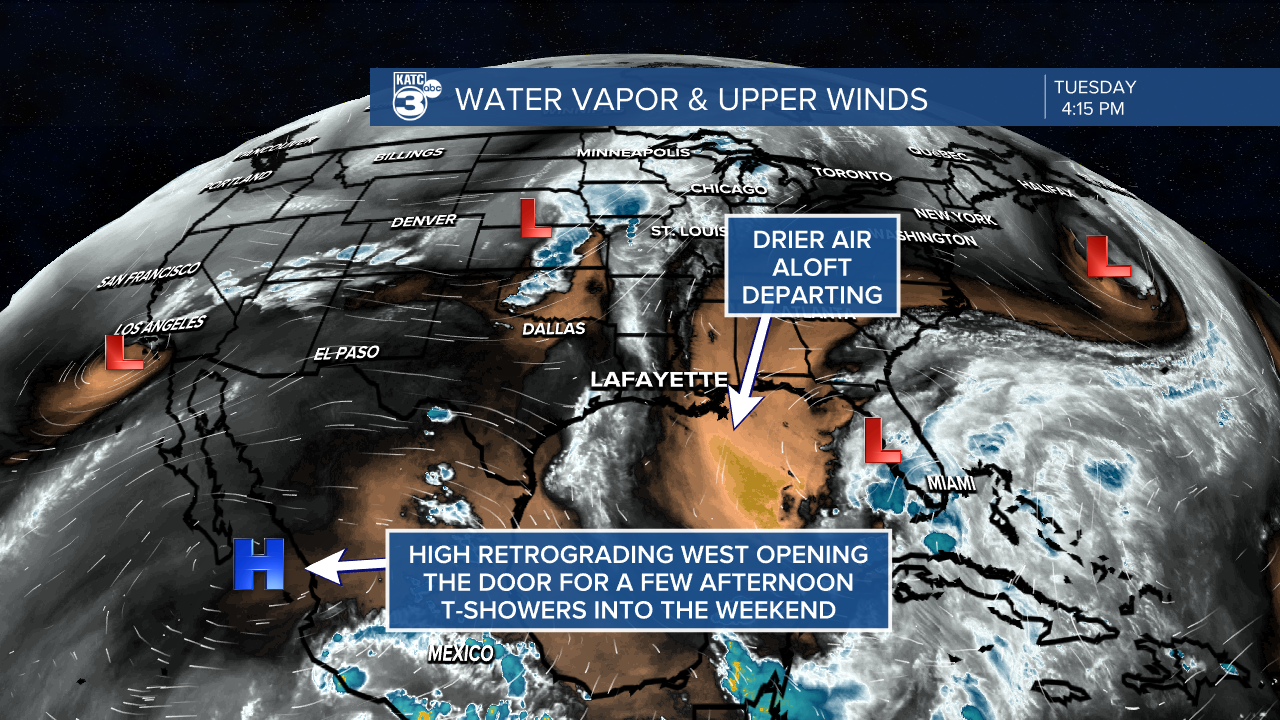
As upper high pressure continues to retrograde back toward the Pacific, the door has been opened for a little more instability aloft...and combine that with a continued humidification of the lower atmosphere, some lower end rain chances will return to the forecast.
Expect partly cloudy, warm and a more humid Wednesday as dew points approach the mid-70s.
And with the daytime heating a few showers/thundershowers will develop mainly over Eastern Louisiana in the earlier afternoon with activity migrating and building westward into Acadiana for the latter part of the afternoon ending during the early evening.
Rain chances will be near 30-40% Wednesday and closer to 20-30% Friday into the weekend.

Any storms that do develop will likely be my garden variety, non-severe, but we may get a few funnel cloud reports with a few quick-developing showers later in the week and into the weekend.
High temperatures will reach the upper 80s through Thursday and should begin to reach the lower 90s Friday into the weekend, while overnight lows get to the more summer-like mid-upper 70s by the end of the week and into the weekend.
Next week is beginning to look quite wet with weakness aloft and upper atmospheric disturbances, combining with a weak surface trough and increasing tropical moisture.

It all spells for much higher rain chances, the threat of some locally heavy rainfall on any given day Monday through Friday, and the risk of more intense embedded thunderstorms.
As a result, temperatures should be closer to the mid-80s for highs for much of next week.
See the KATC 10 Day Forecast for the latest.
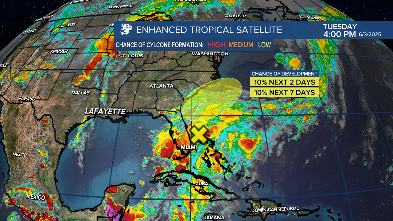
In the tropics, there's little significant news, with a potential weak disturbance possibly developing off the coast of the SE US...no major concerns...and none for the Gulf.
Meanwhile, you may have noticed hazier skies and redder sunrises and sets across Acadiana in recent days.
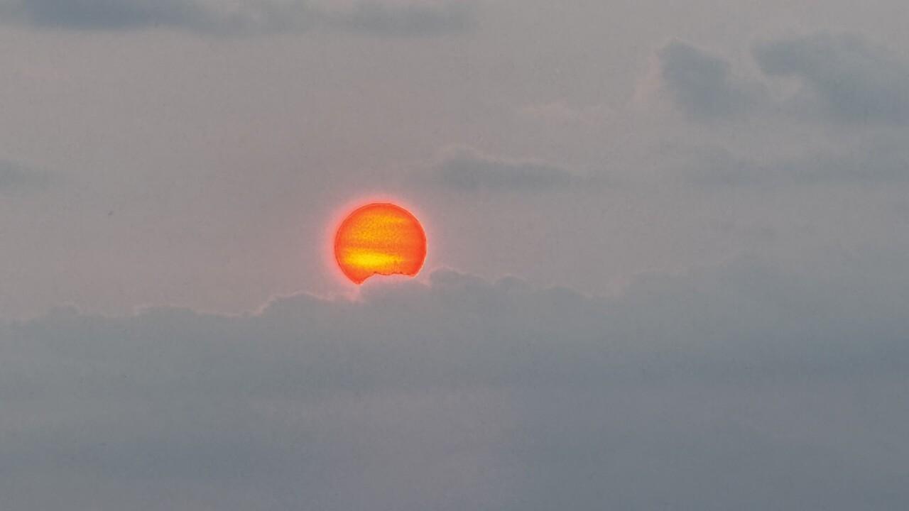
Here's why:
