


A seasonably dry and hot weather pattern is expected for Acadiana into the weekend, but upon exit, we may see a front that could bring some heat and humidity relief into next week.
In the near term, some much need scattered showers and thunderstorms will gradually dissipate this Wednesday evening with skies clearing overnight.
Thursday and Friday will bring mostly sunny skies with near zero rain chances as highs reach the near normal, but still uncomfortable low-mid 90s.

More of the same is anticipated for Saturday but with a slight chance of scattered afternoon showers and/or thunderstorms.
By Sunday, a frontal system will begin to approach the area, likely yielding a better chance of storms that look to end Sunday night.
Thereafter, drier more pleasant conditions will work their way into the region with next week's weather feeling more like September.
Highs early next week could be closer to the mid-upper 80s while lows could dip down into the mid-upper 60s for a few nights.
See the KATC `10 Day Forecast for the latest.
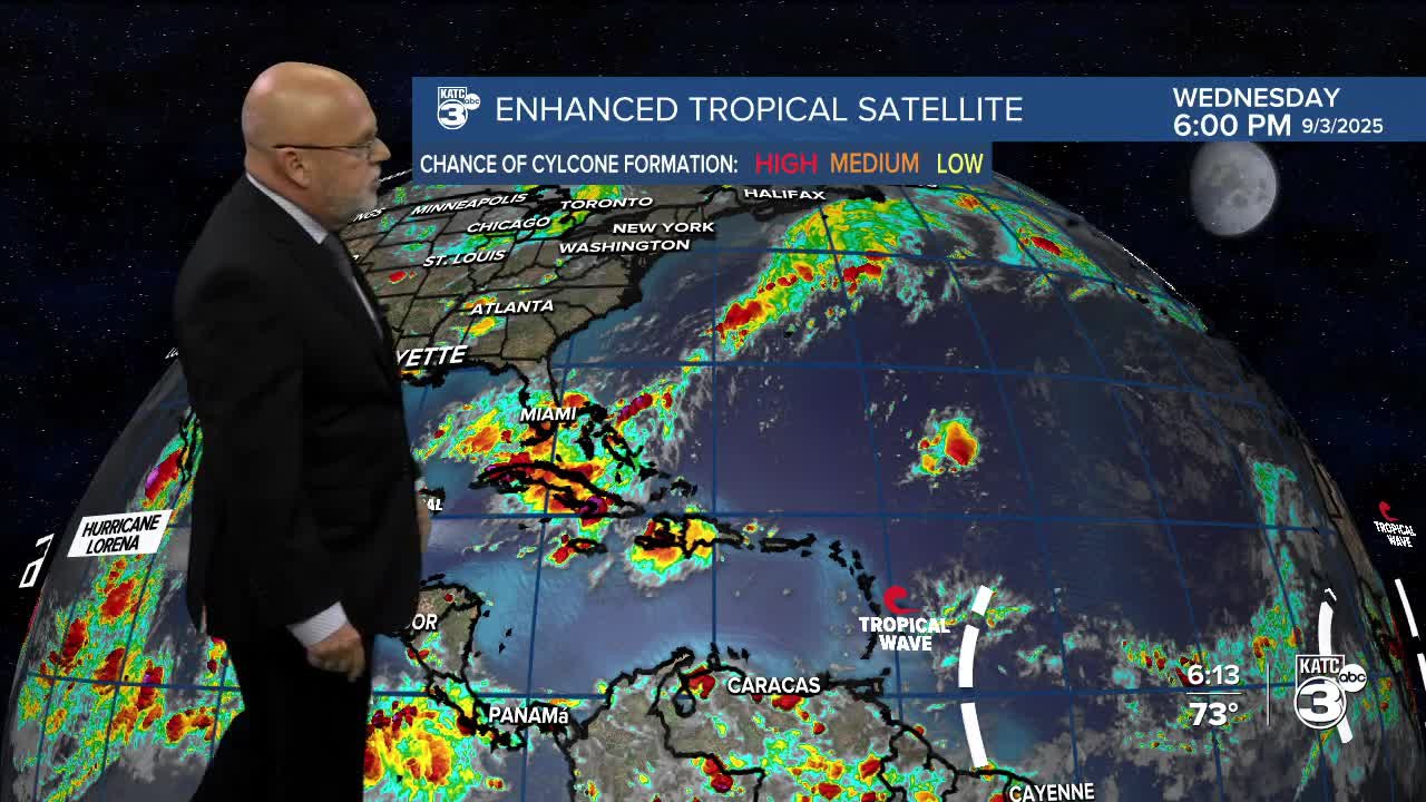
Meanwhile, in the Eastern Tropical Atlantic a tropical wave is looking more like it will develop, and new today, the potential forecast track/development zone takes this system farther south than previous guidance and thus, getting closer to the Northeast Caribbean (versus an out out sea storm) in about a week.

See full update below:
