

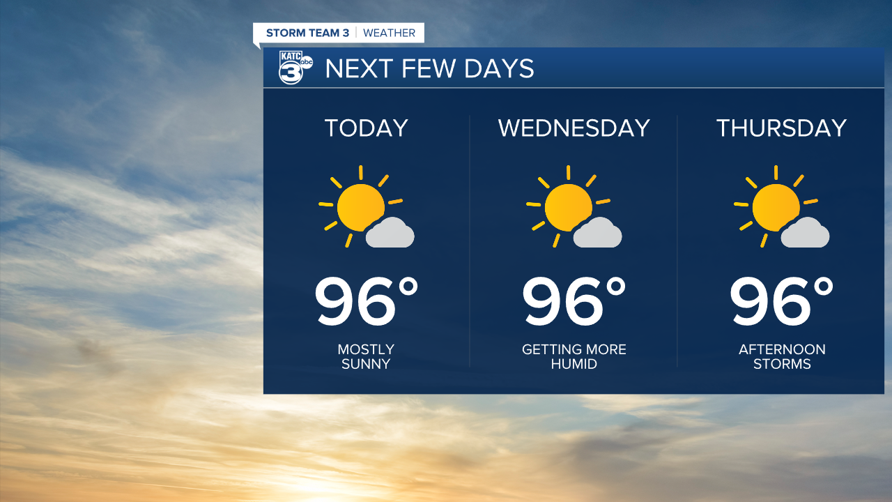
It's funny to say that heat index values around 100 feels like relief here in Acadiana, but after several weeks with the heat index between 110-115, it really feels quite nice. Afternoon temperatures will once again reach the mid 90s, but with the humidity a little lower this afternoon, the dry conditions will keep us outside of the heat advisory range.

Things will start a bit sticky this morning, but sunshine will warm things up into the mid 90s this afternoon. The air will dry out a bit keeping the heat index around 100-102 this afternoon. Inland parishes will reach the upper 90s, but with dew points in the 60s, the heat index will stay close to the actual temperature. Just a few fair weather clouds are expected this afternoon. The only real chance for showers will be along the immediate coast and in the offshore waters.
More of the same for Wednesday, although the humidity will be slightly more noticeable. Highs will reach the mid to upper 90s with heat index values nearing 105. Showers will generally be confined to the coast along the afternoon sea breeze. By Thursday, a little better chance for showers will exist during the afternoon, perhaps moving farther inland toward the I-10 parishes.
The ridge of high pressure that has been broiling the southwest and making headlines for weeks, will push into the Great Plains, and eventually the Midwest by the weekend. Temperatures will soar into the upper 90s to near 100 degrees as we round out the work week and head into the weekend. Heat advisories are likely. It looks like the hot weather will take us into the first few days of August.
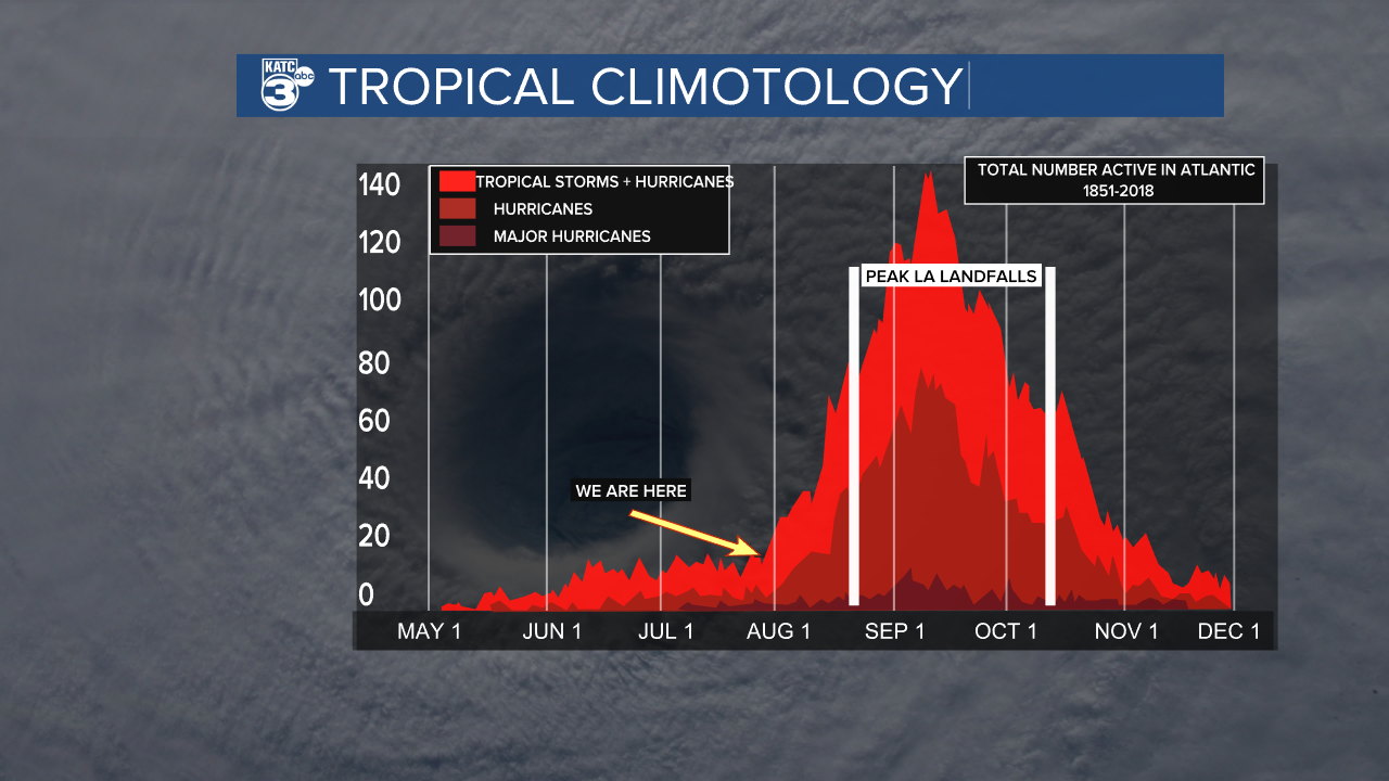
The tropics are showing signs of waking up over the next few weeks. Don has finally dissipated after meandering in the Atlantic for the last 10 days. A couple of areas of concern are near the Windward Islands of the Caribbean, and another area north of The Bahamas. Both of these disturbed areas are only showing a slim chance for any development. Models are hinting at some bigger development as we head toward the end of next week. Nothing threatening the Gulf just yet, but August is the time we usually see an upswing in activity.
