


Acadiana will get to enjoy some nice and cool weather to start the holiday period, but rain is expected to return by the weekend.
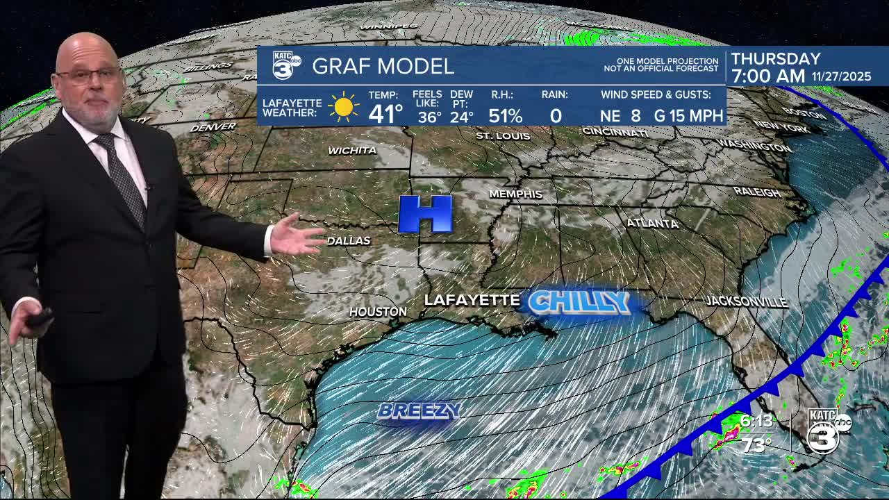
In the wake of today's cold front, a little bit of a winter chill and below normal temperatures are expected for the area through Friday.

In the near term, look for lows into Wednesday morning to be in the low-mid 50s, with gusty winds picking up by daybreak.
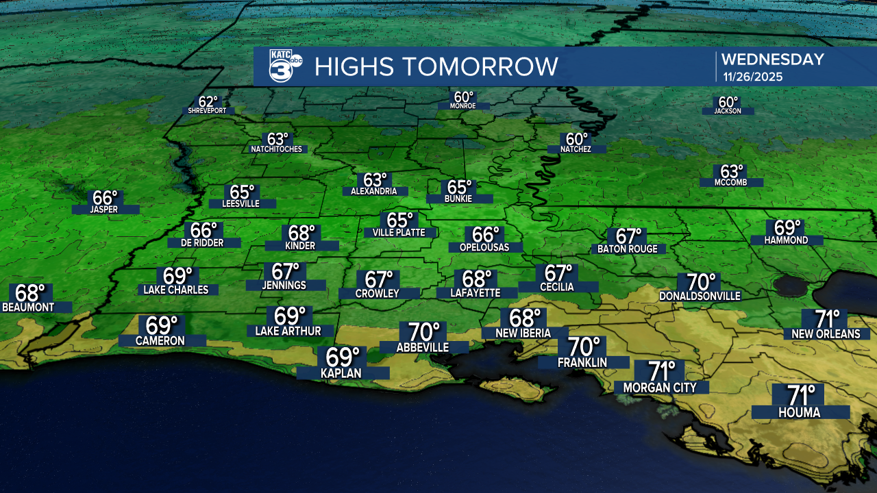
It will be breezy and cool with plenty of sunshine for our Wednesday with highs limited to mostly the mid-upper 60s.
Gusty northerly winds could peak near 24-28 mph, but should diminish into the evening.
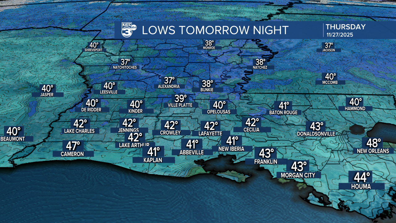
It's going to be chilly for Thanksgiving morning with lows ranging in the upper 30s to lower 40s...and perhaps a bit of a wind chill!
More sunshine is anticipated for Thanksgiving and Friday with highs mostly in the 60s.
The coldest we'll see with this front come Friday morning with readings bottoming out in the mid-upper 30s, and more than likely above the frost zone.

Temperatures will moderate into the weekend ahead of our next disturbance that should bring rain to the area for late Saturday and/or Saturday night, and into early Sunday.
Would should see better rain coverage across the entire area with perhaps an inch possible.

Another round of rains, and maybe a decent soaking of a couple of inches, looks to possible Monday into Tuesday next week...and they'll be chilly rains with temps holding in the 40s/50s!

Rain totals from this weekend through Wednesday look rather promising with the Euro going with a good soaking today...but as we all know, forecasts can, and do change.

See the KATC 10 Day Forecast for the latest details.
