


It's set to be one more quiet day across all Acadiana before we start seeing some changes arriving in the forecast.
Tuesday looks to more or less be a copy of what we saw Monday with temperatures pushing into the upper 80s and the heat index into the 90s.
Moisture continues to move in along gusty southerly winds which will be blowing at a good pace again today.
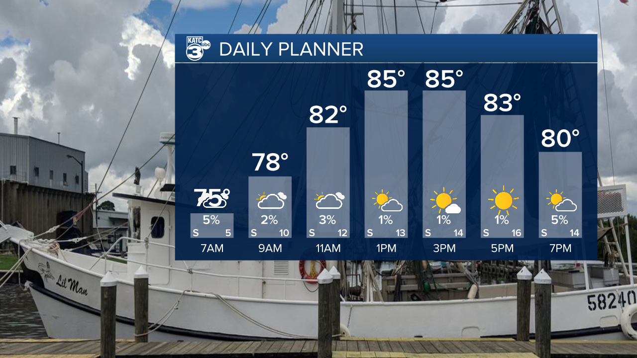
Early morning clouds will give way to sunshine by the afternoon and overall it should be a pretty pleasant day outside despite the warmth.
A front looks to drop down into north Louisiana on Wednesday which could bring a scattering of showers to north Acadiana.
Clouds will start to build on Wednesday and with a slow moving boundary we'll gradually see those spotty showers slide south later this week.
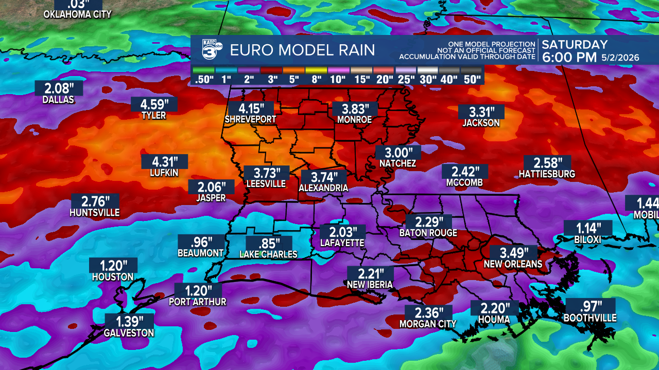
The heaviest rain is expected Friday through Saturday and Acadiana could be on the hook for a solid soaking.
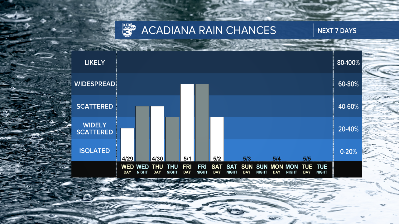
Showers should slowly clear Saturday afternoon which means Saturday evening at the Crawfish Festival may be able to avoid the heavy rain, it'll all be clear and beautiful by Sunday which will be a really nice day in Breaux Bridge.
We could be looking at several inches of much needed rain and this could help us but a bit of a dent into our current drought conditions.
Localized flash flooding may be an issue during the heaviest downpours, and while there's going to be some embedded thunderstorms there's no obvious warning signs for severe weather.
Temperatures will cool once the front passes and we could see highs in the low 70s on Saturday and lows dropping back down into the 50s.
Quiet weather will follow behind the front as high pressure builds by the end of the weekend.
