


Whatever kind of magic y'all had been doing to bring the rain certainly looks like it's worked as Acadiana gears up for another soaker.
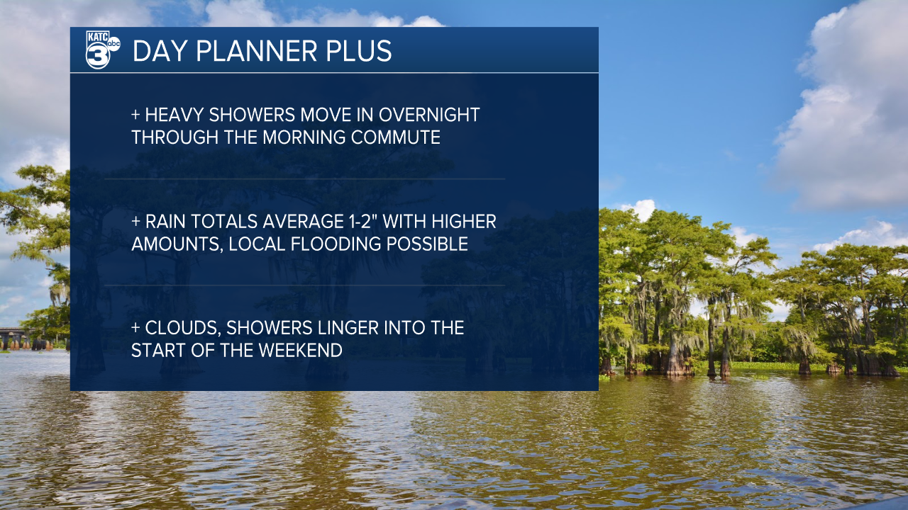
Clouds will start to arrive late Wednesday afternoon and evening ahead of a band of heavy showers that will push through the region early Thursday morning.
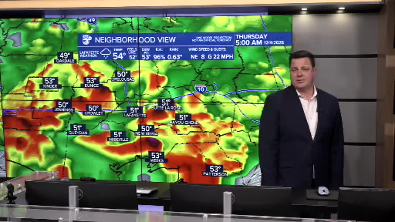
Rain will get started before the sun comes up and will continue through the morning commute before becoming a little more scattered.
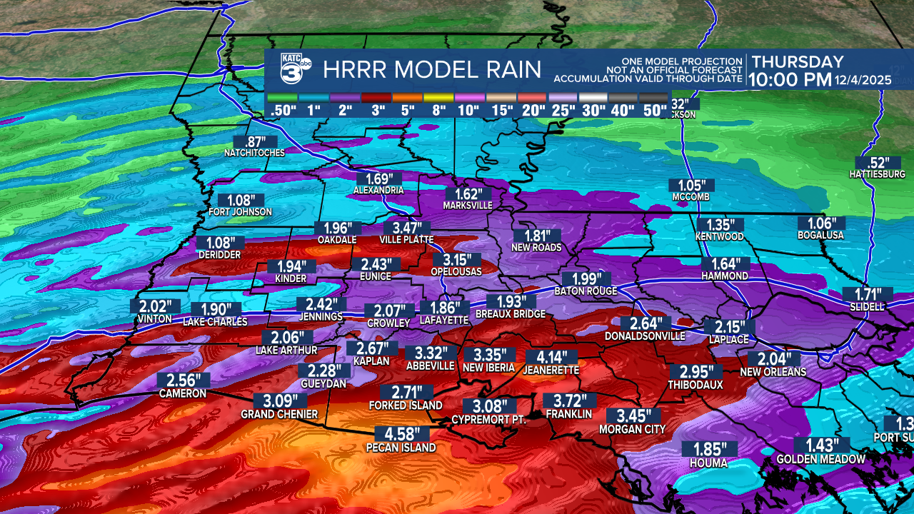
It's safe to say that most of Acadiana will pick up another inch or two of rain with a band of possible 4-6" rain possible which could lead to some issues on the roads.
Most models seem to keep the heaviest band of rain sitting just offshore and along the coast, but if moved a few miles north it could bring the heaviest rain to the I-10 corridor, which would obviously be the most impactful.
We'll have to keep an eye on how thing develop overnight to get a sense of where the heaviest showers will materialize.
The rain will become more scattered Thursday afternoon and evening but another round of showers is expected to roll through again on Friday.
Clouds will likely linger all the way into Saturday before some more sunshine emerges finally returns for the end of the weekend.
It seems Louisiana is desperately trying to get caught up on the drought.
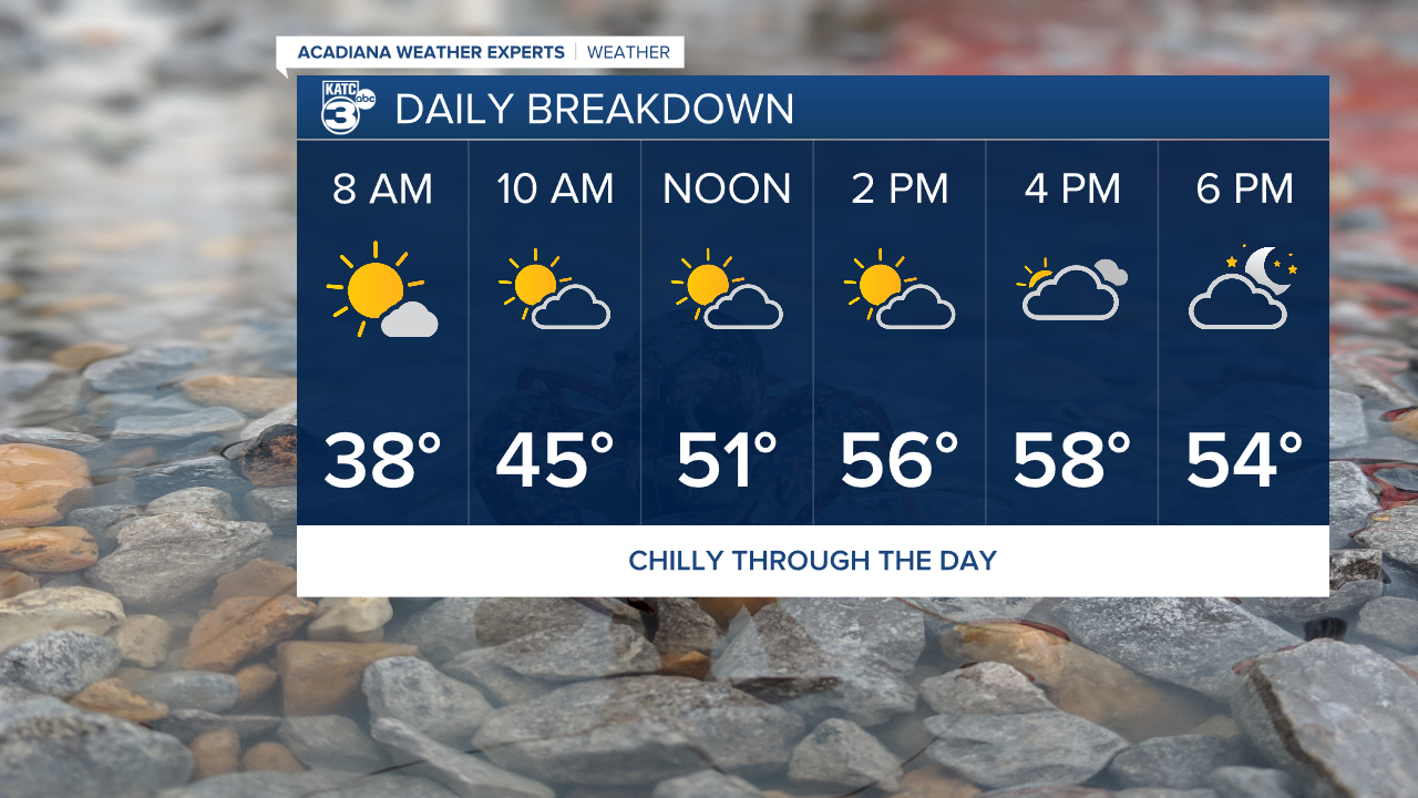
In the meantime it'll be a quiet, chilly day across Acadiana with temperatures creeping up to around 60 in the afternoon, after a frosty start.
Sunshine will give way to the clouds in the afternoon, and once that happens it could be a little while before we get decent sunshine again.
