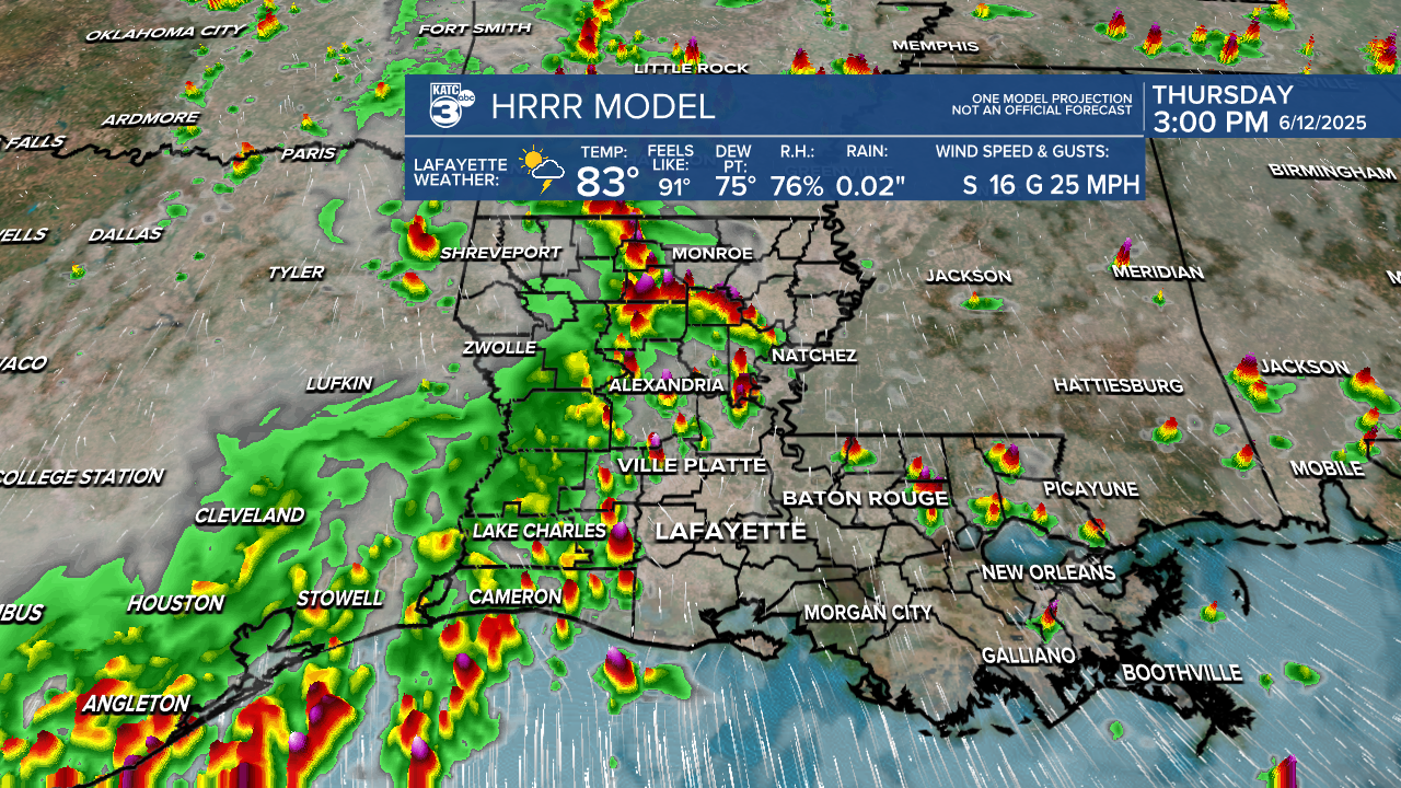
A good chance of scattered showers and thunderstorms will remain in Acadiana's forecast through the weekend, and quite possibly, into early next week.
A nearly stationary weakness in the upper atmosphere across Texas into Louisiana is expected to maintain instability aloft and combined with tropical Gulf moisture at the surface, scattered showers and thunderstorms can continue to be expected in the days ahead.

Like the last couple of days, it appears that our best rain chances Thursday arrive in the afternoon into the early evening hours...so while rain chances stay on the high side, any given day moving forward, shouldn't be a washout.
Per the latest HRRR Model, storms may initiate a little earlier Friday, which could make for a more peaceful Friday evening.

Rain totals over the next 48 hours will vary greatly from 1/4" or less to a few spots with 2-3".

While a severe storm or two may be possible, widespread severe threats are not expected.
However, some activity will continue to be capable of producing strong and gusty winds, small hail, torrential downpours and frequent lightning...and perhaps a few funnel clouds when storms are initiating.
The weakness aloft and an endless supply of Gulf moisture looks to keep the daily chance of scattered showers and thunderstorms with us through early next week.
There remains consistent signs though, that high pressure will begin to edge into the area later next week, perhaps not eliminating the chance of a few storms, but greatly reducing the chance of precipitation.
Thus, the latter part of the KATC 10 Day Forecast looks to get hotter as we near the third week of June.
Meanwhile, the Atlantic Tropics remain quiet with no suspect areas expected over the next 7 days.

In addition, the Climate Prediction Center's 2-3 week forecast shows little opportunity to develop in the Atlantic Basin through the end of the month.


