


Drier air that filtered into the region over the past day or so will begin filling with moisture as the summer patter returns this weekend. Already, dew points have returned to the lower 70s over southern parts of Acadiana, and moisture will continue to surge into the inland areas as the day progresses.
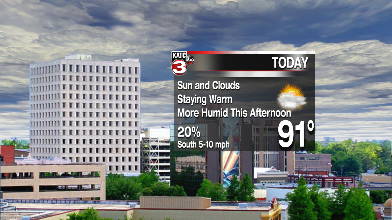
The front that has stalled in the offshore waters will gradually lift northward as well. This could provide some instability to allow for a shower or two, but rain chances should be pretty low today, and confined to the coastal areas. Expect highs to reach the lower 90s.

Over the weekend, as the front moves inland and dissipates, showers and thunderstorms will return to the forecast. Nothing widespread, just afternoon variety storms typically seen over the summer months. Highs should remain around 90, with heat index values creeping toward 100. Overnight temperatures will only drop into the mid 70s. No big changes in the forecast are expected next week, continuing to be very summer like.
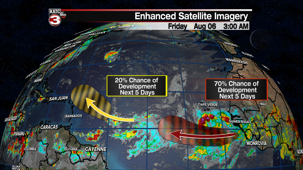
As expected, August is showing an increase in tropical weather. Fortunately anything that is trying to develop is far from Acadiana. The Gulf of Mexico, Caribbean, and much of the western Atlantic is fine. It's the far eastern Atlantic where waves are now starting to roll off the African coast. One wave, near the African coast has a pretty good chance for development over the next few days. It should track westward, but conditions aren't favorable over the Central Atlantic, so at this time there's no concern.
