


After a bit of a winter chill through Wednesday morning, look for milder temperatures and eventually increasing clouds Wednesday afternoon ahead of our next soaking weather system that arrives late Wednesday night.
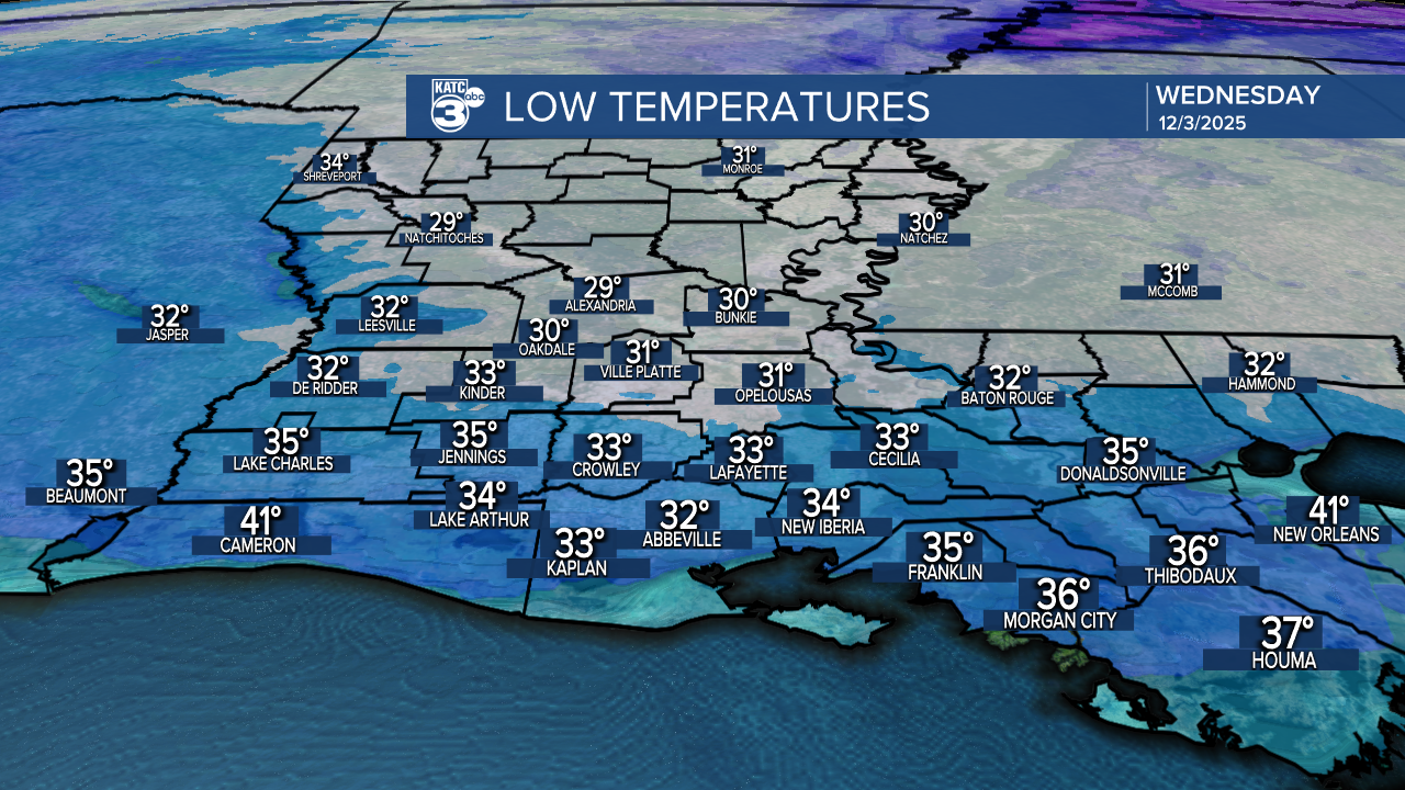
In the near term, with clear skies and light winds temperatures should drop into the lower 30s in most spots by morning with a brief opportunity for a light frost and/or light freeze for a few shorts hours around daybreak.
It's just the plants and pets that will need any attention with no pipe worries.
Temperatures will warm back into the lower 60s Wednesday afternoon...some 10-15° milder than Tuesday.

Clouds will begin to invade later Wednesday ahead of our next soaking rain set-up, that should develop very late Wednesday night, and within hours of daybreak Thursday.
This system looks to bring rain and some embedded thunder to the area, but no severe weather is expected.

This system could manifest into quite a soaking with rain totals estimated to be in the 2-4" range with isolated spots possibly catching more especially south of the I-10 corridor.
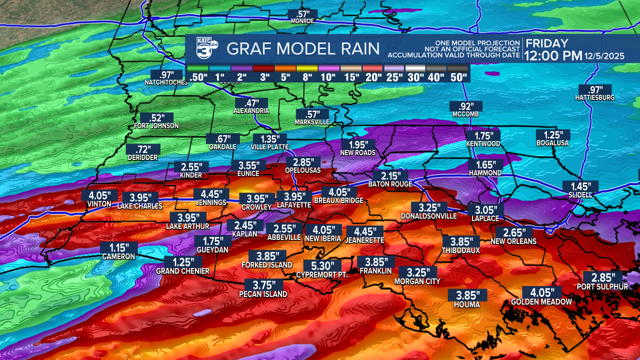
Additional rain shower activity is likely to develop for portions of the area Friday and ending Saturday.
After the soaking it looks like we'll have a dry and cool period starting Sunday and continuing into much of next week.
See the KATC 10 Day Forecast for the latest.
