


While the 10th tropical storm of the Atlantic season has formed, most, if not all eyes in Acadiana are on the slightly cooler and less humid weather on the way for later this week.

In the near term, it remains near summer-like for Acadiana with lows tonight around the lower 70s while highs Wednesday will push 90° once again.
A frontal boundary will cross the area Wednesday perhaps accompanied a few brief showers into the afternoon, but rain chances are expected to stay less than 20%.

You'll know when the front passes Wednesday as northeast winds will get gustier into the afternoon/early evening.
The coolest air behind this front will lag by about 24 hours, but lower humidity and highs still pushing the upper 80s expected Thursday, albeit with much lower humidity and a nice breeze continuing.
Friday into the weekend look sunny and pleasant and right on mark for mid-October with highs in the mid-80s while overnight/morning lows dip into the more refreshing lower 60s.
It looks dry through all of next week with temperatures slowly moderating...and we may not be done with highs near 90° yet.
See the KATC 10 Day Forecast for the latest.
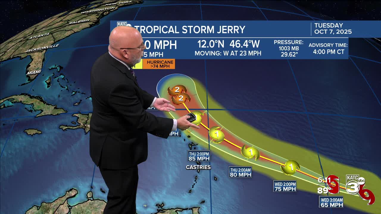
Meanwhile the tropics are still alive, with newly formed Tropical Storm Jerry forming in the mid-tropical Atlantic...this system will be no threat to the Gulf.
Closer to home, a disturbance moving into the Bay of Campeche Tuesday is not expected to develop, and primarily impact Mexico as a rain-maker over the next couple of days.

Full tropical briefing and outlook for the rest of the month below:
