


Scattered showers and a few storms will precede and accompany a cool front that arrives in Acadiana late Saturday night.
The weekend shouldn't be a washout as the bulk of the wet weather should arrive during the overnight hours ending toward Sunday morning.
Look for another warm and humid Saturday, with scattered showers and a few storms popping up from late morning into the afternoon hours.

The activity shouldn't be widespread Saturday with most likely areas to see thunderstorms from Northern Acadiana northward and eastward across the Basin and perhaps St Mary parish.
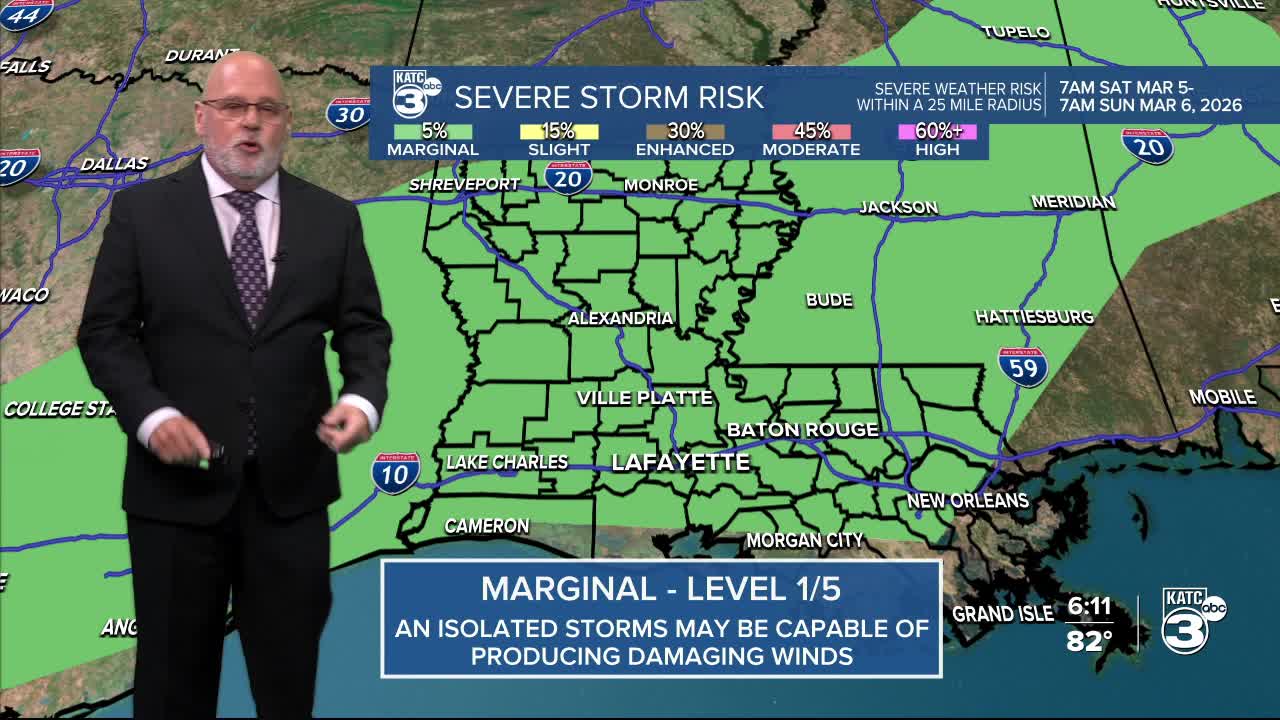
The Storm Prediction Center is maintaining a "marginal risk", a level 1 out of 5, for an isolated severe storm Saturday into early Saturday evening that could produce damaging winds...at this point, it does not appear to be a serious threat, but the threat is not zero.

Rain chances will go from near 40% Saturday up to 90% Saturday night with activity expected to decrease from the northwest to southeast during the morning hours Sunday.
It appears that most of the activity at night will be more rain than any storms as dynamics for thunderstorms is expected to weaken significantly.
Even though there still may be some showers around early Sunday morning, we should see drier conditions for the afternoon, and possibly see some sun for latter part of the afternoon.
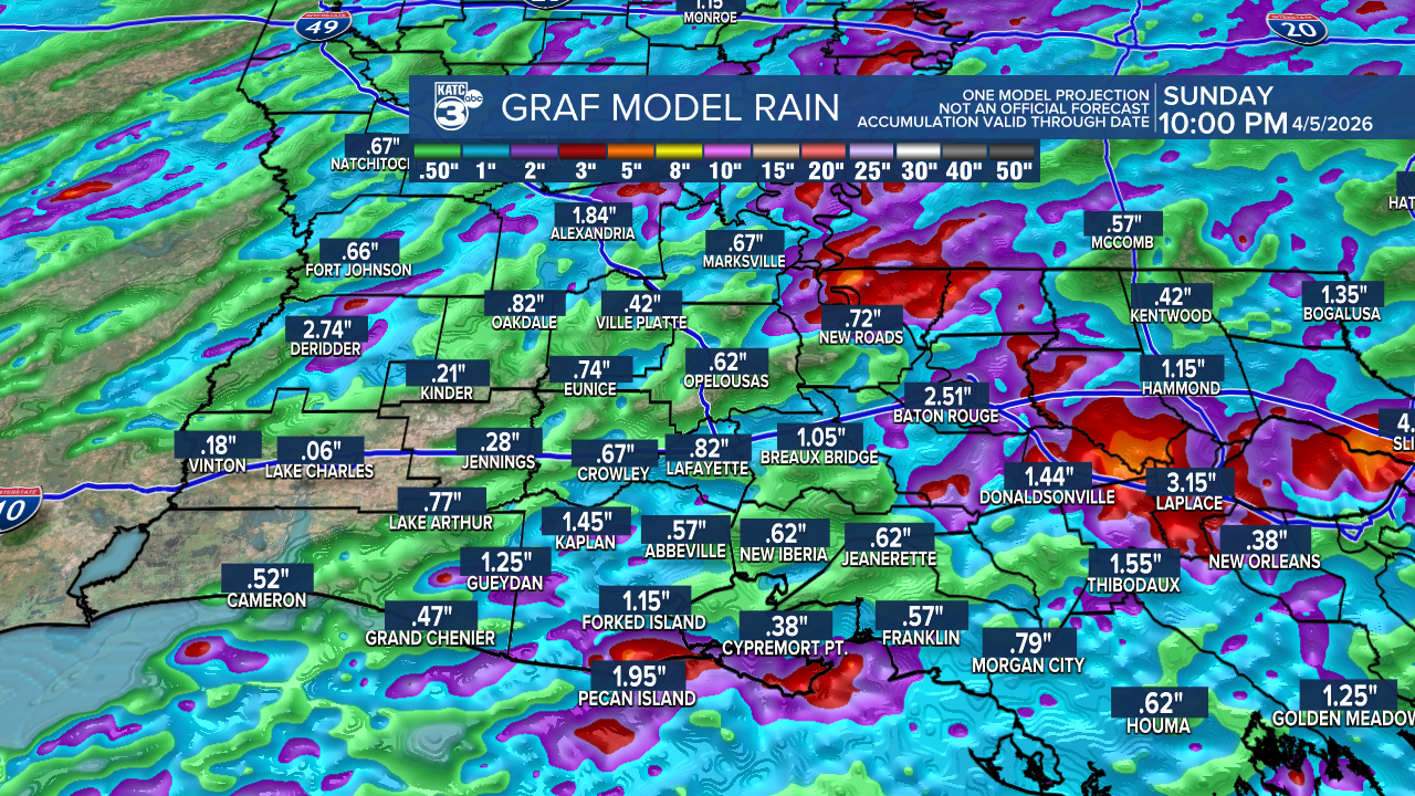
Rain totals remain difficult to pin down, but generally 1/2-1" of much needed rain is expected for the area...and most of that arrives Saturday night/predawn Sunday...some spots may see more, and many may see less.

Temperature-wise, after highs in the 80s Saturday we'll see temperatures cool into the 60s Sunday, but we could get back into the low-mid 70s late Sunday afternoon if the sun does indeed return.
Next week will start off cool and dry with plenty of high clouds in the region. Temperatures will moderate later into the week.
Rain chances look to return late next week and into the following weekend, and perhaps with a little more in the way of rain totals then...we'll see.
See the KATC 10 Day Forecast and Power Doppler 3 for the latest.
