


In a few months I think we'll be able to look back on today as the day that fall finally arrived in Acadiana.
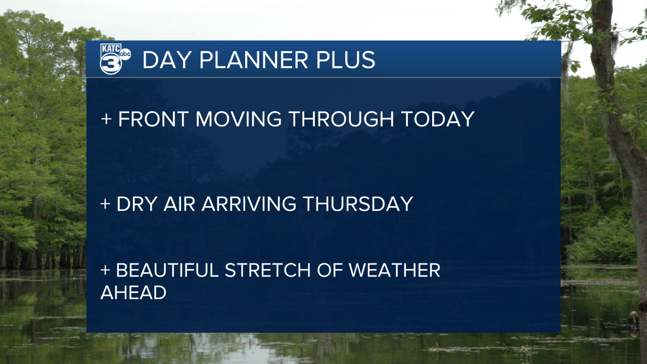
A long anticipated front is expected to move through the region Wednesday, bringing with it a round of showers and followed by the driest air of the season.
We've still got plenty of warm afternoons ahead but lows seem like they'll finally be staying in the 60s consistently moving forward.
The front won't move through until much later in the day so be prepared for a warm, muggy start to the day and highs getting into the mid and upper 80s.
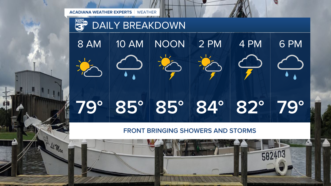
Spotty streamer showers will start to arrive late morning on Wednesday and you'll want to keep an eye out for sporadic showers through the day.
The heaviest rain is expected to move through during the evening when the front finally passes the area, widespread showers and a few storms will be possible.
Rain totals aren't expected to be too much with a few areas picking up one to two inches so we're expecting mostly beneficial rain.
This may not be enough to drought bust but it could help hold it off a little longer, and we'll be entering another dry stretch so some showers wouldn't be the worst thing.
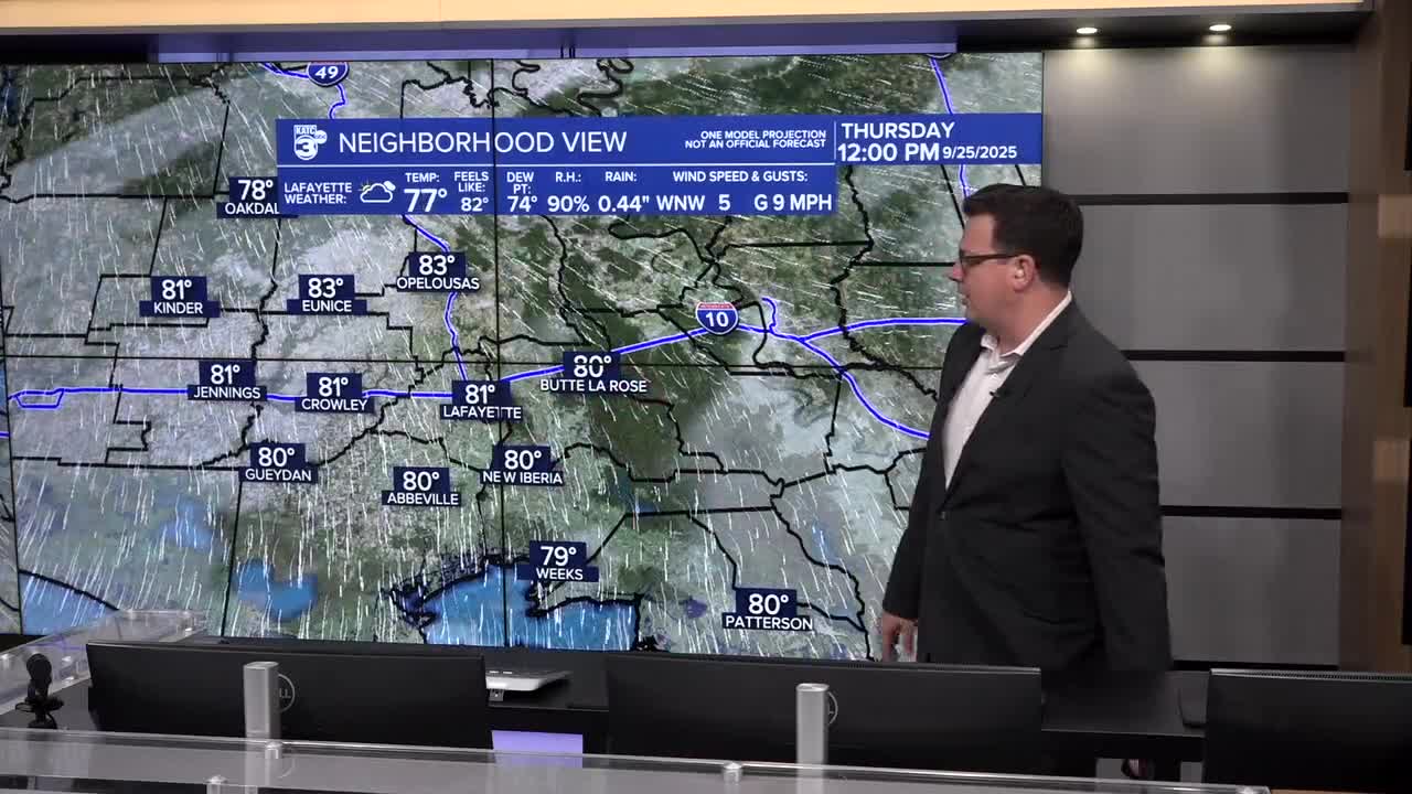
The dry air will tickle in through the day on Thursday so lows will likely stay in the low 70s, with mostly cloudy skies tomorrow we'll see the highs in the mid 80s.
Crisp air finally sets up overnight Thursday with low 60s in the mornings starting Friday and going all the way into next week.
