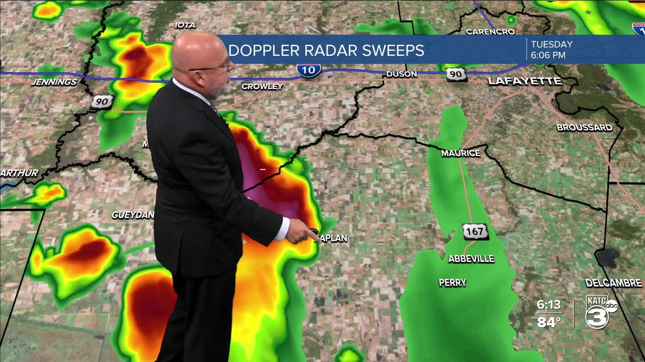


Showers and locally heavy thunderstorms are expected to develop across Acadiana into Wednesday afternoon, with a low-end "marginal" severe weather threat.

The Storm Prediction Center (SPC) has much of the state and Acadiana hatched in for a marginal (level 1/5) severe weather risk, mainly related to the possibility of strong, potentially damaging winds in a few isolated cells.

It probably won't be a day where we have a severe weather "watch" but there may be a few isolated warnings for winds and perhaps some hail.
Look for highest rain chances in the afternoon and evening hours with perhaps some flare up storms reforming tomorrow night ending Thursday morning.
Rainfall totals for most should be in the 1/2-1" range or less for most, but given the nature of storms there may be a few isolated 2-4" amounts possible.

The GRAF Model here looks a little too "hot" with respect to the rainfall hotspots, and we'll have a better feel for totals later tonight so don't miss the 10pm show!
Rains will taper Thursday morning with some partial clearing for the afternoon.
The coolest air arrives Friday into the weekend with highs in the low-mid 80s with much more comfortable humidity, while more importantly, overnight lows drop into the low-mid 60s for a few nights through this weekend.
See the KATC 10 Day Forecast for the latest.
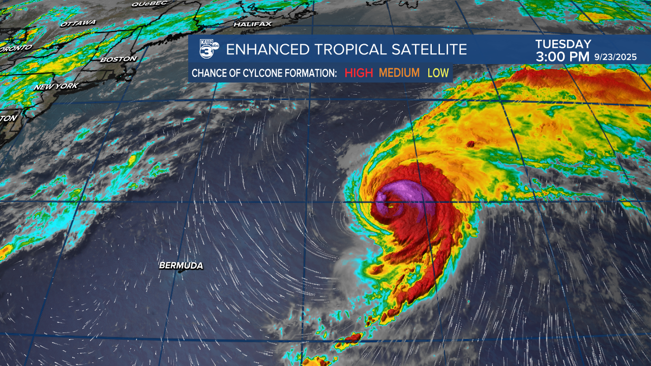
Meanwhile, it remains busy in the Atlantic Tropics with Major Hurricane Gabrielle and two disturbances that show promise for development.

The Gulf will remain unaffected by any tropical systems likely through the first week of October...certainly good news.
Latest tropical discussion below:
Lastly, tonight and Wednesday will be the 20th anniversary, or more appropriately, remembrance of Hurricane Rita in 2005...read more below:
