
A stormy couple of days coming up in Acadiana as a front slowly stalls as it moves into south Louisiana this week/weekend.
Showers will slowly move through Acadiana from north to south on Thursday sparking a few thunderstorms with a few possible severe storms.
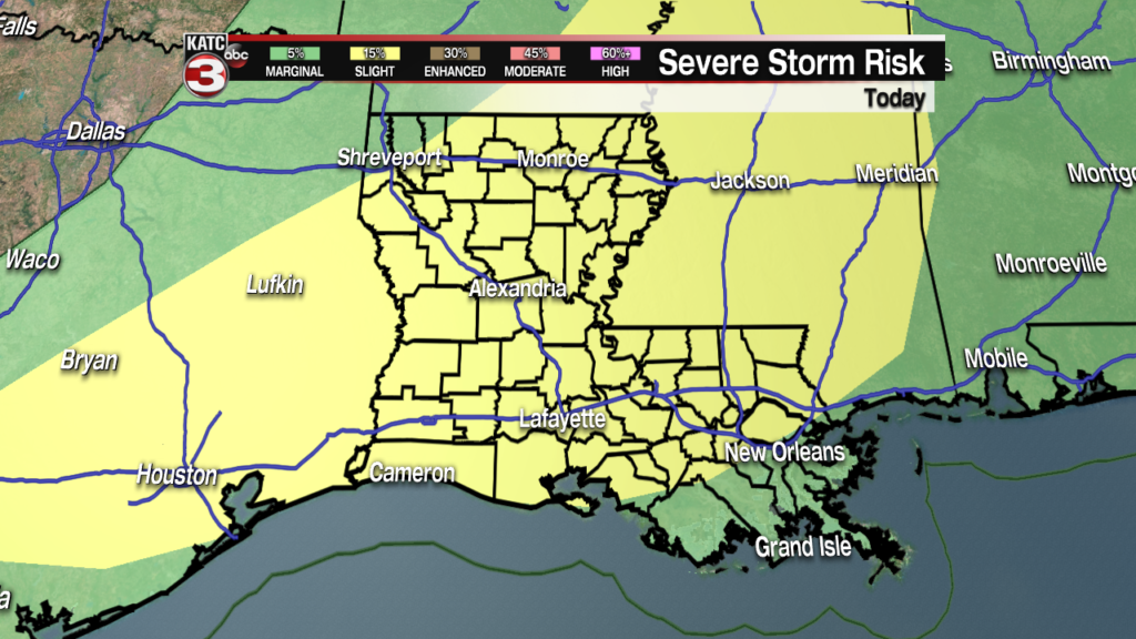
While most of us should avoid the severe weather, those that do see the severe storms will need to keep an eye out for damaging wind and hail.
This comes along with heavy downpours which will have a larger impact on Acadiana over the next several days.
In fact the rain is going to be the biggest issue we have to deal with as several inches of rain fall is expected over the next several days.

This is enough to cause the water ways to run swollen and fast through the weekend, and low lying roadways may have trouble draining.
You’ll need to be careful while going about town this weekend and be prepared to take an alternate route if there is water on the roadway.
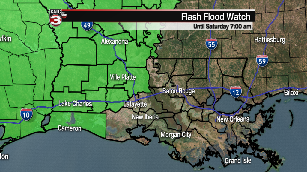
As a result of the rain there is a Flash Flood Watch in effect across north and west Acadiana (this will likely get expanded) until Saturday morning.
It’s not going to be blanketing rainfall from sunrise to sunset, instead it’ll arrive in waves with on again off again showers.
Timing these events can be very difficult but it looks like showers and storms will move through the northern half of Acadiana Thursday, and then late evening/overnight the activity will be down on the coast line.
This on again off again activity is expected to last through Friday and into the weekend, finally starting to ease up by Sunday afternoon.
