
As a major storm system pushes across the country Acadiana’s forecast is shaping up to be dreary but not as active as in other parts of the country.
Clouds are all locked in place and will remain with Acadiana for the next several days, finally breaking up Friday afternoon.
While the clouds are nothing new they will finally start to squeeze out a few showers Thursday afternoon and a strong thunderstorm or two isn’t out of the question.
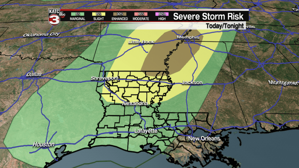
The Storm Prediction Center currently has us locked in to a marginal risk for some severe weather Wednesday night/Thursday morning.
We won’t get any sustained widespread thunderstorms but one or two storms will be capable of damaging winds, but travelers headed toward the Mississippi Arkansas border will need a reliable weather source.
Showers and storms won’t really be picking up until later Wednesday afternoon/evening as the front approaches Louisiana.
As the front gets to Louisiana, however, it will slow and eventually stall keeping the wettest weather just west of Acadiana.
 Futurecast 3 Hour


While the front sits to our west it’ll keep the door open for the streamer showers but also force our winds to increase.
Winds are going to be one of the bigger issues and they’ll be sustained out of the south around 15-20 mph with gusts that reach as high as 25-30 mph.
 Acadiana 1 Hour Wind Forecast


The front will finally move through Acadiana on Thursday bringing along with it more rain and a few thunderstorms.
After several days of cloudy skies and warm, muggy conditions it’ll be a nice change of pace to get some sustained sunshine and cooler, crisper temperatures.
