
Saturday Forecast
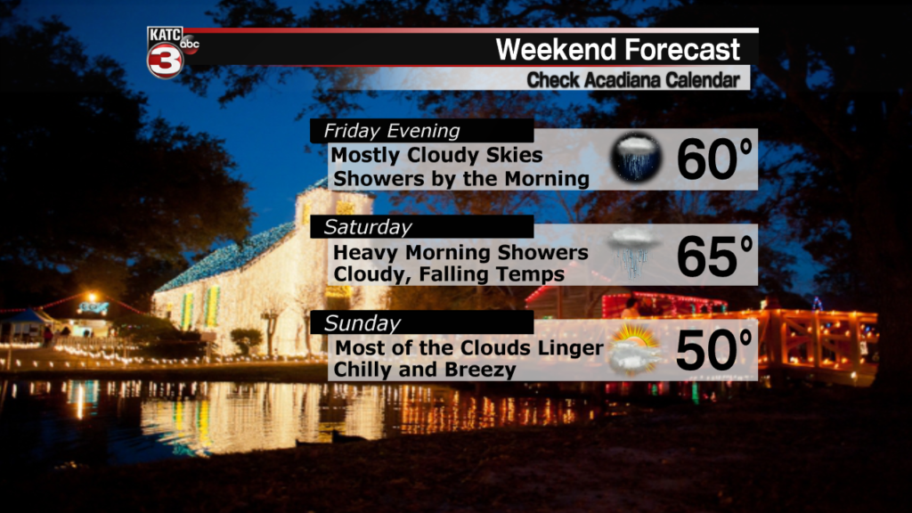
A well advertised front is still scheduled to move through Acadiana on Saturday morning bringing with it a period of heavy rain.
In anticipation of this system there is a Flash Flood Watch in effect for all of Acadiana starting Friday night and lasting through Saturday afternoon.
Since the front will move through so quickly there isn’t a widespread threat of flooding, however, areas that have a hard time draining will likely see some ponding.

Current forecast trends have the rain totals sitting around 1-3″ worth of rain with 2″ looking like the most likely amount on average across Acadiana.
Again, that will arrive in a fairly short amount of time, so if you can avoid roads and travel Saturday morning that’ll be the best option.
The rain won’t be prolonged so it should be wrapping up by lunch time, the clouds on the other hand will stick around the rest of the weekend.
There’s not a major threat of severe weather other than the outside chance of an isolated severe storm down along the coast, such as coastal Iberia Parish and St. Mary Parish.
The timing of this event will be between 7:00 – 9:00 in the morning when the heaviest part of the line will move through Acadiana.
Once the front moves through temperatures will start to drop with our high of 65 expected fairly early in the day before the chilly air arrives.
Friday Forecast
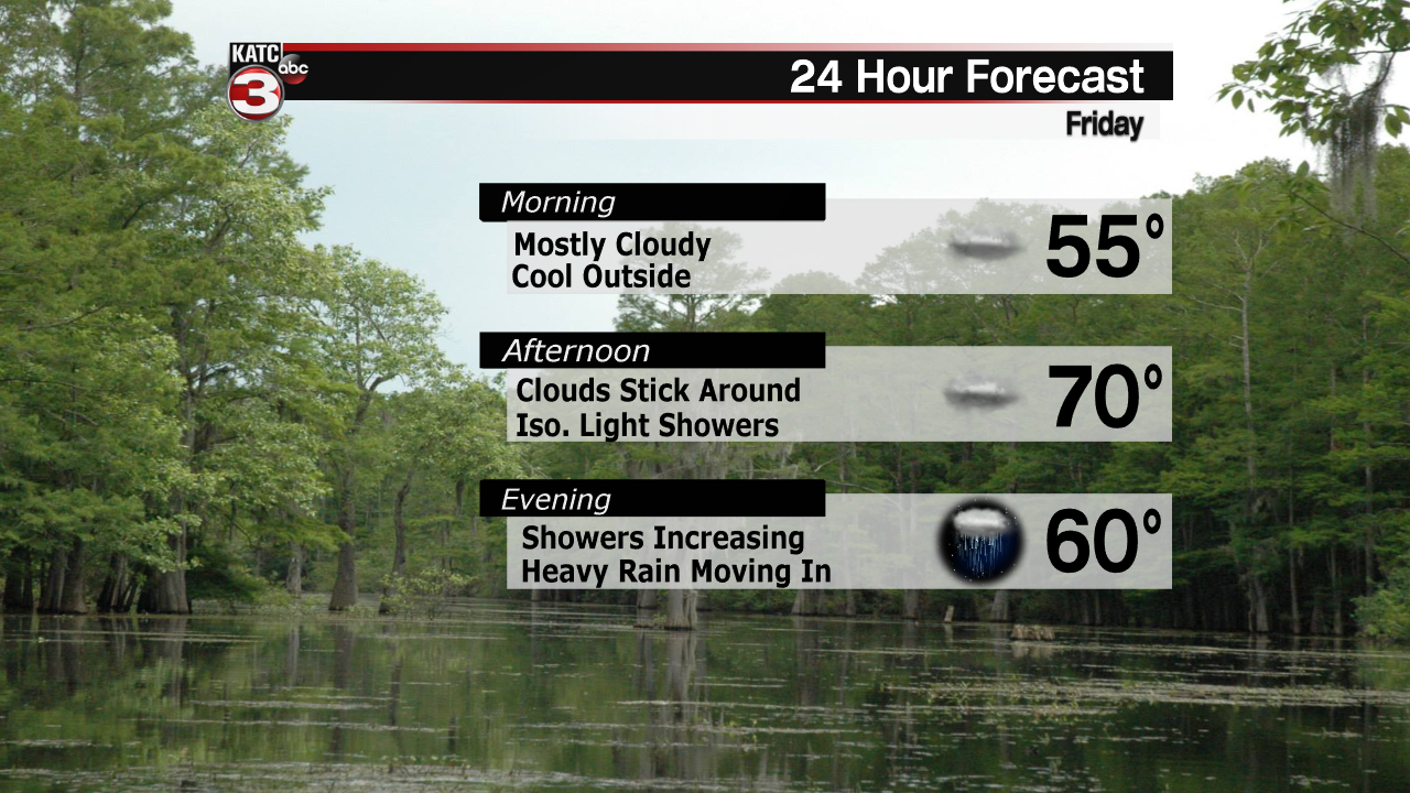
In the meantime Friday should stay fairly quiet, with nothing other than cloudy skies producing the occasional light shower.
The clouds kept us warm overnight and a solid breeze from the south will move temperatures up to around 70 in the afternoon.
Not expecting much of a cool down Friday night and the lows will probably be staying in the low 60s before Saturday’s front.
Outside of a stiff breeze and a few passing light showers Friday’s forecast will stay fairly quiet.
