
UPDATE: The heaviest showers have moved through Acadiana, although this doesn’t mean that the showers are done for the day.
Showers will remain likely and drizzly through the rest of the morning and into the afternoon with little clearing expected at all.
Winds will continue to intensify now that the front has passed with winds from the north expected around 20 mph range and gusts closer to 25-30 mph.
This will keep the wind chill in the upper 40s through the majority of the day as temperatures will now fall all the way through into Saturday morning.
_________________________________________________________________________________________
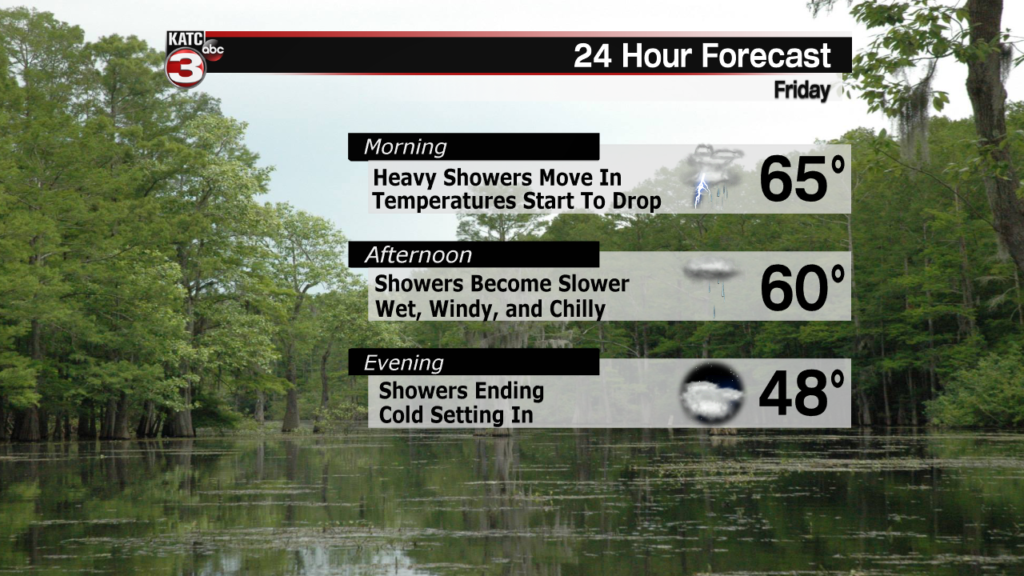
A new weather pattern will be taking up residence in Acadiana and causing a bit of commotion as it kick in the door on Friday morning.
Friday is going to get off to a wet start with a front swinging in from the north bringing in plenty of heavy showers and even a few thunderstorms for the morning commuters.
There’s no expectation of flooding or severe weather, rain totals for Friday will likely sit in the quarter to a half inch range, and even with some early downpours the showers will get a little lighter.
Once the initial front moves through we’ll get some slower steadier showers that will last through the remainder of the afternoon and tapering off in the evening.
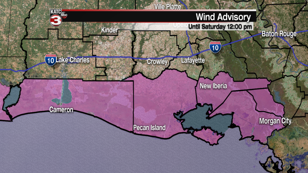
Along with the showers the winds are going to be picking up through the day eventually peaking around 15-20 mph, and even a little higher than that down on the coast.
This will be good for a Wind Advisory to be in effect through noon on Saturday and for those going offshore a Gale Warning will be in effect for the same time period.
While it’ll certainly still be breezy on Saturday the winds should start to ease through the day, which will also help with the wind chill.
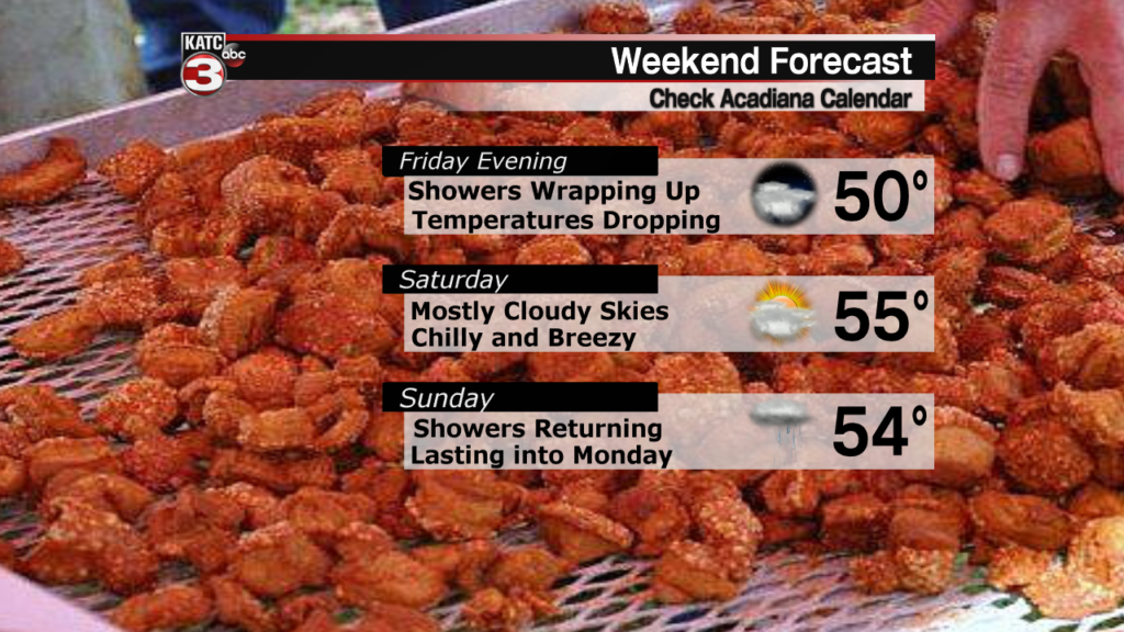
This set up isn’t going to make for an ideal week, that being said though it could certainly be a lot worse as we, at least, get a break from the showers on Saturday.
Saturday will be mostly cloudy with chilly temperatures and the breeze continuing through the majority of the day.
The showers will be back on Sunday afternoon as we get ready for yet another front to move through the area to start the week.
