


Acadiana will continue to see mild, foggy mornings followed by partly sunny and warm afternoons, with a few record highs likely to be threatened through Sunday.

Change however, is on the horizon, with a sharp cold front ushering winter-like temperatures and very likely a couple of light freezes into next week.

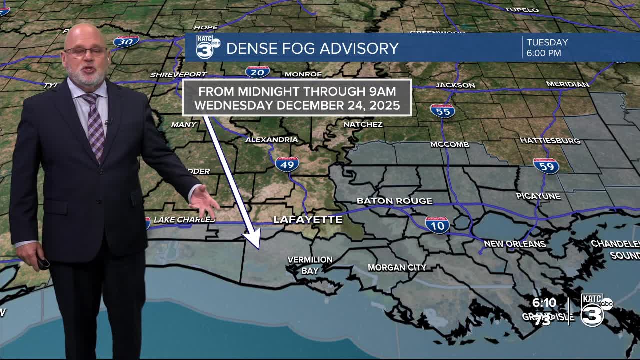
In the near term, expect another mild night with dense fog likely again through Wednesday.
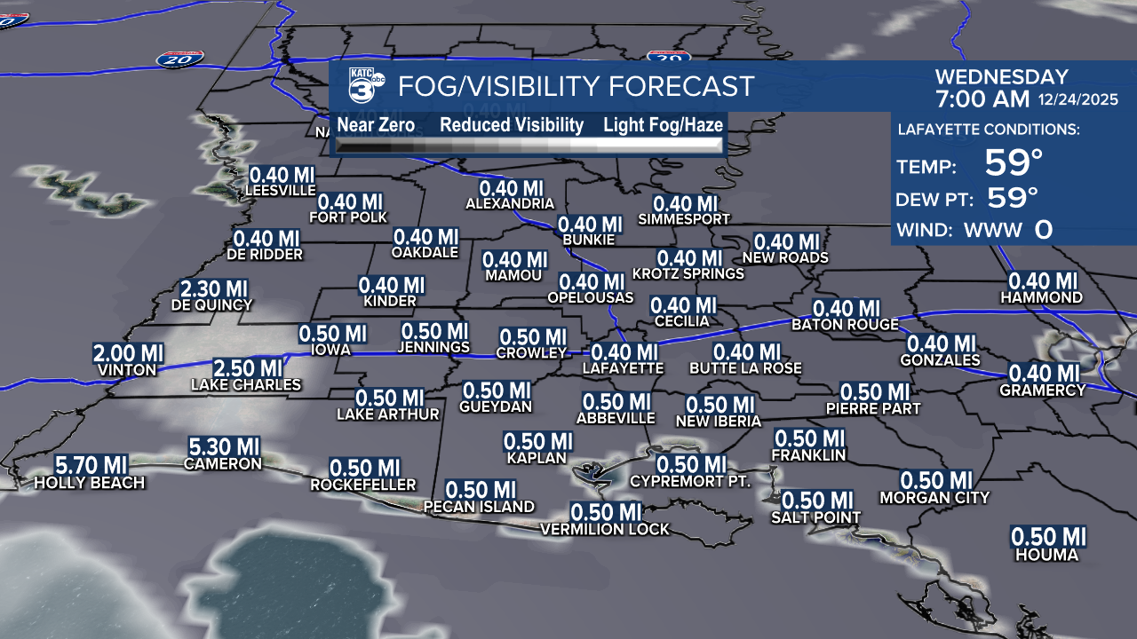
Even though portions of Acadiana, as of this article, were not under a fog advisory, but like the last couple of nights, we expect the advisory to expand to cover most, if not all the area by morning.

Fog/clouds look slow to burn off Wednesday, which will dictate how warm we get during the afternoon, but mid-upper 70s, perhaps 80° in a few spots will still be possible.
More of the same is expected for Christmas, Friday and into the weekend before our cold front arrives Sunday night.
High temperatures records for Lafayette this time of year are in the lower 80s, so it would not be surprising to see one or more records broken into the weekend.
A cold front is slated to arrive to Acadiana late Sunday afternoon/evening with a few showers accompanying and following the front Sunday night into early Monday.
Rain chances may go as high as 40% Sunday night, but activity will be light and scattered in nature.
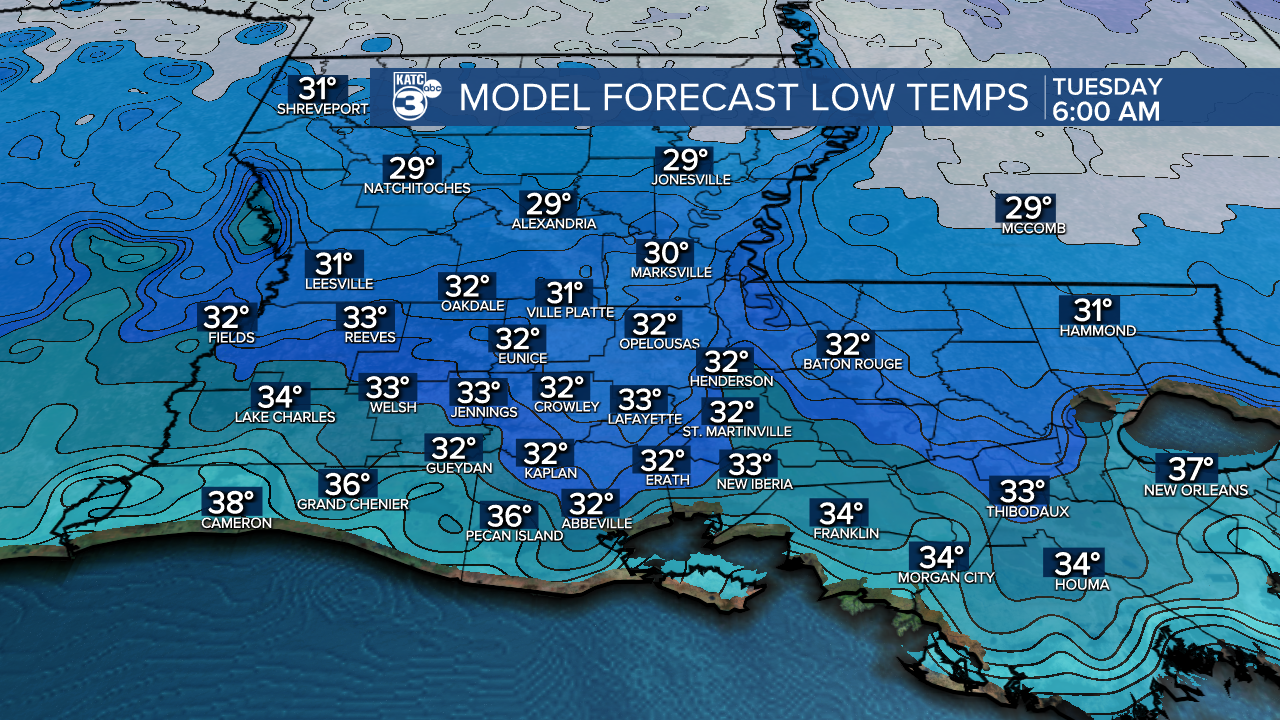
Next week starts off in winter mode with highs perhaps holding in the mid-upper 40s under mostly cloudy skies Monday, with clearing conditions and a light freeze anticipated for Monday night into Tuesday morning.
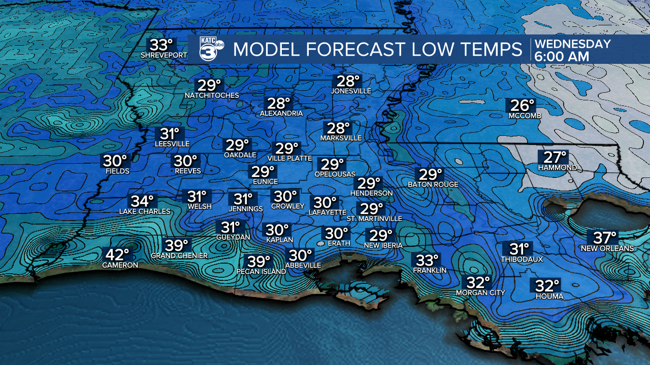
Sunny skies return Tuesday with highs only in the upper 40s to near 50° with another light freeze, and perhaps a better chance at a frost, Tuesday night into Wednesday morning.
Thereafter, Acadiana will see a slow moderating trend into the New Year.
See the KATC 10 Day Forecast for the latest.
