


After a one day break from the wet and unsettled weather pattern for Acadiana Friday, it will be back to more widespread showers and storms and localized heavy downpours for the area starting Saturday.
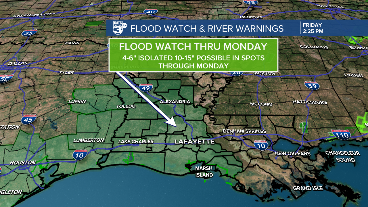
The National Weather Service has issued a Flood Watch for all of Acadiana through Monday evening with their estimates of up to 4-6", isolated 10-15" possible over the period through Monday evening.

Rain chances return are expected to rerun to 80-90% Saturday through Monday and remain near 60-70% Tuesday through Thursday.
So as previously advertised, this will go on for a while, but with hopefully a day break somewhere in there like today, over the next 6 days.
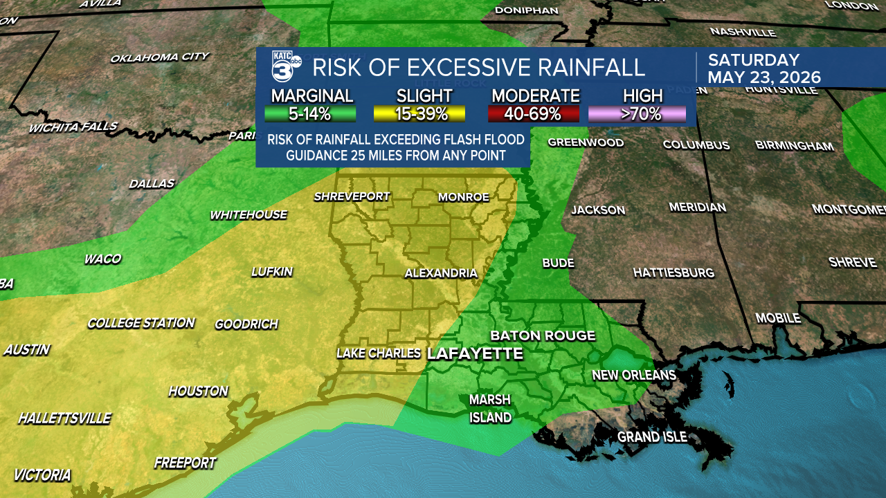
Acadiana remains hatched in by the Weather Prediction Center (WPC) for slight risks of excessive rainfall with the threat growing into Sunday and perhaps Monday at the least.

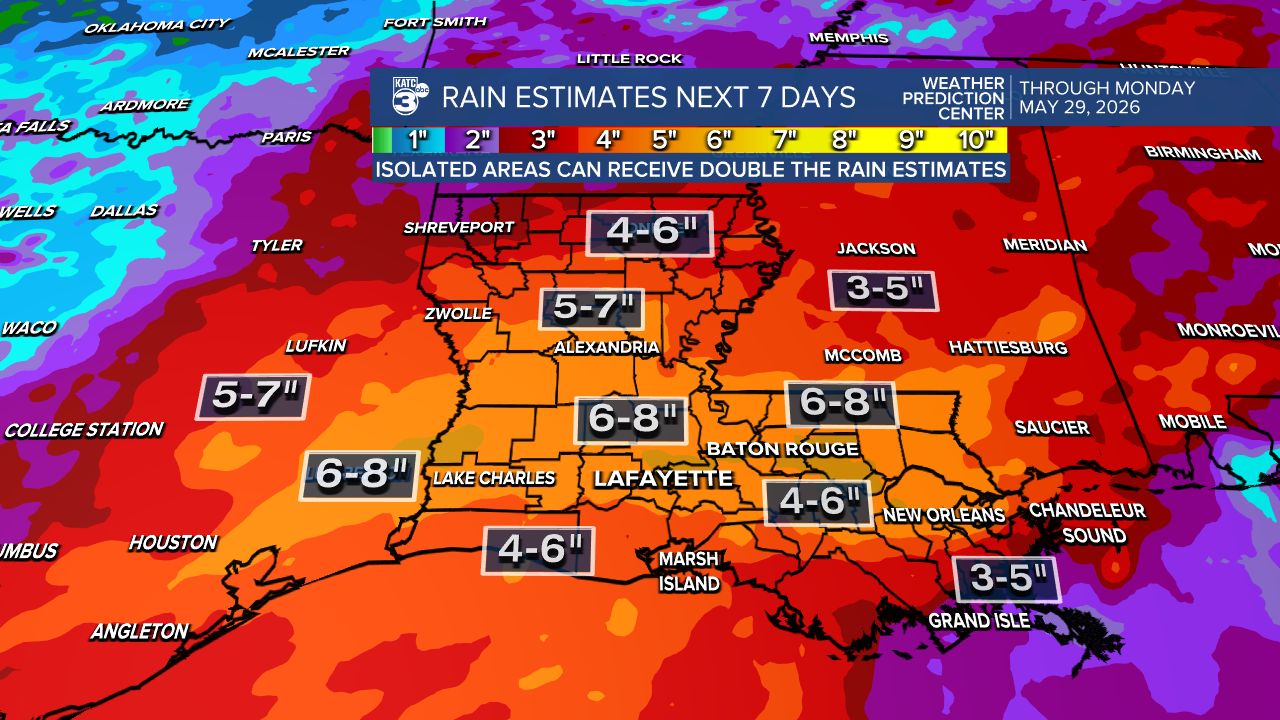
Rain totals per the WPC & NWS over the next week could exceed 6-8".
In the near term, expect 1/2"-1" most areas Saturday with isolated amounts approaching 3" or more...the same should play out for Sunday and Monday...and likely a few more days that follow.

The same upper pattern with disturbance getting carried in the sub-tropical jet stream will likely keep a good chance of storms through the end of next week.

Rain chances may begin to ease starting next weekend and into the 1st days of June.
See the KATC 10 Day Forecast and KATC's Power Doppler 3 page for the latest.
