


The Flood Watch now includes Lafayette, Acadia, St. Martin, Northern Vermilion, and Northern Iberia until Saturday morning. Please use extra caution if you’re on the roads—especially in areas PRONE to flooding.

We’re still under a slight risk (2/5) for heavy rain, leading to flooding concerns.

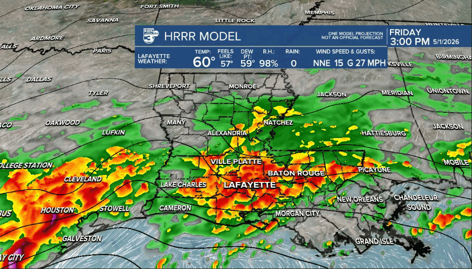
Expect intermittent heavy rain to continue today, with expected rainfall totals between 2 and 6 inches.

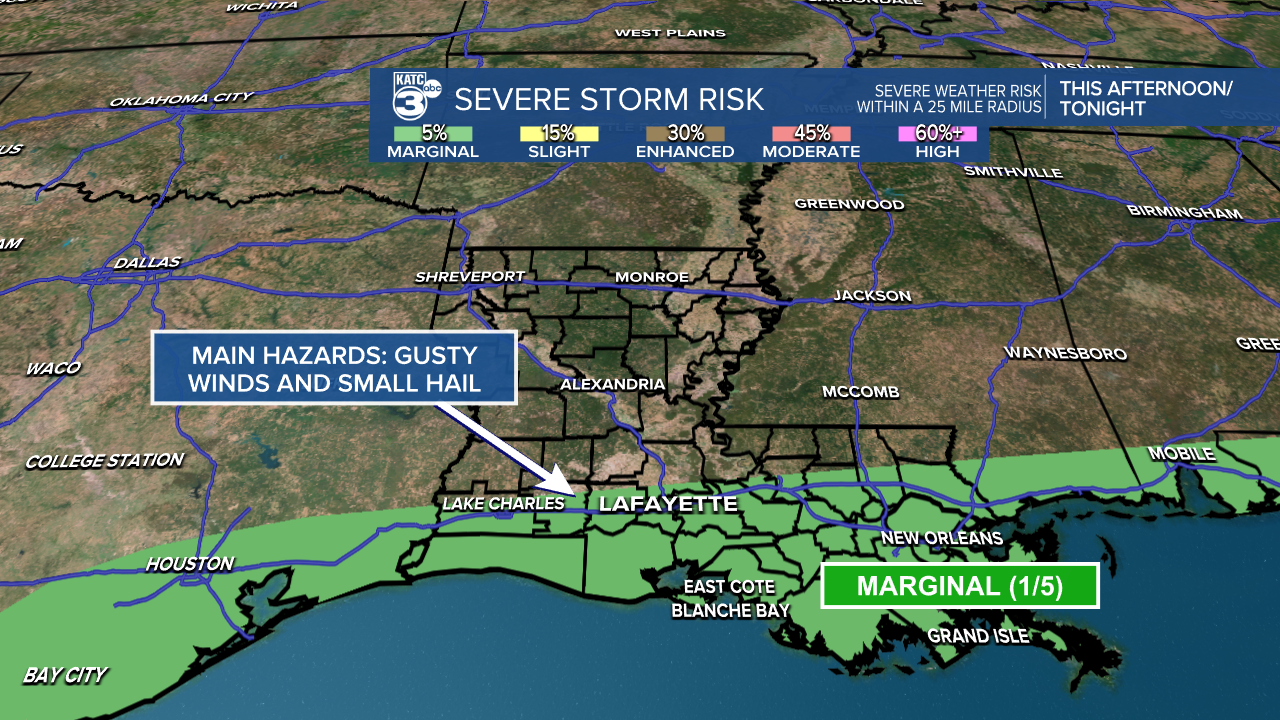
Before we dive into those weekend plans, the SPC has issued a marginal risk (1/5) for gusty winds and small hail for parishes along I-10 and south. No tornado threat is expected. The MAIN concern will be the heavy rain.
The NWS in Lake Charles has also issued a WIND ADVISORY for St. Landry, Jeff Davis, Acadia, Lafayette, St. Martin, Vermilion, Iberia, and St. Mary until 1 AM tonight.
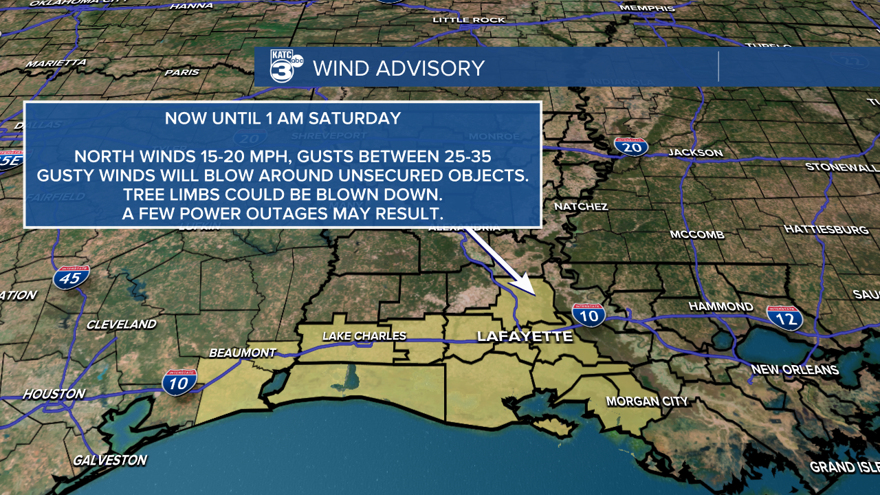
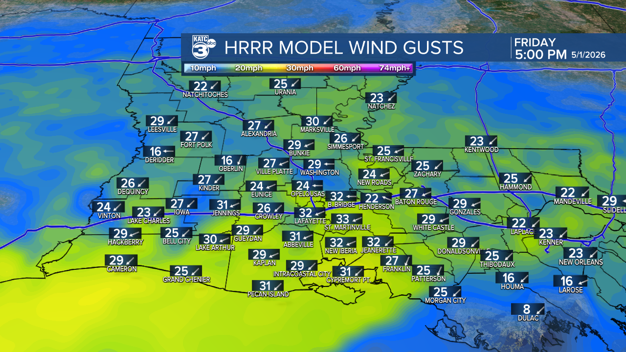
We can expect north winds around 20 mph, with gusts between 25 and 35 mph.
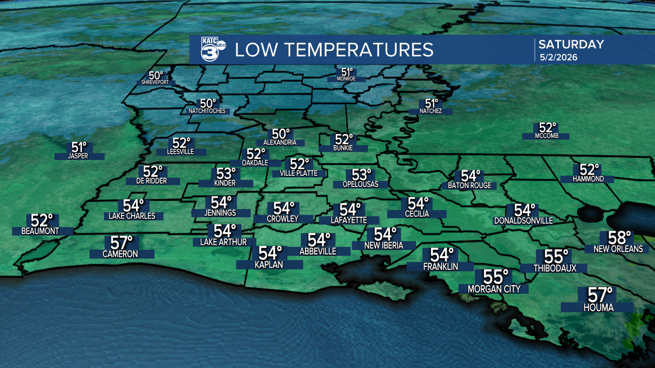
Now for the weekend forecast, tonight will cool down to the low 50s.
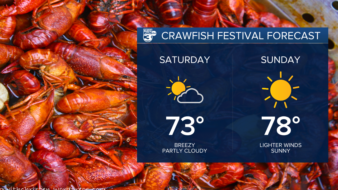
Tomorrow, we’ll enjoy highs in the low 70s with plenty of sunshine and fewer clouds.

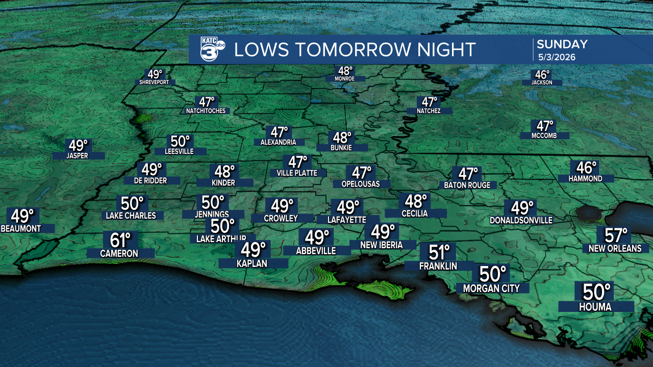
Saturday night will be much cooler in the upper 40s to low 50s.
Sunday? Even better! We’re warming up into the upper 70s with clear skies—perfect for all those Crawfish Festival plans!

Follow Meteorologist Breyanna Lewis for further updates.
See the KATC 10 Day Forecast for the latest.
