


While the threat of flooding for Acadiana is diminishing into the weekend, there will still be a decent chance of scattered storms for our Saturday, but fewer storms are expected Sunday...and that means hotter temperatures.
The remnants of Disturbance 93L should still deliver ample moisture to the Acadiana area for scattered showers and thunderstorms Saturday, but by Sunday, high pressure will begin to become the dominate feature in our forecast that lasts at least, through Tuesday.
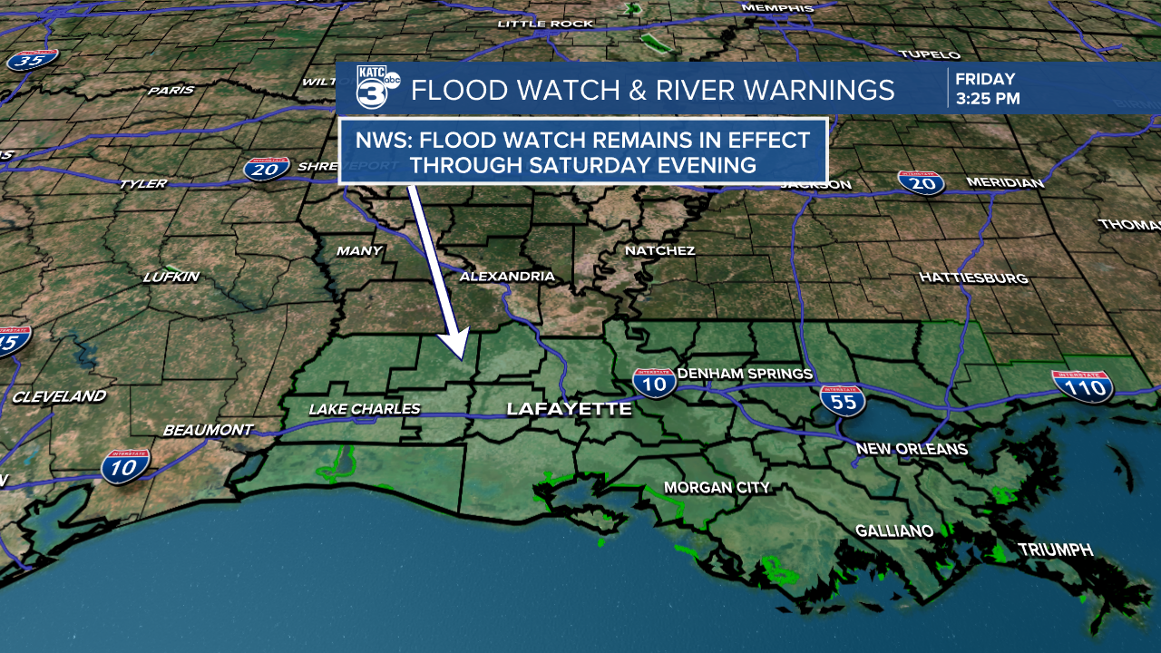
While the National Weather Service is maintaining the Flood Watch for Acadiana through Saturday, with activity expected to be scattered in nature, so there should be no widespread flood issues...but the NWS is keeping the advisory up for the "just in case" scenario given the recent rains.
But with that being said, any slow-moving thunderstorm (at any time in the summer) can produce torrential downpours that could temporarily flood streets etc, but this is not expected to be a widespread phenomenon for our Saturday.

Temperatures should top out in the upper 80s Saturday with a cloud and sun mix accompanied by the cooling storms.
Expect more sun and fewer storms Sunday as temperatures climb back into the lower 90s.
Early next week looks hot and dry with rain chances down to 10% or less...a rarity since April.

Temperatures will rise closer to the mid-90s Monday and Tuesday with heat indices climbing up closer to 104-108°.
And in the "what comes around, goes around" category: we'll probably be looking at another tropical disturbance moving east to west across the Gulf Coast later next week with high rain chances likely to return for next Thursday/Friday.

See the KATC 10 Day Forecast for the latest.
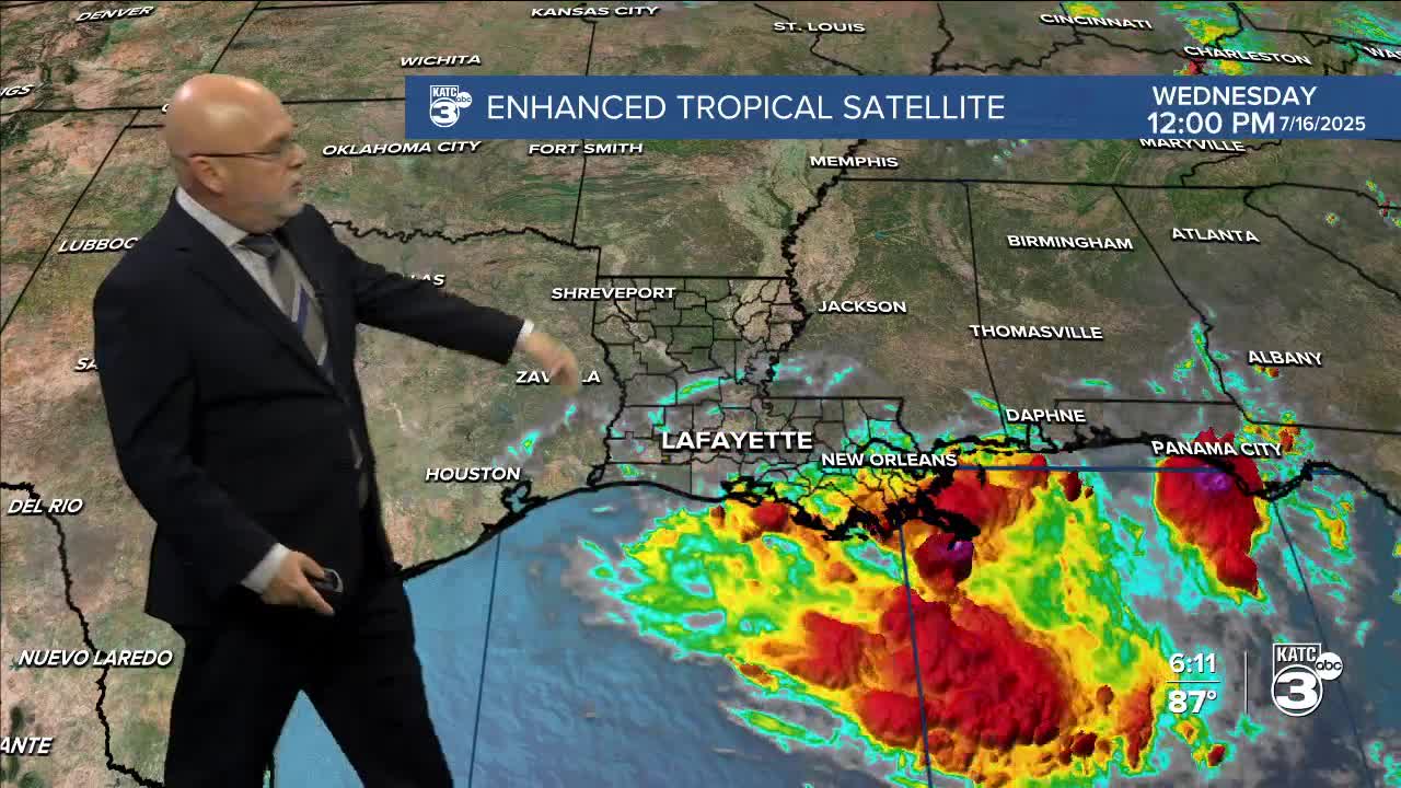
Elsewhere in the tropics, it remains quit.
