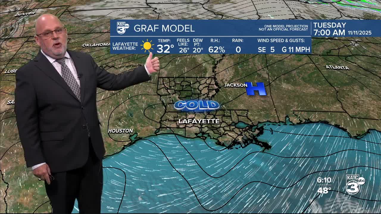


The first freeze of the season is expected for most of Acadiana by Tuesday morning with a warming trend to follow.

Freeze Warnings are in effect for most of Acadiana except for marshy areas from Southern Calcasieu, Southern Jeff Davis and Cameron Parishes where readings should go no lower than the mid-upper 30s.

Elsewhere, most of Acadiana will see a light freeze (just plants and pets...no pipe worries) by daybreak with low ranging from the upper 20s across our northern parishes to lower 30s elsewhere.

Readings at or below freezing should not last longer than a few hours.
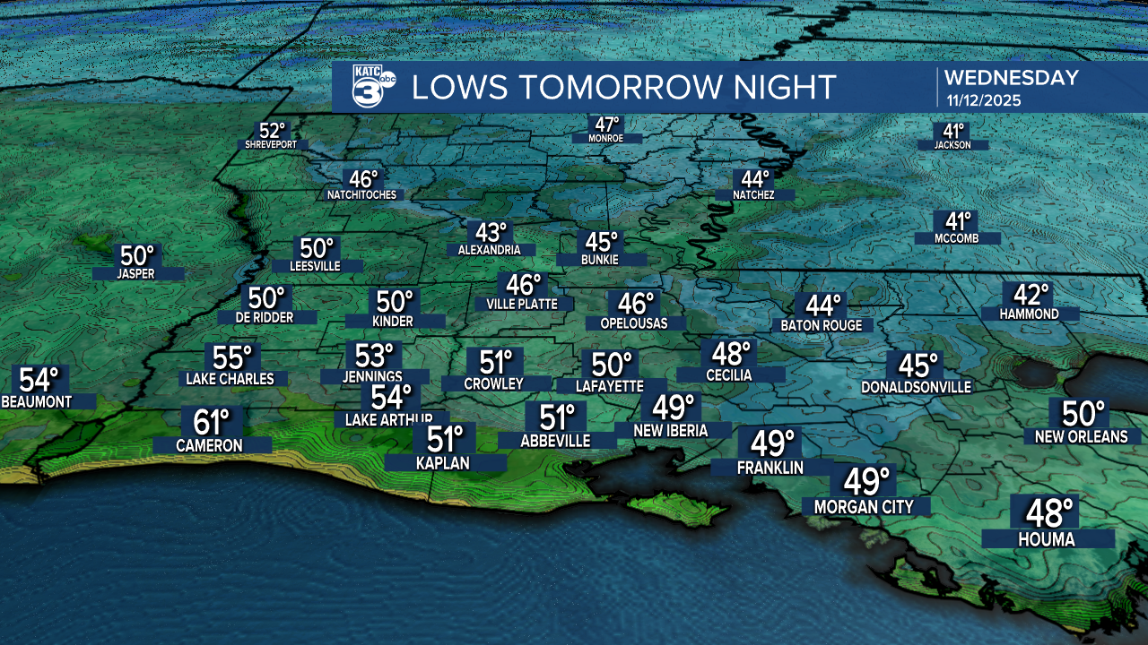
A warming trend will ensue with sunny skies bring our highs back into the mid-60s tomorrow and mid-upper 40s (well above freezing) tomorrow nighht into Wednesday morning.
Highs will be back into the mid-upper 70s for the rest of the week and near 80° this weekend while lows migrate back into the 50s.
The weather pattern is expected to remain dry until the latter part of the weekend (Sunday) into next week where a more progressive and changeable pattern, which should lead to some decent rain chances, eventually...we'll see. Euro model below.

See the KATC 10 Day Forecast for the latest.
