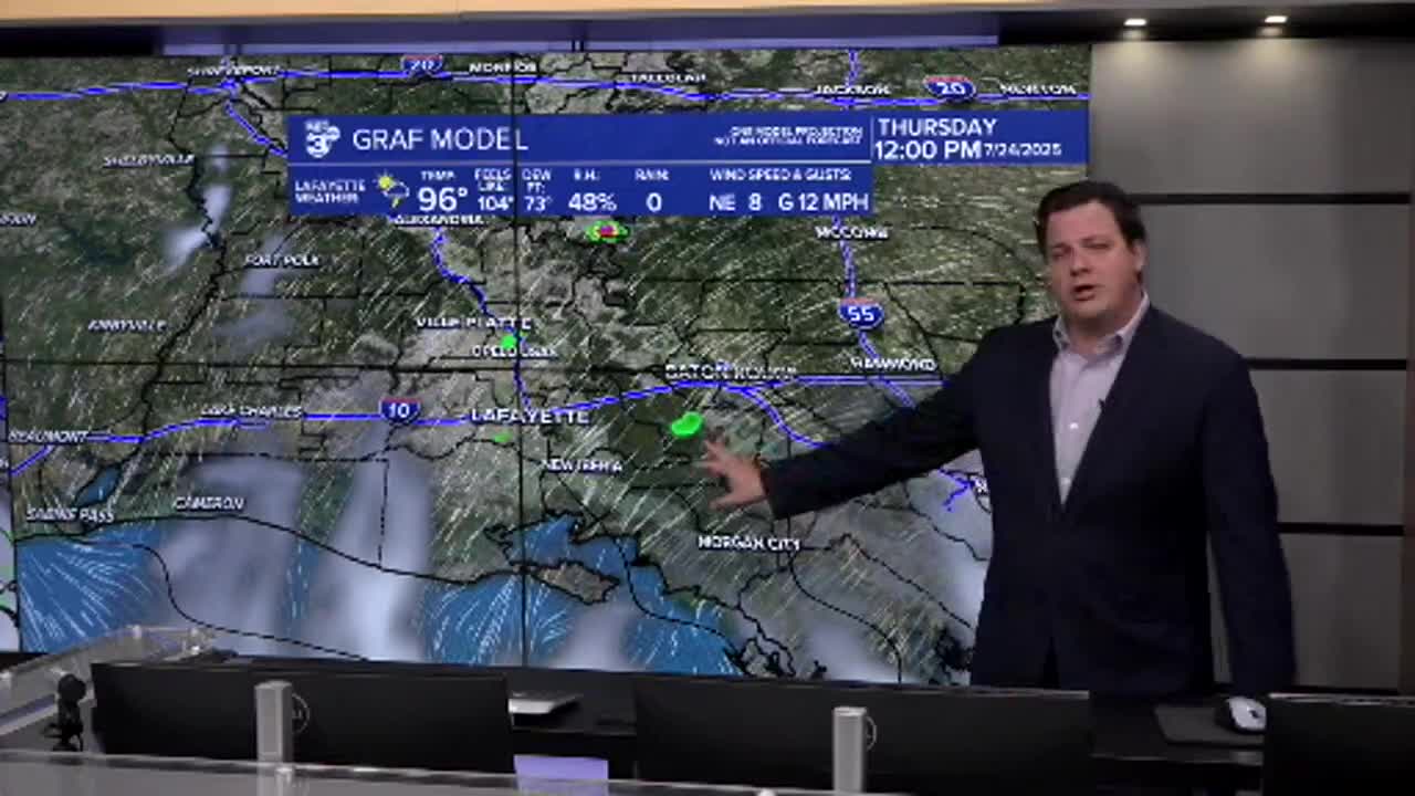


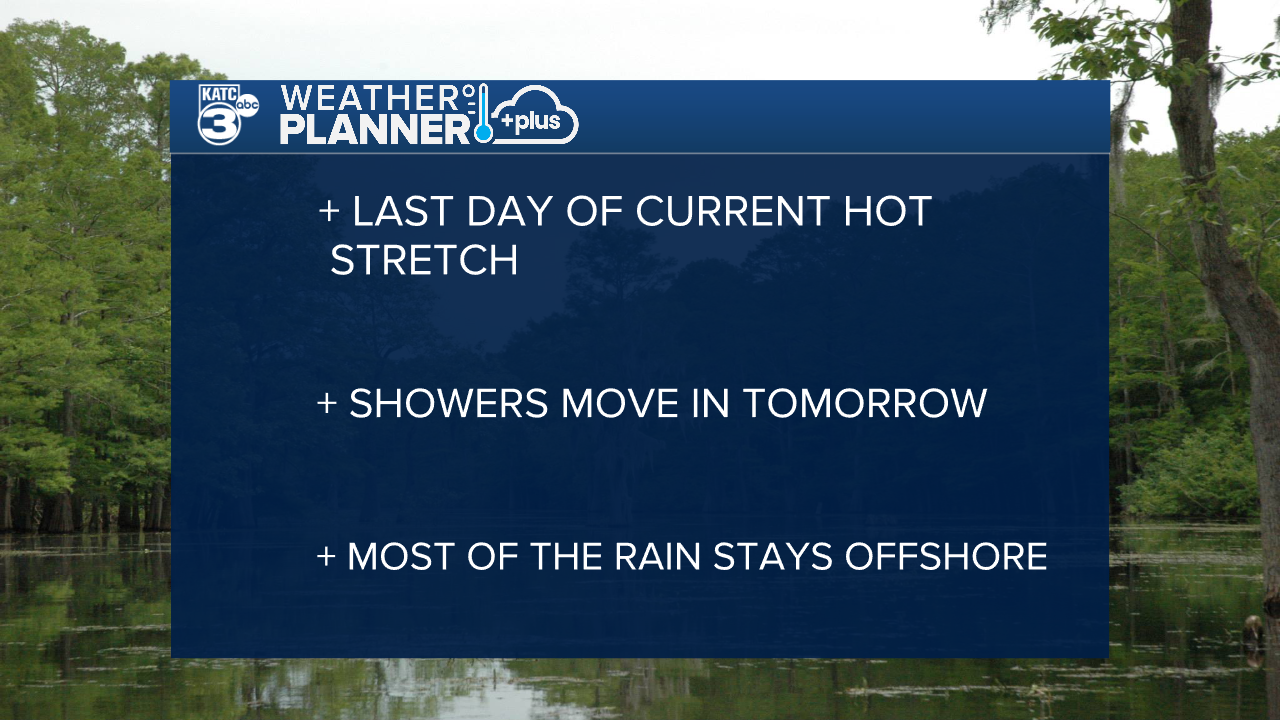
The heat will last for one more day before we get a little bit of a break from those temperatures.
Heat advisories remain in place for Acadiana with the heat index returning to the 105-110 range in the afternoon.
Folks who live along the Atchafalaya Basin may get a little more relief from some scattered showers in the afternoon, but west Acadiana will remain mostly dry.
Those showers will be the first sign of that tropical moisture which will push into the area on Thursday bringing widely scattered showers to the area.
At times the rain will be pretty heavy given the amount of moisture in the atmosphere, which could lead to some localized street flooding, but overall these should be manageable rains.
Luckily for Acadiana the heaviest showers and deepest moisture will remain just offshore.
Coastal communities could pick up 2-4" of rain over a couple of days and rain totals will gradually decrease the further north you get.
Showers will persist again on Friday before starting to taper off over the weekend, and we'll return to the typical summer pattern for next week.
