


Courtesy of a weak Gulf disturbance, Acadiana will continue to see the chance of scattered showers and perhaps a few thunderstorms for the first few days this week, while drier and eventually cooler conditions are on the way by next weekend.

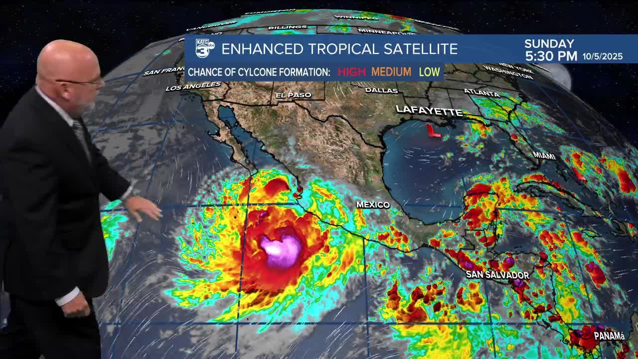
A weak, disorganized and lop-sided low pressure south of the Louisiana Coast is not expected to do much and should eventually get strung out to a weak trough due to dry air west and shear aloft, with threat of best locally heavier tropical rains for portions of Southeast Louisiana to the Florida Panhandle.

The National Hurricane Center gives the feature a 00% chance of development.
More on the rest of the tropics below...
The weak disturbance should provide Acadiana with the chance of some tropical showers, and some patchy light rain/drizzle/mist overnight for the area.

Highs Monday will hold in the mid-80s but are likely to push the upper 80s for mid-week. Our lows will stay some 6-8° above normal near the lower 70s.
Scattered activity for our Monday and Tuesday is expected to be more likely earlier than later in the day with rain chances (as of Sunday evening) for both days in the 40% range.
And do not expect significant rain totals for other than a very few isolated spots.

Drier air and a weak front should push through Acadiana by Thursday setting up for some stellar weather going into our Festivals Acadiens et Créoles.
Temperatures by this weekend look to be closer to the mid-80s for highs while more importantly lows dip down into the lower 60s...which means there could be some upper 50s for the norther-most parishes of the area.
See the KATC 10 Day Forecast for the latest.
Meanwhile in the tropics, way out in the Tropical Atlantic Disturbance 95L likely to become a tropical depression this week, and has hurricane potential down the road.
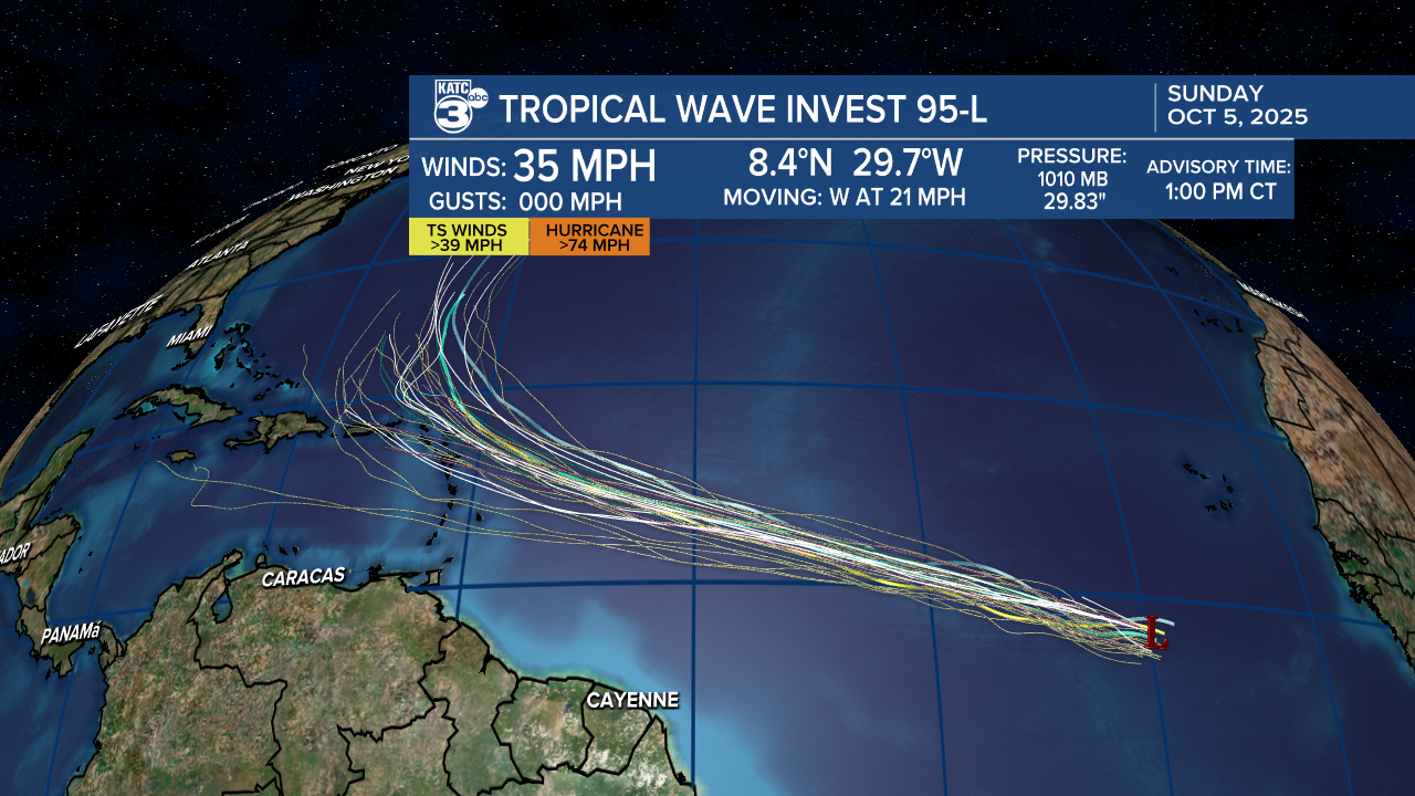
This potential system may threaten the Eastern to Northeast Caribbean by Friday into the weekend before making a turn northward into the open Atlantic and should not be a Gulf threat.
Full tropical briefing:
Drought Status and the outlook through December:
Unfortunately, the scattered showers over the next two days will likely not help with the ongoing worsening drought across the region.
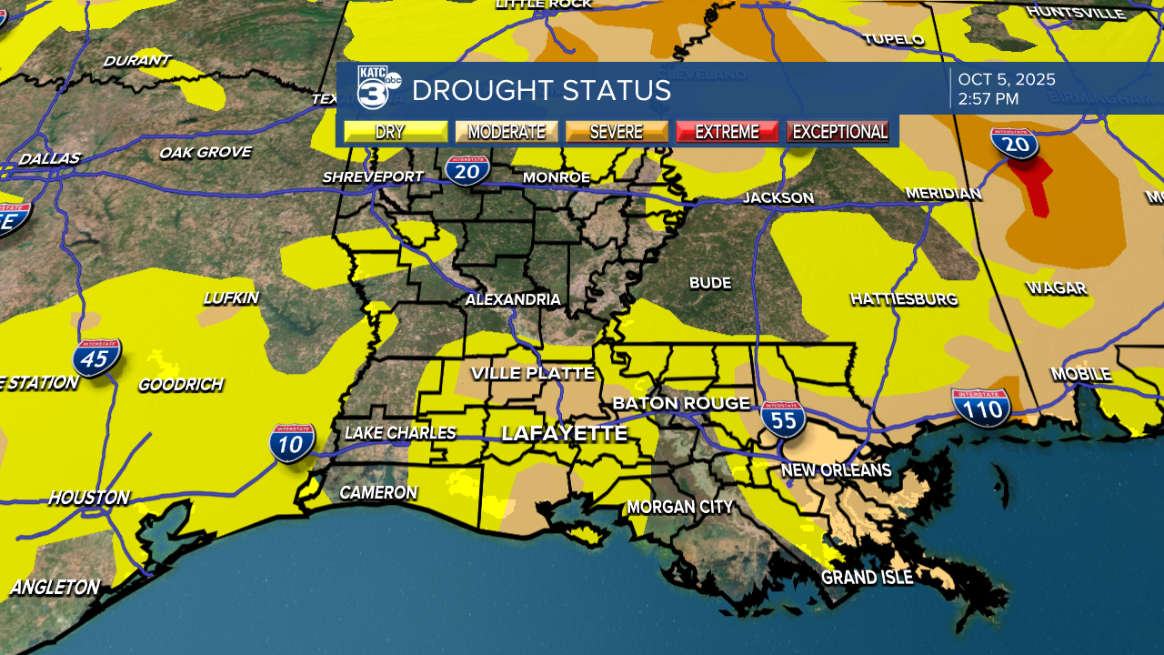
A "Moderate" Drought has been worsening across most of Acadiana and Southern Louisiana.

To make matters potentially worse, the 3 month outlook from the Climate Prediction Center through the rest of the year is calling for drier than normal conditions.

And along with drier than normal, warmer than normal conditions are anticipated with a pending La Nina developing this winter...which will support drier and warmer than normal conditions through the winter but it doesn't necessarily mean we wont have any cold weather systems.
If La Nina continues into next summer it could also make for another active tropical system in the Atlantic Basin...we'll see.
