


Two fronts are in the forecast for Acadiana, a weak one Wednesday, but the weekend system will bring more substantial rain and storms into the area Saturday evening/night, and perhaps, accompanied by a low-end severe weather threat.
In the near term, it looks to be another round of late night/early morning fog for the area with temperatures hovering in the relatively mild upper 50s to lower 60s.
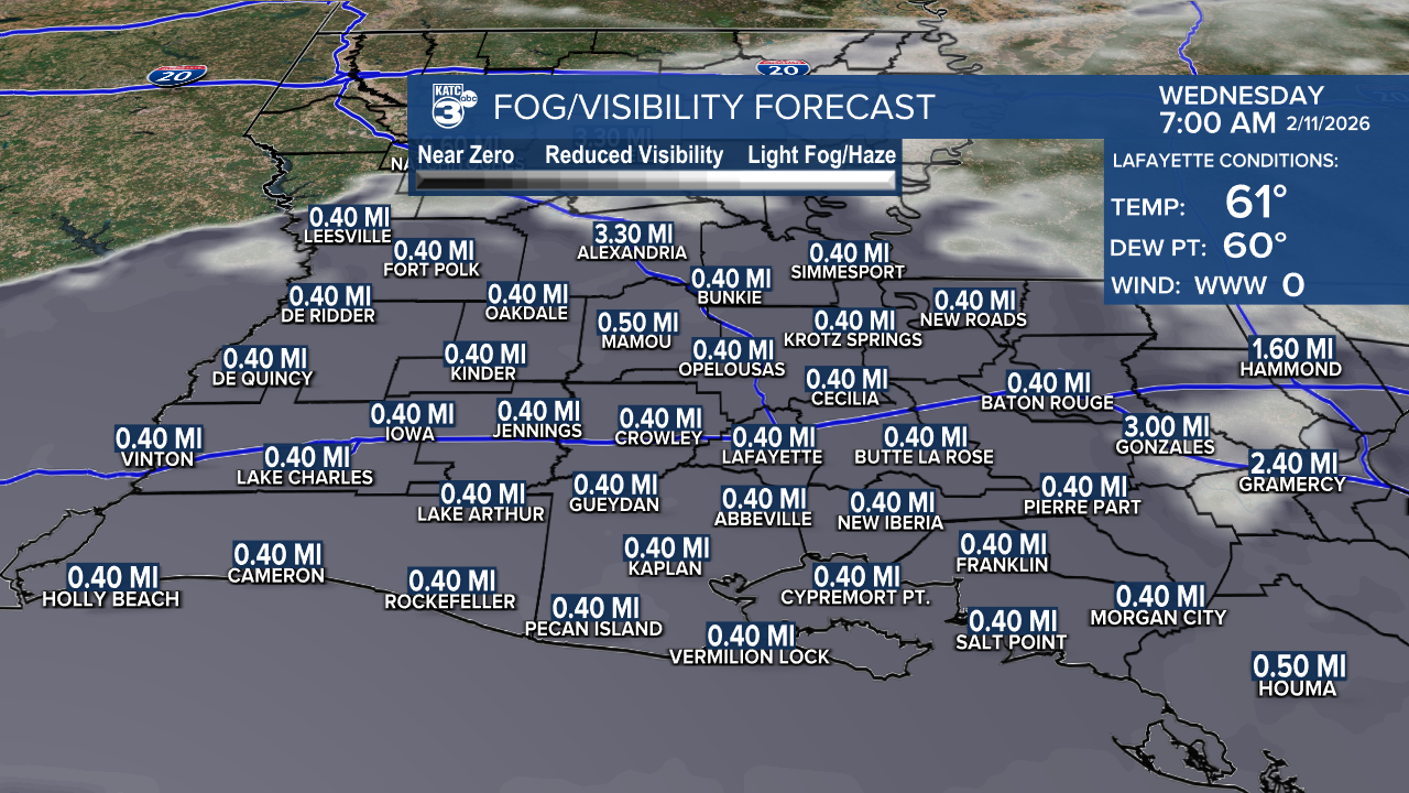
Wednesday will bring mostly cloudy skies, with some intervals of sun, and a few brief, scattered showers with rain chances in the 20-30% Wednesday afternoon/evening.
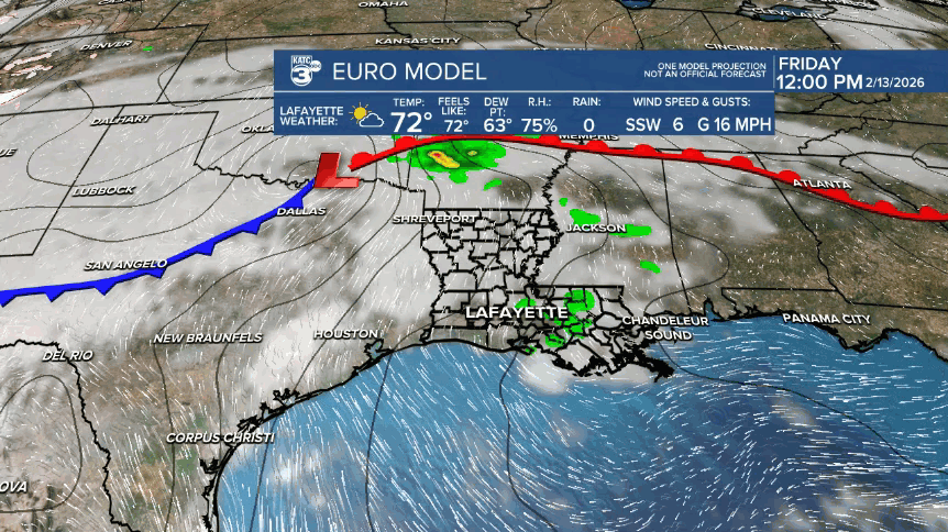
Thereafter we have some good-looking, and slightly cooler weather for Thursday and Friday.

Rain chances Thursday will be near zero, but could be in the 10-20% range Friday.
A couple of potent Pacific systems will phase and from the Western U.S. to Texas by Friday/Saturday.

This system could initiate scattered showers (30-40%) during the day Saturday as strong southerly winds, gusting to near 30mph get cranking into the afternoon.
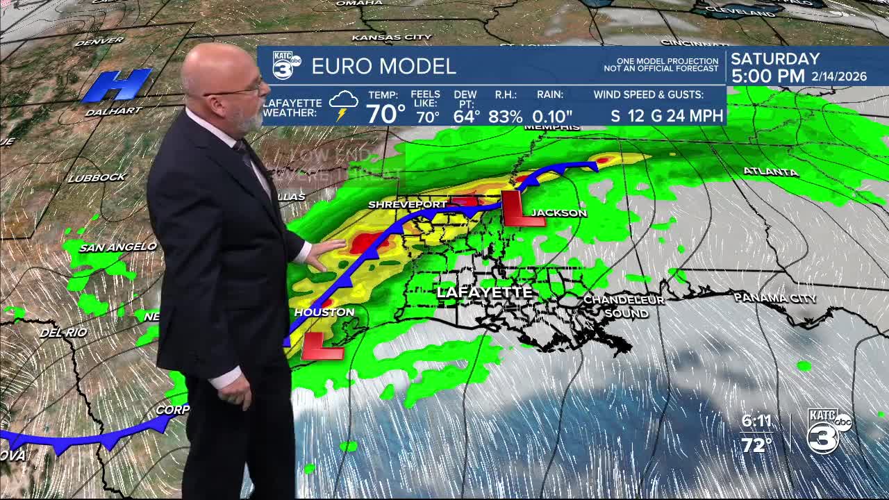
Heavier storms look to arrive either later in the afternoon Saturday and most likely (for now) into the evening hours (based on the Euro shown here), and should exit the region Sunday.
Rain chances will eventually go to 90% Saturday evening/night.
Timing of this weekend's system is still not set in stone as the GFS is slower, and brings the storms deeper into Saturday night, while the Euro's timing can't be argued with at this time...and has been consistent.
Although the Storm Prediction Center does not have a slight risk outlined for Saturday yet, but they are indicating there should be at least a marginal risk of a few severe storms...and most likely for storms that could contain damaging winds and/or some hail...the risk of an isolated tornado will be low, but not zero...stay tuned.
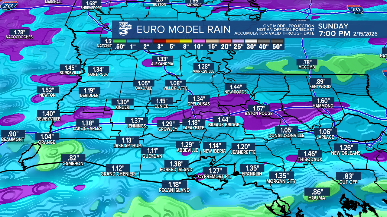
We'll probably see a 1-2" soaking when the rains arrive this weekend.
Hopefully we can get in all the Saturday Mardi Gras festivities in before the storms strike later into the evening, but there are absolutely no guarantees...and do not change your plans yet, as timing 4 days out still leaves a potential 6-12 hour timing change in either direction.
As for Mardi Gras, after a cool start in the 50s, look for breezy and mild conditions with highs in the lower 70s for our Fat Tuesday!
See the KATC 10 Day Forecast for the latest.
