


Acadiana's summer pattern continues to linger on, but with a few more afternoon/early evening showers for our Wednesday, while the Atlantic tropics are looking more active in the days ahead.
In the near term, after a few welcomed scattered afternoon showers for a few Tuesday, models indicate that way may see a few more afternoon and/or early evening showers and/or a thunderstorms Wednesday, with rain chances near 30%....as high as they have been in a while, but not enough for parched soils.

Temperatures will start once again in the lower 70s Wednesday and top out in the lower 90s.
There will be little change in our highs and lows moving into the weekend...and much, if not all of next week.
Rain chances will drop to 10-20% or less for the rest of the week and well into the next.
There are still no definitive fronts, nor overt rain chances in the current 10 day forecast as summer lingers on past the fall equinox next Monday.
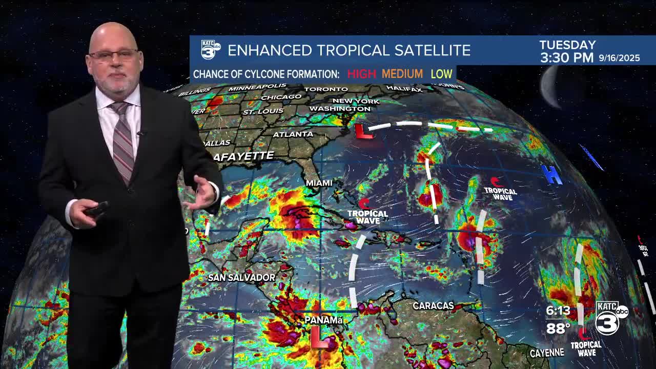
At least there are no tropical threats for the Northern Gulf expected for at least the next week to 10 days.

Meanwhile, Disturbance 92L is poised to become a tropical depression and most likely a tropical storm soon (within the next day or two at most).

The next tropical storm will be named "Gabrielle".

This potential system looks to avoid the Caribbean and may curve far enough east to miss Bermuda per operational Euro.

But as always, have to watch how each system consolidates before we can get a better idea on their future.
New system coming off the African Coast introduced today by the NHC with a 20% chance of development later in the week or weekend.
