


It's the hazy days of summer, and African dust has made sure we've reached maximum haze.
If your sinuses have felt irritated the last two days it's because we've been locked in with dust blown in from the Sahara.
While the dust seemed to peak on Monday it will certainly linger for the next several days keeping skies fairly hazy through the majority of the week.
Dusty skies can help limit shower development, although not get rid of it entirely, so rain will be isolated over the next few days.

Over the weekend we started talking about a stationary front in the Gulf that we would keep an eye on for development, and see if it meant a wet holiday for beach goers.
There's some good news on both fronts Tuesday, the chances of development are lower than they were yesterday, and by dropping just a little further south that means some drier air should sink in to the Gulf region.
Acadiana may not have much rain the next few days but wetter weather will sit to our east so there's still a few wet beach days out there, but by the holiday weekend it will be drying up.
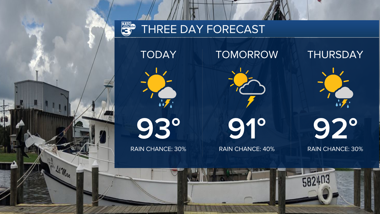
It's mostly a lot more of the same for folks in Acadiana, with temperatures consistently in the low 90s, and heat index in the triple digits.
This pattern seems to hold through the holiday and into next week.
