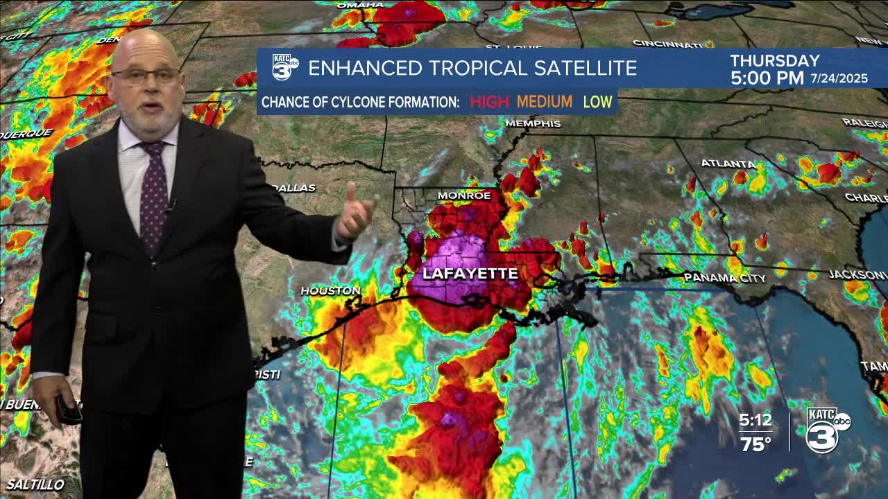


A weak tropical disturbance drifting westward across the Northern Gulf Coast remains disorganized, but will continue to enhance rain chances for most portions of Acadiana over the next 2-3 days.

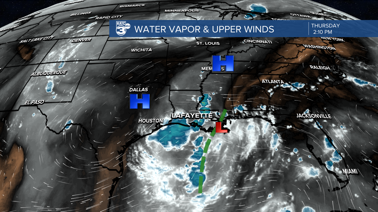
The odds of this system developing any organization in the next day remain quite low per the National Hurricane Center.
An upper high to the north of this system will also limit rainfall penetration into the central and northern part of the state, while keeping the 3 day rain totals in mostly a tolerable range for most of Acadiana.
Thunderstorms ongoing for Acadiana into this evening could contain strong and gusty winds, on top of the usual torrential downpours and pockets of frequent lightning.

Tropical showers and storms look to become more scattered in nature into Friday and Saturday as the weak disturbance eventually moves into Texas.
Activity Friday and Saturday should primarily be the "on and off" daytime variety, until high pressure rebuilds into the area Sunday into early next week.

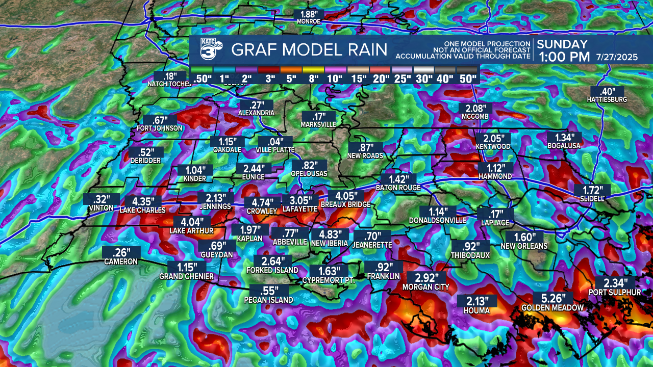
In general, look for anywhere from 1-3" of rain for most areas in Acadiana over the next 72 hours...some will see less, some isolated areas may catch up to 5-6" especially across the coastal parishes.
High temperatures will likely hold in the mid-upper 80s for our Friday and Saturday but rise back into the lower 90s Sunday as coverage of scattered storms begins to decrease.
High pressure will be nearly overhead Monday into Tuesday shutting down most, if not all storm activity, and allowing for highs to reach back into the mid-90s...heat advisories may be required for those days.
A slow-moving upper disturbance will drift into the area mid-late next week bringing back a good chance of scattered, mainly daytime showers and thunderstorms, that may carry into the weekend that follows.
See the KATC 10 Day Forecast for the latest.
