


Dry, warm and humid conditions should turn to the wetter side later this week with some decent rains possible followed by a cool start to May.
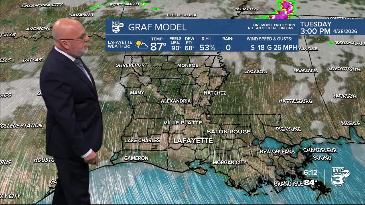
In the near term, it will be a rather warm and humid night for Acadiana through Tuesday morning with lows holding in the low-mid 70s...normal for June, not April!
Look for another breezy, warm and humid day Tuesday under partly to at times mostly cloudy skies. Highs Tuesday will push the mid-upper 80s.

South to southeast breezes near 10-18 mph will increase mid-morning through the afternoon with gusts reaching into the 25 mph range at times.
Those winds will likely be feeding into strong to severe storms well to our north for Tuesday.

Look for more clouds, warm temperatures and perhaps a few showers into Wednesday, but better rain chances and some storms are ahead later that evening, and then for the rest of the week.

A series of disturbances aloft will trigger some activity Wednesday evening and perhaps Thursday, while and a frontal boundary will sag into the area by Friday allowing for better rain chances as early as Thursday but continuing into Friday, Friday night and perhaps into early Saturday.
The Storm Prediction Center does have our area hatched in for a marginal risk of a severe storm that could contain damaging winds into Wednesday evening.
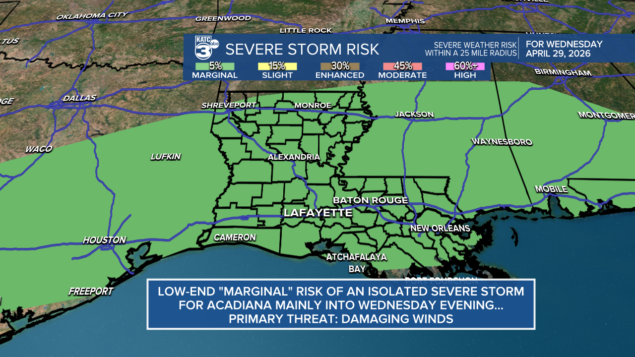
At this time, there does not be be an overt severe weather threat with the activity after Wednesday evening, but as always, that may be subject to change.
Too early to be certain, but some much needed rain accumulation Wednesday through early Saturday will be possible, with the Euro today indicating at least a 1-2" rainfall. We'll see.

Thereafter, it looks to be a rather cool start to May with highs in the low-mid 70s Friday through Sunday while nighttime dip into the lower 50s for a few nights into early next week.
See the KATC 10 Day Forecast for the latest.
