


Hopefully everyone took advantage of the chance to dry out this weekend, because the forecast is sliding back to another wet pattern this week.
Showers and storms will be returning to the afternoons, with widely scattered storms popping up starting around lunch and going through the evening commute.
As was the case the last few weeks there will be the possibility of some heavy downpours and frequent lightning as the primary issues.
Any rain will wind down late in the evening as we lose the daytime heating and we'll then get ready to do it all over again tomorrow.

The biggest difference between the rain this week and the last few weeks is it will arrive mostly in the afternoon.
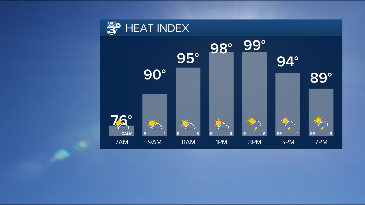
This means that we'll still have plenty of time to heat up with highs pushing the low 90s and the heat index right around the triple digits.
These temperatures are more or less what you'd expect in late June, but that doesn't make it any less hot.
So drink that water and do your best not to overdo it during the hottest parts of the day.
This is the pattern you can expect for the remainder of the month, which will end as one of the wetter Junes we've had since records started being kept.
July looks to get off to a similar start but hopefully we can get things settled down before the 4th of July.
