


More "scattered" torrential downpours and the possibility of some localized flooding remains in Acadiana's future through the holiday weekend.
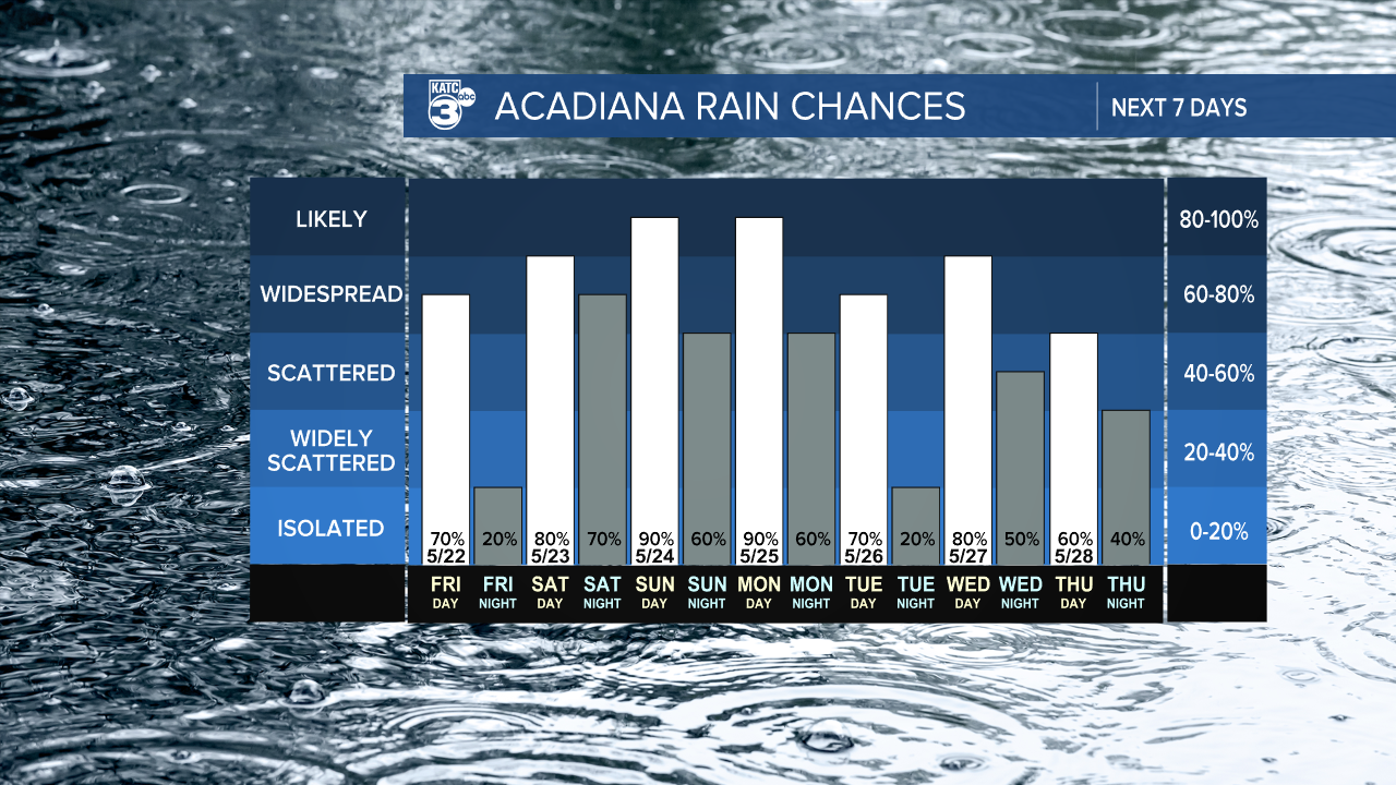
A nearly monsoonal pattern will continue well into next week with rain chances varying from 70-90% each day through at least next Wednesday.

Rain totals on any given 24 hour period will be between 1/4-1/2" with isolated amounts up to 3-4".
Heaviest rain days look to be shaping up at this time for Saturday, Sunday and Monday.

Over the last 48 hours, rainfall totals in Acadiana have been anywhere from a trace up to 5"+, with most of us catching roughly 1-2 inches so far.

Per the Weather Prediction Center, Acadiana remains in marginal to slight risk for excessive rainfall through Monday, with potential upgrades to these outlooks as we progress into the weekend.
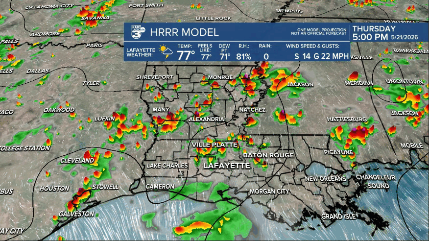
Due to the random nature of thunderstorms, not all days will be washouts; some days clouds and perhaps a few sprinkles, others will have some heavy downpours, depending on your location.
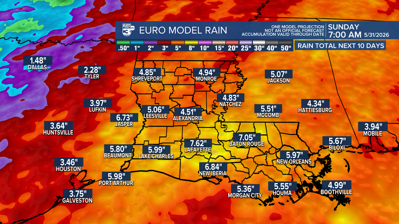
"General" 10 day total rain accumulations per the Euro and GFS models are in the 6-10" range...and there will likely isolated be hot spots double the amounts shown.

The 72 hour GRAF Model forecast yields close to the 10 day amounts shown above...a big reason while the medium range deterministic models such as the Euro and GFS may be underplaying the rain totals over the next week to 10 days.

This is a pattern where it's difficult to put up a general flood "watch" but it may come with time once most areas in the region become saturated.
Meanwhile, there will probably be additional flood warnings in spots depending on how storms set up in the days ahead.
Again this is a pattern where a round of storms will be possible during the day and/or night.
Some days may be also workable too, for the many folks that require work outdoors (we feel for you).
See the KATC 10 Day Forecast and Power Doppler 3 page for the latest.
